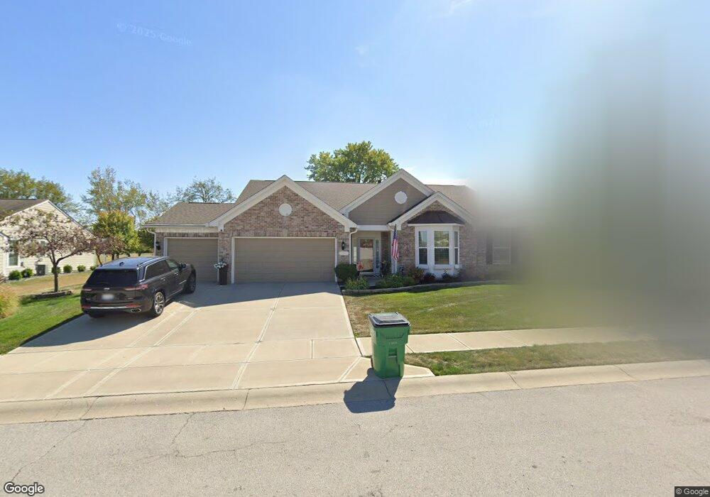
579 King Fisher Dr Brownsburg, IN 46112
Estimated Value: $422,000 - $460,000
4
Beds
2
Baths
2,613
Sq Ft
$167/Sq Ft
Est. Value
About This Home
This home is located at 579 King Fisher Dr, Brownsburg, IN 46112 and is currently estimated at $436,024, approximately $166 per square foot. 579 King Fisher Dr is a home with nearby schools including Eagle Elementary School, Brownsburg West Middle School, and Brownsburg High School.
Ownership History
Date
Name
Owned For
Owner Type
Purchase Details
Closed on
Aug 4, 2011
Sold by
Pulte Homes Of Indiana Llc
Bought by
Avery Susan T and Avery Gary L
Current Estimated Value
Home Financials for this Owner
Home Financials are based on the most recent Mortgage that was taken out on this home.
Original Mortgage
$209,000
Outstanding Balance
$145,180
Interest Rate
4.64%
Mortgage Type
New Conventional
Estimated Equity
$290,844
Create a Home Valuation Report for This Property
The Home Valuation Report is an in-depth analysis detailing your home's value as well as a comparison with similar homes in the area
Home Values in the Area
Average Home Value in this Area
Purchase History
| Date | Buyer | Sale Price | Title Company |
|---|---|---|---|
| Avery Susan T | -- | None Available |
Source: Public Records
Mortgage History
| Date | Status | Borrower | Loan Amount |
|---|---|---|---|
| Open | Avery Susan T | $209,000 |
Source: Public Records
Tax History Compared to Growth
Tax History
| Year | Tax Paid | Tax Assessment Tax Assessment Total Assessment is a certain percentage of the fair market value that is determined by local assessors to be the total taxable value of land and additions on the property. | Land | Improvement |
|---|---|---|---|---|
| 2024 | $3,924 | $392,400 | $63,200 | $329,200 |
| 2023 | $3,865 | $377,100 | $60,200 | $316,900 |
| 2022 | $3,356 | $335,600 | $58,300 | $277,300 |
| 2021 | $2,896 | $289,600 | $58,300 | $231,300 |
| 2020 | $2,830 | $283,000 | $58,300 | $224,700 |
| 2019 | $2,687 | $268,700 | $56,300 | $212,400 |
| 2018 | $2,699 | $269,900 | $56,300 | $213,600 |
| 2017 | $2,553 | $255,300 | $53,600 | $201,700 |
| 2016 | $2,479 | $247,900 | $53,600 | $194,300 |
| 2014 | $2,387 | $238,700 | $52,000 | $186,700 |
Source: Public Records
Map
Nearby Homes
- 751 Fish Hawk Ct
- 5037 Carmine St
- 5523 Sienna Ct
- 4970 Amber Crest Dr
- 5010 Carmine St
- 4919 Amber Crest Dr
- 4928 Amber Crest Dr
- 5015 Carmine St
- 5066 Carmine St
- 4976 Amber Crest Dr
- 5024 Carmine St
- 5040 Carmine St
- 5002 Bergamot Dr
- 4947 Amber Crest Dr
- 5052 Carmine St
- 5026 Bergamot Dr
- 5032 Carmine St
- Glacier II Plan at Auburn Ridge - Legacy Series
- Ainsley II Plan at Auburn Ridge - Prestige Series
- Berkeley Basement Plan at Auburn Ridge - Prestige Series
- 571 King Fisher Dr
- 587 King Fisher Dr
- 574 King Fisher Dr
- 582 King Fisher Dr
- 563 King Fisher Dr
- 595 King Fisher Dr
- 566 King Fisher Dr
- 590 King Fisher Dr
- 601 Kingfisher Dr
- 555 Kingfisher Dr
- 547 King Fisher Dr
- 760 Pigeon Dr
- 539 King Fisher Dr
- 604 King Fisher Dr
- 607 King Fisher Dr
- 550 King Fisher Dr
- 754 Pigeon Dr
- 542 King Fisher Dr
- 531 King Fisher Dr
- 763 Pigeon Dr