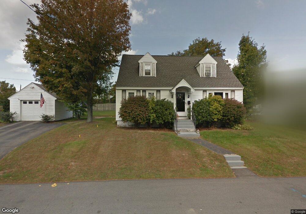
579 Maplewood Ave Portsmouth, NH 03801
West End NeighborhoodEstimated Value: $719,000 - $825,000
3
Beds
1
Bath
1,264
Sq Ft
$597/Sq Ft
Est. Value
About This Home
This home is located at 579 Maplewood Ave, Portsmouth, NH 03801 and is currently estimated at $754,700, approximately $597 per square foot. 579 Maplewood Ave is a home located in Rockingham County with nearby schools including New Franklin School, Portsmouth Middle School, and Portsmouth High School.
Ownership History
Date
Name
Owned For
Owner Type
Purchase Details
Closed on
Aug 27, 2020
Sold by
Kramer Karen H
Bought by
Foley Jared A
Current Estimated Value
Home Financials for this Owner
Home Financials are based on the most recent Mortgage that was taken out on this home.
Original Mortgage
$352,000
Outstanding Balance
$312,377
Interest Rate
2.9%
Mortgage Type
New Conventional
Estimated Equity
$442,323
Purchase Details
Closed on
Feb 11, 2015
Sold by
Foley Karen H
Bought by
Foley Karen H
Purchase Details
Closed on
May 16, 1985
Bought by
Foley Karen H
Create a Home Valuation Report for This Property
The Home Valuation Report is an in-depth analysis detailing your home's value as well as a comparison with similar homes in the area
Home Values in the Area
Average Home Value in this Area
Purchase History
| Date | Buyer | Sale Price | Title Company |
|---|---|---|---|
| Foley Jared A | $440,000 | None Available | |
| Foley Karen H | -- | -- | |
| Foley Karen H | -- | -- |
Source: Public Records
Mortgage History
| Date | Status | Borrower | Loan Amount |
|---|---|---|---|
| Open | Foley Jared A | $352,000 | |
| Previous Owner | Foley Karen H | $77,500 | |
| Previous Owner | Foley Karen H | $78,000 |
Source: Public Records
Tax History Compared to Growth
Tax History
| Year | Tax Paid | Tax Assessment Tax Assessment Total Assessment is a certain percentage of the fair market value that is determined by local assessors to be the total taxable value of land and additions on the property. | Land | Improvement |
|---|---|---|---|---|
| 2024 | $6,945 | $621,200 | $301,000 | $320,200 |
| 2023 | $6,649 | $412,200 | $200,700 | $211,500 |
| 2022 | $6,265 | $412,200 | $200,700 | $211,500 |
| 2021 | $6,195 | $412,200 | $200,700 | $211,500 |
| 2020 | $6,059 | $412,200 | $200,700 | $211,500 |
| 2019 | $6,125 | $412,200 | $200,700 | $211,500 |
| 2018 | $6,596 | $374,700 | $189,700 | $185,000 |
| 2017 | $6,536 | $360,100 | $175,100 | $185,000 |
| 2016 | $6,138 | $301,300 | $151,100 | $150,200 |
| 2015 | $5,059 | $301,300 | $151,100 | $150,200 |
| 2014 | $5,128 | $283,300 | $148,300 | $135,000 |
| 2013 | $5,074 | $283,300 | $148,300 | $135,000 |
| 2012 | $4,968 | $283,100 | $148,300 | $134,800 |
Source: Public Records
Map
Nearby Homes
- 19 Eden Ln Unit 2
- 15 Eden Ln Unit 1
- 27 Eden Ln Unit 4
- 31 Eden Ln Unit 5
- 9 Prospect St Unit 1
- 281 Dennett St
- 12 Ruth St
- 14 Birch St
- 25 Mangrove St
- 201 Kearsarge Way
- 255 Thornton St
- 99 Foundry Place Unit 106
- 99 Foundry Place Unit 408
- 99 Foundry Place Unit 102
- 99 Foundry Place Unit 310
- 99 Foundry Place Unit 308
- 99 Foundry Place Unit 208
- 99 Foundry Place Unit 101
- 99 Foundry Place Unit 207
- 99 Foundry Place Unit 301
- 0 Maplewood Ave
- 559 Maplewood Ave
- 8 Central Ave
- 8 Central Ave Unit 2
- 5 Central Ave
- 1 Ashland St
- 635 Maplewood Ave
- 18 Cutts St
- 553 Maplewood Ave
- 7 Central Ave
- 42 Cutts St
- 686 Maplewood Ave
- 639 Maplewood Ave
- 40 Cutts St
- 12 Central Ave Unit 2B
- 12 Central Ave Unit 2A
- 12 Central Ave Unit 1
- 12 Central Ave Unit 2
- 4 Ashland St
- 70 Cutts St