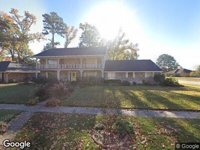
579 N Marlborough Cir Shreveport, LA 71106
East Shreveport NeighborhoodEstimated Value: $339,348 - $368,000
5
Beds
4
Baths
3,251
Sq Ft
$109/Sq Ft
Est. Value
About This Home
This home is located at 579 N Marlborough Cir, Shreveport, LA 71106 and is currently estimated at $352,837, approximately $108 per square foot. 579 N Marlborough Cir is a home located in Caddo Parish with nearby schools including Fairfield Magnet School, Judson Fundamental Elementary School, and Eden Gardens Fundamental Elementary School.
Ownership History
Date
Name
Owned For
Owner Type
Purchase Details
Closed on
Mar 22, 2013
Sold by
Hovis Warren Albert and Hovis Karrie Lynn Bourgeois
Bought by
Friestad Scott Owen and Friestad Kerry Schultz
Current Estimated Value
Home Financials for this Owner
Home Financials are based on the most recent Mortgage that was taken out on this home.
Original Mortgage
$227,260
Interest Rate
3.59%
Mortgage Type
Unknown
Purchase Details
Closed on
Jan 27, 2012
Sold by
Mendenhall Shannon and Mendenhall Jean Sentell
Bought by
Hovis Warren Albert and Hovis Karrie Lynn Bourgeois
Create a Home Valuation Report for This Property
The Home Valuation Report is an in-depth analysis detailing your home's value as well as a comparison with similar homes in the area
Home Values in the Area
Average Home Value in this Area
Purchase History
| Date | Buyer | Sale Price | Title Company |
|---|---|---|---|
| Friestad Scott Owen | $220,000 | None Available | |
| Hovis Warren Albert | $220,000 | None Available |
Source: Public Records
Mortgage History
| Date | Status | Borrower | Loan Amount |
|---|---|---|---|
| Open | Friestad Scott Owen | $159,870 | |
| Closed | Friestad Scott Owen | $227,260 |
Source: Public Records
Tax History Compared to Growth
Tax History
| Year | Tax Paid | Tax Assessment Tax Assessment Total Assessment is a certain percentage of the fair market value that is determined by local assessors to be the total taxable value of land and additions on the property. | Land | Improvement |
|---|---|---|---|---|
| 2024 | $4,474 | $28,702 | $4,918 | $23,784 |
| 2023 | $4,268 | $26,780 | $4,684 | $22,096 |
| 2022 | $4,268 | $26,780 | $4,684 | $22,096 |
| 2021 | $4,203 | $26,780 | $4,684 | $22,096 |
| 2020 | $4,204 | $26,780 | $4,684 | $22,096 |
| 2019 | $4,352 | $26,909 | $4,684 | $22,225 |
| 2018 | $2,499 | $26,909 | $4,684 | $22,225 |
| 2017 | $4,421 | $26,909 | $4,684 | $22,225 |
| 2015 | $2,211 | $24,560 | $4,680 | $19,880 |
| 2014 | $2,228 | $24,560 | $4,680 | $19,880 |
| 2013 | -- | $24,560 | $4,680 | $19,880 |
Source: Public Records
Map
Nearby Homes
- 505 Dumbarton Dr
- 513 Dumbarton Dr
- 8705 W Wilderness Way
- 547 N Marlborough Cir
- 502 Dunmoreland Dr
- 534 Dunmoreland Dr
- 8724 W Wilderness Way
- 410 Danbury Dr
- 604 Dumbarton Dr
- 0 Loch Ridge Dr
- 417 Landmark Dr
- 605 Dumbarton Dr
- 8950 W Wilderness Way Unit 1
- 8950 W Wilderness Way Unit 2
- 8950 W Wilderness Way Unit 5
- 8950 W Wilderness Way Unit 6
- 8950 W Wilderness Way Unit 7
- 8950 W Wilderness Way Unit 8
- 8950 W Wilderness Way Unit 9
- 8418 W Wilderness Way
- 579 N Marlborough Cir
- 575 N Marlborough Cir
- 0 W Wilderness Way Unit 1
- 501 Dumbarton Dr
- 571 N Marlborough Cir
- 8642 W Wilderness Way
- 574 N Marlborough Cir
- 8638 W Wilderness Way
- 568 N Marlborough Cir
- 509 Dumbarton Dr
- 8650 W Wilderness Way
- 567 N Marlborough Cir
- 560 N Marlborough Cir
- 8630 W Wilderness Way
- 8630 W Wilderness Way
- 8630 W Wilderness Way
- 8630 W Wilderness Way
- 8629 W Wilderness Way
- 565 N Marlborough Cir
- 565 N Marlborough Cir