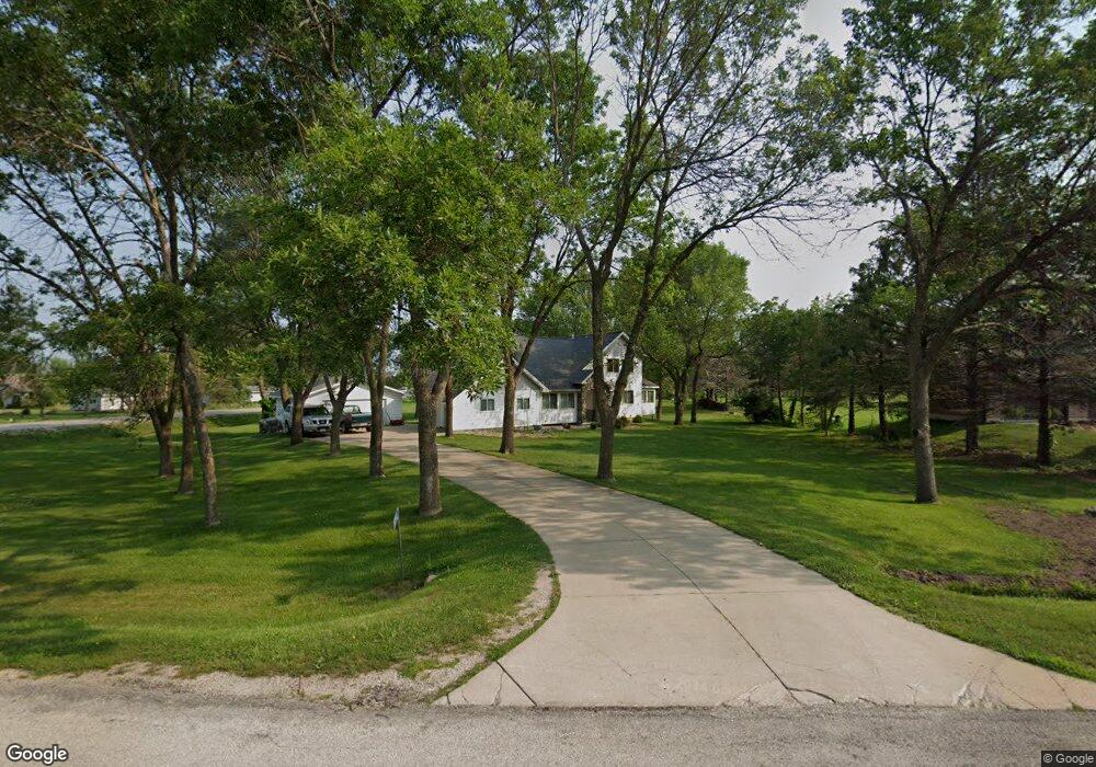
5790 Michael Dr Cedar Rapids, IA 52411
Estimated Value: $307,000 - $385,509
3
Beds
3
Baths
1,850
Sq Ft
$187/Sq Ft
Est. Value
About This Home
This home is located at 5790 Michael Dr, Cedar Rapids, IA 52411 and is currently estimated at $346,127, approximately $187 per square foot. 5790 Michael Dr is a home located in Linn County with nearby schools including Viola Gibson Elementary School, Ponderosa Elementary School, and Harding Middle School.
Ownership History
Date
Name
Owned For
Owner Type
Purchase Details
Closed on
Oct 30, 2003
Sold by
Sherwood James W and Sherwood Jean A
Bought by
Brecht William L and Brecht Mary B
Current Estimated Value
Home Financials for this Owner
Home Financials are based on the most recent Mortgage that was taken out on this home.
Original Mortgage
$182,000
Outstanding Balance
$84,493
Interest Rate
6.02%
Mortgage Type
Unknown
Estimated Equity
$261,634
Create a Home Valuation Report for This Property
The Home Valuation Report is an in-depth analysis detailing your home's value as well as a comparison with similar homes in the area
Home Values in the Area
Average Home Value in this Area
Purchase History
| Date | Buyer | Sale Price | Title Company |
|---|---|---|---|
| Brecht William L | $214,000 | -- |
Source: Public Records
Mortgage History
| Date | Status | Borrower | Loan Amount |
|---|---|---|---|
| Open | Brecht William L | $182,000 |
Source: Public Records
Tax History Compared to Growth
Tax History
| Year | Tax Paid | Tax Assessment Tax Assessment Total Assessment is a certain percentage of the fair market value that is determined by local assessors to be the total taxable value of land and additions on the property. | Land | Improvement |
|---|---|---|---|---|
| 2025 | $5,048 | $336,200 | $77,800 | $258,400 |
| 2024 | $5,426 | $313,900 | $77,800 | $236,100 |
| 2023 | $5,426 | $302,700 | $77,800 | $224,900 |
| 2022 | $5,362 | $257,300 | $62,200 | $195,100 |
| 2021 | $5,036 | $258,800 | $62,200 | $196,600 |
| 2020 | $5,036 | $228,200 | $51,900 | $176,300 |
| 2019 | $4,846 | $224,800 | $51,900 | $172,900 |
| 2018 | $4,712 | $224,800 | $51,900 | $172,900 |
| 2017 | $4,922 | $226,000 | $51,900 | $174,100 |
| 2016 | $4,640 | $218,300 | $51,900 | $166,400 |
| 2015 | $4,928 | $231,632 | $51,850 | $179,782 |
| 2014 | $4,928 | $231,632 | $51,850 | $179,782 |
| 2013 | $4,824 | $231,632 | $51,850 | $179,782 |
Source: Public Records
Map
Nearby Homes
- 5843 Wells Ln
- 5854 Wells Ln
- 6312 Casey Ln NE
- 6524 Michael Dr NE
- 5515 W Mustang Rd
- 6718 Lauder Ln
- 6720 Caldwell Ln
- 4301 Viola St NE
- 2420 Heritage Green Dr
- 2255 Blairsferry Crossing
- 6505 Blairs Ferry Rd
- 6300 Westwind Rd
- 225 Ridgewood Dr
- 2492 River Run Rd
- Lot 1A Buffalo Ridge Dr NE
- 4620 Prairie Stone Dr NE
- 4408 Prairie Stone Dr NE
- 4510 Prairie Stone Dr NE
- 5180 Chestnut Valley Rd
- 2596 Anne Ln
- 5770 Michael Dr NE
- 5800 Michael Dr NE
- 5719 Shiloh Ln NE
- 5711 Shiloh Ln NE
- 5801 Shiloh Ln
- 5791 Michael Dr NE
- 5791 Michael Dr NE
- 5750 Michael Dr NE
- 5771 Michael Dr NE
- 5810 Michael Dr
- 5703 Shiloh Ln NE
- 5771 Michael Dr
- 7012 Milburn Rd
- 5801 Michael Dr
- 5751 Michael Dr NE
- 5625 Shiloh Ln NE
- 5730 Michael Dr NE
- 5811 Michael Dr NE
- 5751 Michael Dr
- 5722 Shiloh Ln NE