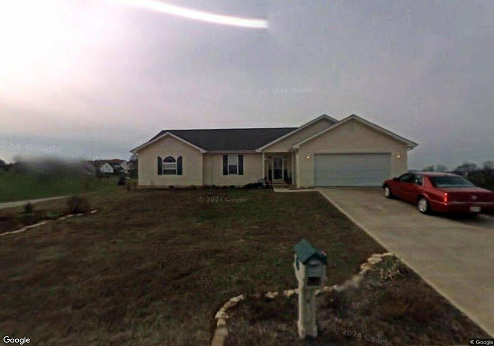
5791 Kay Dr Russellville, TN 37860
Estimated Value: $303,000 - $363,000
3
Beds
2
Baths
1,778
Sq Ft
$188/Sq Ft
Est. Value
About This Home
This home is located at 5791 Kay Dr, Russellville, TN 37860 and is currently estimated at $334,073, approximately $187 per square foot. 5791 Kay Dr is a home located in Hamblen County with nearby schools including Russellville Elementary School, East Ridge Middle School, and Morristown East High School.
Ownership History
Date
Name
Owned For
Owner Type
Purchase Details
Closed on
Dec 12, 2013
Sold by
Obrien William John Timoth
Bought by
Dean D Dianne
Current Estimated Value
Purchase Details
Closed on
Apr 27, 2009
Sold by
Smith Mary Rose
Bought by
Obrien William John Timothy
Purchase Details
Closed on
Dec 30, 2005
Sold by
Robinson Mark
Bought by
Rose Smith Mary
Purchase Details
Closed on
Nov 6, 2001
Sold by
Matthew Clemons
Bought by
Seals William
Purchase Details
Closed on
Dec 15, 2000
Sold by
Scott Brooks F
Bought by
Robinson Mark
Purchase Details
Closed on
Dec 31, 1999
Bought by
Robinson Mark and Ratliff Elster D
Purchase Details
Closed on
Jun 24, 1998
Bought by
Brooks F Scott F and Brooks Julia D
Purchase Details
Closed on
Sep 30, 1988
Bought by
Horner Charles Keith and Horner Geralene
Purchase Details
Closed on
Mar 24, 1987
Bought by
Horner Charles Keith and Horner Geralene
Purchase Details
Closed on
Mar 1, 1962
Create a Home Valuation Report for This Property
The Home Valuation Report is an in-depth analysis detailing your home's value as well as a comparison with similar homes in the area
Home Values in the Area
Average Home Value in this Area
Purchase History
| Date | Buyer | Sale Price | Title Company |
|---|---|---|---|
| Dean D Dianne | $137,500 | -- | |
| Obrien William John Timothy | -- | -- | |
| Rose Smith Mary | $144,000 | -- | |
| Seals William | $110,000 | -- | |
| Robinson Mark | $19,000 | -- | |
| Robinson Mark | $19,000 | -- | |
| Brooks F Scott F | $160,000 | -- | |
| Horner Charles Keith | -- | -- | |
| Horner Charles Keith | -- | -- | |
| -- | -- | -- |
Source: Public Records
Tax History Compared to Growth
Tax History
| Year | Tax Paid | Tax Assessment Tax Assessment Total Assessment is a certain percentage of the fair market value that is determined by local assessors to be the total taxable value of land and additions on the property. | Land | Improvement |
|---|---|---|---|---|
| 2024 | $813 | $41,275 | $6,500 | $34,775 |
| 2023 | $813 | $41,275 | $0 | $0 |
| 2022 | $813 | $41,275 | $6,500 | $34,775 |
| 2021 | $813 | $41,275 | $6,500 | $34,775 |
| 2020 | $813 | $41,275 | $6,500 | $34,775 |
| 2019 | $806 | $37,825 | $6,975 | $30,850 |
| 2018 | $806 | $37,825 | $6,975 | $30,850 |
| 2017 | $806 | $37,825 | $6,975 | $30,850 |
| 2016 | $753 | $37,825 | $6,975 | $30,850 |
| 2015 | $700 | $37,825 | $6,975 | $30,850 |
| 2014 | -- | $37,825 | $6,975 | $30,850 |
| 2013 | -- | $42,275 | $0 | $0 |
Source: Public Records
Map
Nearby Homes
- 5751 Charlene Dr
- 1290 Little Mountain Rd
- 1341 Little Mountain Rd
- 814 Pullen Rd
- 00 Shinbone E Sugar Hollow Rd
- Tract 3 Shinbone Rd
- Tract 4 Shinbone Rd
- 1976/1986 Shinbone Rd
- Tract 2 Shinbone Rd
- 1475 Shinbone Rd
- 5740 Dodson Ferry Rd
- 6284 Old Russellville Pike
- 5790 N 2nd St
- 6330 Old Russellville Pike
- 6563 E Andrew Johnson Hwy
- 6650 E Andrew Johnson Hwy
- 1041 Wilburn Rd
- 233 Harvey Dr
- 6421 Old Russellville Pike
- 1342 Slop Creek Rd
- 5760 Christine Dr
- 5760 Christine Ln Unit S/D LITTLE MOUNTAIN
- 5760 Christine Ln
- 5795 Kay Dr
- 1050 Sarah Way
- 5785 Kay Dr
- . Sarah Way
- 5792 Kay Dr
- 5799 Kay Dr
- 5788 Kay Dr
- lot 83 Sarah Way
- 5746 Christine Ln
- 5746 Christine Ln
- 5746 Christine Ln
- 5779 Kay Dr
- 5706 Christine Ln
- 5745 Christine Dr
- 1070 Sarah Way
- 5773 Kay Dr
- 5739 Christine Dr