Estimated Value: $258,000 - $265,000
2
Beds
2
Baths
1,108
Sq Ft
$236/Sq Ft
Est. Value
About This Home
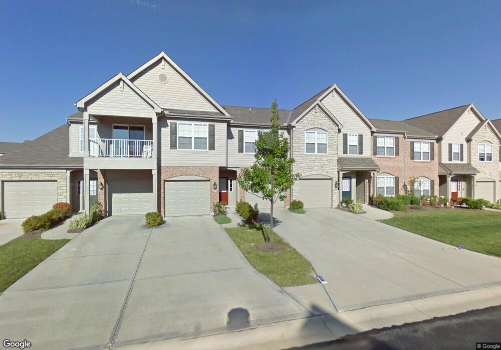
This home is located at 5799 Bayswater Dr Unit 210C, Mason, OH 45040 and is currently estimated at $261,294, approximately $235 per square foot. 5799 Bayswater Dr Unit 210C is a home located in Warren County with nearby schools including Mason Intermediate Elementary School, Mason Middle School, and William Mason High School.
Ownership History
Date
Name
Owned For
Owner Type
Purchase Details
Closed on
Apr 2, 2004
Sold by
The Dress Co
Bought by
Stark Erika E
Current Estimated Value
Home Financials for this Owner
Home Financials are based on the most recent Mortgage that was taken out on this home.
Original Mortgage
$116,000
Outstanding Balance
$54,474
Interest Rate
5.63%
Mortgage Type
Purchase Money Mortgage
Estimated Equity
$206,820
Create a Home Valuation Report for This Property
The Home Valuation Report is an in-depth analysis detailing your home's value as well as a comparison with similar homes in the area
Home Values in the Area
Average Home Value in this Area
Purchase History
| Date | Buyer | Sale Price | Title Company |
|---|---|---|---|
| Stark Erika E | $122,266 | Title Quest Agency Inc |
Source: Public Records
Mortgage History
| Date | Status | Borrower | Loan Amount |
|---|---|---|---|
| Open | Stark Erika E | $116,000 |
Source: Public Records
Tax History Compared to Growth
Tax History
| Year | Tax Paid | Tax Assessment Tax Assessment Total Assessment is a certain percentage of the fair market value that is determined by local assessors to be the total taxable value of land and additions on the property. | Land | Improvement |
|---|---|---|---|---|
| 2024 | $3,205 | $78,980 | $24,500 | $54,480 |
| 2023 | $2,786 | $57,998 | $14,822 | $43,176 |
| 2022 | $2,750 | $57,999 | $14,823 | $43,176 |
| 2021 | $2,605 | $57,999 | $14,823 | $43,176 |
| 2020 | $2,511 | $47,933 | $12,250 | $35,683 |
| 2019 | $2,309 | $47,933 | $12,250 | $35,683 |
| 2018 | $2,316 | $47,933 | $12,250 | $35,683 |
| 2017 | $2,171 | $41,927 | $11,519 | $30,408 |
| 2016 | $2,236 | $41,927 | $11,519 | $30,408 |
| 2015 | $2,240 | $41,927 | $11,519 | $30,408 |
| 2014 | $2,184 | $38,120 | $10,470 | $27,640 |
| 2013 | $2,189 | $44,580 | $12,250 | $32,330 |
Source: Public Records
Map
Nearby Homes
- 5836 Bayswater Dr
- 5787 Southwater Dr Unit 206H
- 5837 Southwater Dr Unit 205F
- 6134 Lakelyn Unit 300D
- 6260 Lake Front
- 6134 Nicholas Way
- 6142 Nicholas Way
- 5513 Harvestdale Dr
- 6356 Amber Ct Unit 91
- 6138 Nicholas Way
- 6387 Coverage Ct
- 6369 Coverage Ct
- 6403 Coverage Ct
- 6357 Coverage Ct
- 6383 Coverage Ct
- 6407 Coverage Ct
- 6375 Coverage Ct
- 6365 Coverage Ct
- 6361 Coverage Ct
- 6379 Coverage Ct
- 5797 Bayswater Dr
- 5801 Bayswater Dr Unit 210B
- 5795 Bayswater Dr Unit 210E
- 5803 Bayswater Dr Unit 210A
- 5793 Bayswater Dr Unit 210F
- 5791 Bayswater Dr Unit 210G
- 5789 Bayswater Dr Unit 210H
- 5787 Bayswater Dr Unit 210Y
- 5798 Bayswater Dr Unit 208G
- 5829 Bayswater Dr Unit 209J
- 5802 Bayswater Dr Unit 2081
- 5794 Bayswater Dr Unit 208E
- 5785 Bayswater Dr Unit 210J
- 5790 Bayswater Dr Unit 208C
- 5800 Bayswater Dr Unit 208H
- 5804 Bayswater Dr Unit 208J
- 5831 Bayswater Dr Unit 2091
- 5796 Bayswater Dr Unit 208F
- 5792 Bayswater Dr Unit 208D
- 5834 Bayswater Dr Unit 207C