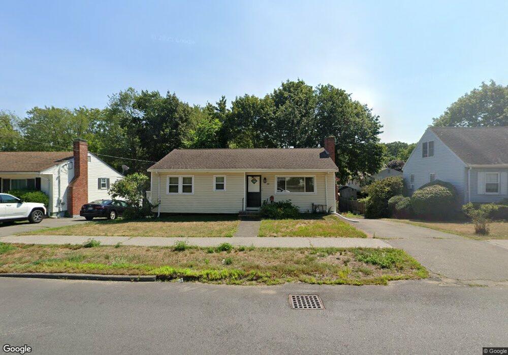
58 Bartholomew St Peabody, MA 01960
South Peabody NeighborhoodEstimated Value: $493,000 - $560,000
3
Beds
1
Bath
1,016
Sq Ft
$521/Sq Ft
Est. Value
About This Home
This home is located at 58 Bartholomew St, Peabody, MA 01960 and is currently estimated at $529,765, approximately $521 per square foot. 58 Bartholomew St is a home located in Essex County with nearby schools including Peabody Veterans Memorial High School and North Shore Christian School.
Ownership History
Date
Name
Owned For
Owner Type
Purchase Details
Closed on
Apr 21, 2011
Sold by
Carty Donna
Bought by
Depillo James
Current Estimated Value
Home Financials for this Owner
Home Financials are based on the most recent Mortgage that was taken out on this home.
Original Mortgage
$175,437
Interest Rate
4.87%
Mortgage Type
FHA
Purchase Details
Closed on
Sep 26, 2008
Sold by
Es Purrington Sophie E and Carty Donna
Bought by
Carty Donna
Create a Home Valuation Report for This Property
The Home Valuation Report is an in-depth analysis detailing your home's value as well as a comparison with similar homes in the area
Home Values in the Area
Average Home Value in this Area
Purchase History
| Date | Buyer | Sale Price | Title Company |
|---|---|---|---|
| Depillo James | $180,000 | -- | |
| Carty Donna | -- | -- |
Source: Public Records
Mortgage History
| Date | Status | Borrower | Loan Amount |
|---|---|---|---|
| Open | Carty Donna | $175,134 | |
| Closed | Carty Donna | $175,437 |
Source: Public Records
Tax History
| Year | Tax Paid | Tax Assessment Tax Assessment Total Assessment is a certain percentage of the fair market value that is determined by local assessors to be the total taxable value of land and additions on the property. | Land | Improvement |
|---|---|---|---|---|
| 2025 | $3,968 | $428,500 | $229,400 | $199,100 |
| 2024 | $3,989 | $437,400 | $229,400 | $208,000 |
| 2023 | $4,081 | $428,700 | $204,800 | $223,900 |
| 2022 | $3,772 | $373,500 | $182,900 | $190,600 |
| 2021 | $3,488 | $332,500 | $166,300 | $166,200 |
| 2020 | $3,510 | $326,800 | $166,300 | $160,500 |
| 2019 | $3,481 | $316,200 | $166,300 | $149,900 |
| 2018 | $3,146 | $274,500 | $151,200 | $123,300 |
| 2017 | $3,063 | $260,500 | $151,200 | $109,300 |
| 2016 | $2,831 | $237,500 | $151,200 | $86,300 |
| 2015 | $2,878 | $234,000 | $147,400 | $86,600 |
Source: Public Records
Map
Nearby Homes
- 26 Bartholomew Terrace
- 12 Tara Rd
- 6 Allen Rd
- 4 Pulver Dr
- 11 Pulver Dr
- 18 Kittredge St
- 10 Fairview Rd
- 30 Longwood Rd
- 333 Lynnfield St
- 217 Cedar Brook Rd
- 325 Den Quarry Rd
- 54 Harris Rd
- 9 Sutcliffe Rd
- 2 Anchor Rd
- 75 Park Rd
- 175 Jenness St
- 103 Kernwood Dr
- 233 Bartholomew St
- 73 Lockwood Rd
- 22 Strongwater Dr
- 60 Bartholomew St
- 56 Bartholomew St
- 2 Daniel Terrace
- 54 Bartholomew St
- 57 Bartholomew St
- 4 Daniel Terrace
- 62 Bartholomew St
- 55 Bartholomew St
- 6 Daniel Terrace
- 1 Daniel Terrace
- 65 Bartholomew St
- 64 Bartholomew St
- 52 Bartholomew St
- 51 Bartholomew St
- 3 Daniel Terrace
- 8 Daniel Terrace
- Lot-5 Daniel Terrace
- 3 Murphy Rd
- 1 Murphy Rd
- 69 Bartholomew St
Your Personal Tour Guide
Ask me questions while you tour the home.