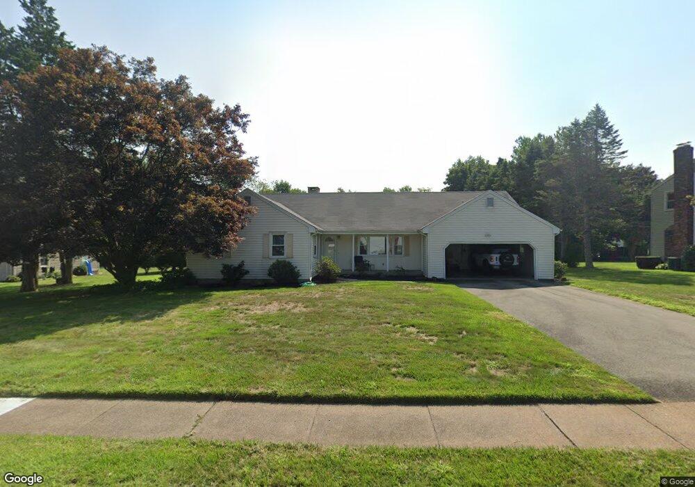
58 Dusty Ln Wethersfield, CT 06109
Estimated Value: $479,000 - $572,000
3
Beds
2
Baths
1,820
Sq Ft
$291/Sq Ft
Est. Value
About This Home
This home is located at 58 Dusty Ln, Wethersfield, CT 06109 and is currently estimated at $528,941, approximately $290 per square foot. 58 Dusty Ln is a home located in Hartford County with nearby schools including Highcrest School, Woodcrest Elementary School, and Silas Deane Middle School.
Ownership History
Date
Name
Owned For
Owner Type
Purchase Details
Closed on
Dec 1, 2003
Sold by
Delgaudio Richard and Delgaudio Vincent
Bought by
Pazdar John S
Current Estimated Value
Home Financials for this Owner
Home Financials are based on the most recent Mortgage that was taken out on this home.
Original Mortgage
$236,000
Outstanding Balance
$93,868
Interest Rate
3.87%
Estimated Equity
$435,073
Purchase Details
Closed on
Jan 15, 2002
Sold by
Mary Delgauidio Ft and Delgaudio Mary
Bought by
Delgaudio Richard and Delgaudio Vincent
Purchase Details
Closed on
Aug 28, 2001
Sold by
Mary Delgaudio Ft and Delgaudio Mary
Bought by
Delgaudio Richard and Delgaudio Vincent
Create a Home Valuation Report for This Property
The Home Valuation Report is an in-depth analysis detailing your home's value as well as a comparison with similar homes in the area
Home Values in the Area
Average Home Value in this Area
Purchase History
| Date | Buyer | Sale Price | Title Company |
|---|---|---|---|
| Pazdar John S | $295,000 | -- | |
| Delgaudio Richard | $189,400 | -- | |
| Delgaudio Richard | $110,000 | -- |
Source: Public Records
Mortgage History
| Date | Status | Borrower | Loan Amount |
|---|---|---|---|
| Open | Delgaudio Richard | $236,000 |
Source: Public Records
Tax History Compared to Growth
Tax History
| Year | Tax Paid | Tax Assessment Tax Assessment Total Assessment is a certain percentage of the fair market value that is determined by local assessors to be the total taxable value of land and additions on the property. | Land | Improvement |
|---|---|---|---|---|
| 2025 | $12,123 | $294,100 | $113,920 | $180,180 |
| 2024 | $8,829 | $204,270 | $87,810 | $116,460 |
| 2023 | $8,534 | $204,270 | $87,810 | $116,460 |
| 2022 | $8,391 | $204,270 | $87,810 | $116,460 |
| 2021 | $8,308 | $204,270 | $87,810 | $116,460 |
| 2020 | $8,312 | $204,270 | $87,800 | $116,470 |
| 2019 | $8,322 | $204,270 | $87,800 | $116,470 |
| 2018 | $8,119 | $199,100 | $87,700 | $111,400 |
| 2017 | $7,918 | $199,100 | $87,700 | $111,400 |
| 2016 | $7,673 | $199,100 | $87,700 | $111,400 |
| 2015 | $7,604 | $199,100 | $87,700 | $111,400 |
| 2014 | $7,315 | $199,100 | $87,700 | $111,400 |
Source: Public Records
Map
Nearby Homes
- 42 Rose Ct
- 155 Old Common Rd
- 325 Fox Hill Rd
- 0 Old Post Rd
- 268 Fox Hill Rd
- 5 Robeth Ln
- 18 Stone Hill Dr
- 1279 Maple St
- 19 Jacob Dr
- 45 Sandy Dr
- 6 Vinnie Dr
- 211 Fairlane Dr
- 67 Luca (Homesite 6) Ln
- 53 Luca (Homesite 4) Ln
- 8 Stella Dr
- 39 Cottonwood Rd Unit 39
- 61 Luca Ln
- 76 Luca Lane Homesite 8
- 221 Westmeadow Rd
- 88 Highland St