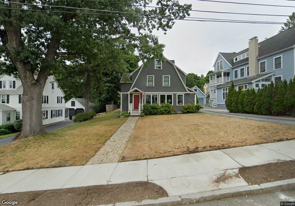
58 Myrtle St West Newton, MA 02465
West Newton NeighborhoodEstimated Value: $1,798,000 - $1,968,000
3
Beds
2
Baths
1,826
Sq Ft
$1,049/Sq Ft
Est. Value
About This Home
This home is located at 58 Myrtle St, West Newton, MA 02465 and is currently estimated at $1,914,962, approximately $1,048 per square foot. 58 Myrtle St is a home located in Middlesex County with nearby schools including Peirce Elementary School, F.A. Day Middle School, and Newton North High School.
Ownership History
Date
Name
Owned For
Owner Type
Purchase Details
Closed on
Aug 20, 2007
Sold by
33-35 Everett Street R and Harkins Philip J
Bought by
Mceachern Catharine R and Mceachern Duncan B
Current Estimated Value
Home Financials for this Owner
Home Financials are based on the most recent Mortgage that was taken out on this home.
Original Mortgage
$940,000
Outstanding Balance
$595,465
Interest Rate
6.67%
Mortgage Type
Purchase Money Mortgage
Estimated Equity
$1,319,497
Purchase Details
Closed on
Nov 10, 2006
Sold by
Ristaino Dorothy and Brown Mary Emily
Bought by
33-35 Everett Street R and Harkins Philip J
Create a Home Valuation Report for This Property
The Home Valuation Report is an in-depth analysis detailing your home's value as well as a comparison with similar homes in the area
Home Values in the Area
Average Home Value in this Area
Purchase History
| Date | Buyer | Sale Price | Title Company |
|---|---|---|---|
| Mceachern Catharine R | $1,175,000 | -- | |
| 33-35 Everett Street R | $480,000 | -- |
Source: Public Records
Mortgage History
| Date | Status | Borrower | Loan Amount |
|---|---|---|---|
| Open | Mceachern Catharine R | $940,000 |
Source: Public Records
Tax History Compared to Growth
Tax History
| Year | Tax Paid | Tax Assessment Tax Assessment Total Assessment is a certain percentage of the fair market value that is determined by local assessors to be the total taxable value of land and additions on the property. | Land | Improvement |
|---|---|---|---|---|
| 2025 | $16,406 | $1,674,100 | $971,700 | $702,400 |
| 2024 | $15,863 | $1,625,300 | $943,400 | $681,900 |
| 2023 | $15,121 | $1,485,400 | $725,300 | $760,100 |
| 2022 | $14,469 | $1,375,400 | $671,600 | $703,800 |
| 2021 | $13,961 | $1,297,500 | $633,600 | $663,900 |
| 2020 | $13,546 | $1,297,500 | $633,600 | $663,900 |
| 2019 | $13,164 | $1,259,700 | $615,100 | $644,600 |
| 2018 | $12,716 | $1,175,200 | $557,800 | $617,400 |
| 2017 | $12,329 | $1,108,700 | $526,200 | $582,500 |
| 2016 | $11,792 | $1,036,200 | $491,800 | $544,400 |
| 2015 | $11,243 | $968,400 | $459,600 | $508,800 |
Source: Public Records
Map
Nearby Homes
- 17 Gilbert St
- 1639 Washington St
- 0 Duncan Rd Unit 72925240
- 51 Bourne St
- 68 Mignon Rd
- 1488 Washington St Unit 1488
- 10 Ruane Rd
- 18 Sewall St
- 13 Weir St
- 10 Crescent St Unit 2
- 12 Inis Cir
- 17 Crescent St
- 1754 Washington St
- 283 Woodland Rd
- 179 Auburn St
- 66 Webster St
- 429 Cherry St Unit 11
- 194 Auburn St
- 163 Day St
- 62-64 Rowe St Unit B