B
Seller's Agent in 2025
Bailey Clermont
Today Real Estate
(603) 348-7327
3 in this area
84 Total Sales
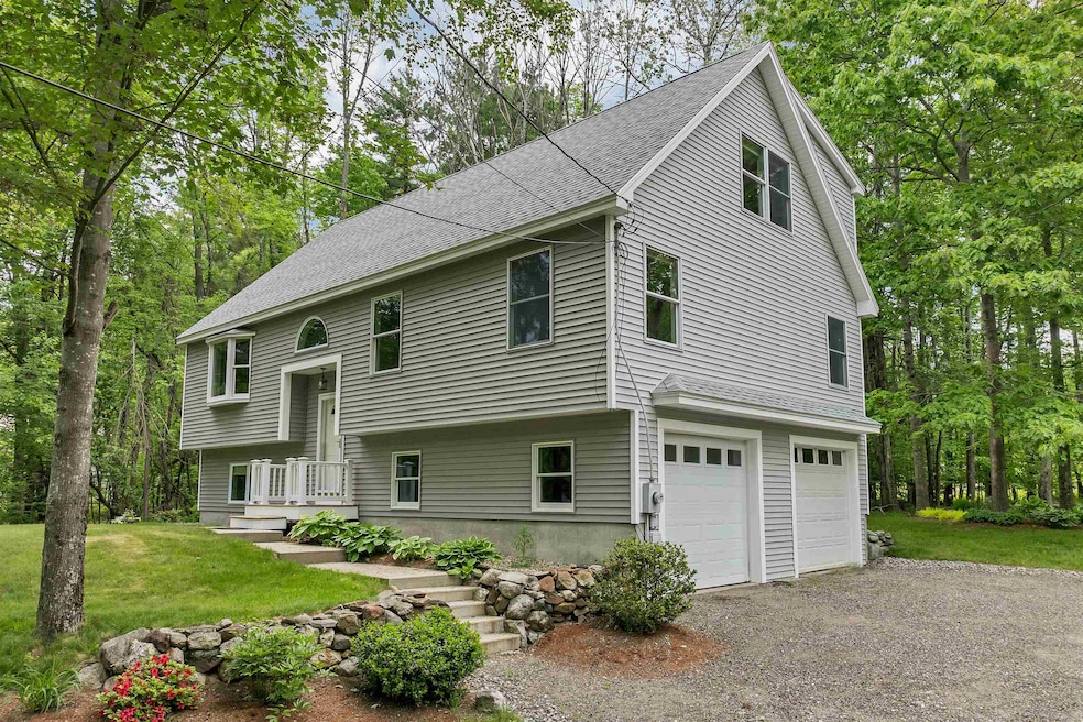
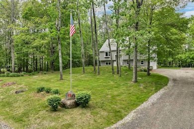
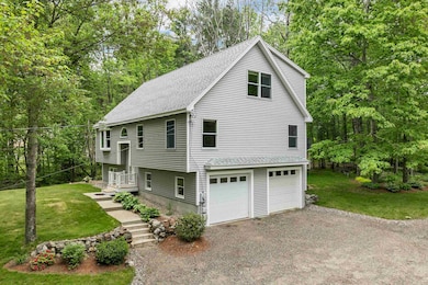
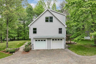
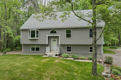
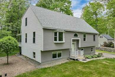
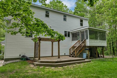
Tucked away in a peaceful wooded setting, this charming home offers the perfect blend of privacy, space, and natural beauty. Surrounded by mature trees and lush landscaping, the property invites you to relax and enjoy the serenity of nature, whether from the screened porch or while exploring the scenic yard complete with a rustic garden shed and stream. Step inside to find an open-concept kitchen with granite countertops, stainless steel appliances, and a spacious center island—ideal for cooking and entertaining. The adjacent dining and living areas are filled with natural light and gleaming hardwood floors, creating a warm and welcoming atmosphere. Upstairs, a generously sized bedroom features a large walk-in closet, and spacious primary bathroom. Enter through the two car heated garage to find the perfect office space on the first level, with plenty of storage in the adjacent utility room. The main level is home to two bedrooms with one full and one half bathroom respectively. Whether you're seeking a quiet retreat or a place to gather with friends and family, this home delivers a rare combination of seclusion and comfort—all within easy reach of local amenities. Your woodland escape awaits!
| Date | Type | Sale Price | Title Company |
|---|---|---|---|
| Warranty Deed | $550,000 | -- | |
| Warranty Deed | $550,000 | -- | |
| Warranty Deed | $550,000 | -- | |
| Deed | $156,000 | -- | |
| Deed | $156,000 | -- |
| Date | Status | Loan Amount | Loan Type |
|---|---|---|---|
| Open | $530,337 | VA | |
| Closed | $530,337 | VA | |
| Previous Owner | $149,139 | Stand Alone Refi Refinance Of Original Loan | |
| Previous Owner | $121,800 | Purchase Money Mortgage | |
| Previous Owner | $137,500 | Unknown |
| Date | Event | Price | List to Sale | Price per Sq Ft |
|---|---|---|---|---|
| 07/02/2025 07/02/25 | Sold | $550,000 | 0.0% | $250 / Sq Ft |
| 06/02/2025 06/02/25 | For Sale | $549,900 | -- | $250 / Sq Ft |
| Year | Tax Paid | Tax Assessment Tax Assessment Total Assessment is a certain percentage of the fair market value that is determined by local assessors to be the total taxable value of land and additions on the property. | Land | Improvement |
|---|---|---|---|---|
| 2024 | $3,406 | $262,400 | $84,700 | $177,700 |
| 2022 | $2,983 | $262,400 | $84,700 | $177,700 |
| 2021 | $3,335 | $293,100 | $115,400 | $177,700 |
| 2020 | $4,431 | $235,400 | $73,800 | $161,600 |
| 2019 | $4,379 | $235,400 | $73,800 | $161,600 |
| 2018 | $4,268 | $235,400 | $73,800 | $161,600 |
| 2017 | $4,089 | $235,400 | $73,800 | $161,600 |
| 2016 | $3,105 | $219,400 | $80,800 | $138,600 |
| 2015 | $3,181 | $222,900 | $84,300 | $138,600 |
| 2014 | $3,141 | $226,800 | $86,000 | $140,800 |
| 2013 | $3,195 | $237,700 | $71,600 | $166,100 |
B
Seller's Agent in 2025
Bailey Clermont
Today Real Estate
(603) 348-7327
3 in this area
84 Total Sales

Buyer's Agent in 2025
Roxanne Mailhot
BHG Masiello Concord
(603) 723-4447
1 in this area
73 Total Sales
Source: PrimeMLS
MLS Number: 5044113
APN: ALTN-000031-000000-000049
Disclaimer: Certain information contained herein is derived from information provided by parties other than Homes.com. All information provided is deemed reliable, but is not guaranteed to be accurate and should be independently verified.
![]() Copyright 2026 PrimeMLS, Inc. All rights reserved. This information is deemed reliable, but not guaranteed. The data relating to real estate displayed on this display comes in part from the IDX Program of PrimeMLS. The information being provided is for consumers’ personal, non-commercial use and may not be used for any purpose other than to identify prospective properties consumers may be interested in purchasing.
Copyright 2026 PrimeMLS, Inc. All rights reserved. This information is deemed reliable, but not guaranteed. The data relating to real estate displayed on this display comes in part from the IDX Program of PrimeMLS. The information being provided is for consumers’ personal, non-commercial use and may not be used for any purpose other than to identify prospective properties consumers may be interested in purchasing.
Ask me questions while you tour the home.