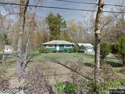
58 Progressive Ave West Bridgewater, MA 02379
Estimated Value: $427,000 - $491,000
2
Beds
2
Baths
960
Sq Ft
$472/Sq Ft
Est. Value
About This Home
This home is located at 58 Progressive Ave, West Bridgewater, MA 02379 and is currently estimated at $453,271, approximately $472 per square foot. 58 Progressive Ave is a home located in Plymouth County with nearby schools including Spring Street Elementary School, Rose L. MacDonald Elementary School, and Howard Elementary School.
Ownership History
Date
Name
Owned For
Owner Type
Purchase Details
Closed on
Aug 21, 2020
Sold by
Salvador Evelyn I
Bought by
Progressive Avenue Rt
Current Estimated Value
Purchase Details
Closed on
May 22, 1987
Sold by
Dawe Helen S
Bought by
Salvador Albert
Home Financials for this Owner
Home Financials are based on the most recent Mortgage that was taken out on this home.
Original Mortgage
$40,000
Interest Rate
9.48%
Mortgage Type
Purchase Money Mortgage
Create a Home Valuation Report for This Property
The Home Valuation Report is an in-depth analysis detailing your home's value as well as a comparison with similar homes in the area
Home Values in the Area
Average Home Value in this Area
Purchase History
| Date | Buyer | Sale Price | Title Company |
|---|---|---|---|
| Progressive Avenue Rt | -- | None Available | |
| Salvador Albert | $156,000 | -- |
Source: Public Records
Mortgage History
| Date | Status | Borrower | Loan Amount |
|---|---|---|---|
| Previous Owner | Salvador Albert | $25,000 | |
| Previous Owner | Salvador Albert | $40,000 |
Source: Public Records
Tax History Compared to Growth
Tax History
| Year | Tax Paid | Tax Assessment Tax Assessment Total Assessment is a certain percentage of the fair market value that is determined by local assessors to be the total taxable value of land and additions on the property. | Land | Improvement |
|---|---|---|---|---|
| 2025 | $5,795 | $423,900 | $233,200 | $190,700 |
| 2024 | $5,410 | $381,800 | $211,500 | $170,300 |
| 2023 | $5,203 | $338,500 | $183,200 | $155,300 |
| 2022 | $5,005 | $308,600 | $172,300 | $136,300 |
| 2021 | $4,903 | $293,400 | $172,300 | $121,100 |
| 2020 | $4,749 | $290,100 | $172,300 | $117,800 |
| 2019 | $4,761 | $288,000 | $172,300 | $115,700 |
| 2018 | $4,596 | $268,800 | $163,600 | $105,200 |
| 2017 | $4,379 | $247,000 | $148,300 | $98,700 |
| 2016 | $4,257 | $236,500 | $137,800 | $98,700 |
| 2015 | $4,178 | $234,600 | $137,800 | $96,800 |
| 2014 | $3,816 | $231,400 | $137,800 | $93,600 |
Source: Public Records
Map
Nearby Homes
- 368 N Elm St
- 459 N Elm St
- 30 Grant St
- 262 N Elm St
- 6 Maddison
- Lot 0 Jeffrey Dr
- Lot 00 Jeffrey Dr
- 18 Skyview Dr
- Lot 0000 Jeffrey Dr (Off Crescent St)
- Lot 000 Jeffrey Dr (Off Crescent St)
- 454 Copeland St
- 23 Pearl Rd
- 152 Country Club Ln
- 29 Glendale Ave
- 36 Commonwealth Ave
- 17 Ej Medairos Way
- 47 Southworth St
- 131 West St
- 10 Longworth Ave Unit 12
- 169 W Center St
- 58 Progressive Ave
- 56 Progressive Ave
- 62 Progressive Ave
- 59 Progressive Ave
- 61 Progressive Ave
- 54 Progressive Ave
- 0 Progressive Avenue #1
- LOT16B West St
- LOT16A West St
- #9 Walnut St
- 4 Bayberry Rd
- 70 Progressive Ave
- 55 Progressive Ave
- 71 Progressive Ave
- 6 Timothy Dr
- 10 Timothy Dr
- 50 Progressive Ave
- 2 Rioux Rd
- 473 Spring St
- 2 Timothy Dr