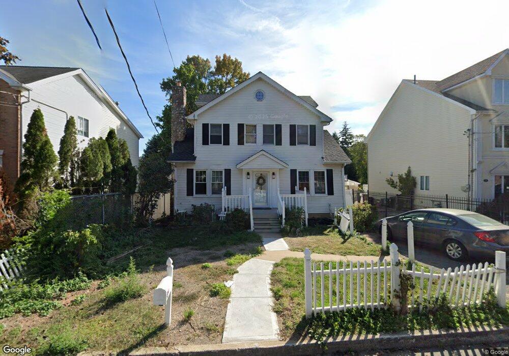
58 Sharrotts Rd Staten Island, NY 10309
Woodrow NeighborhoodEstimated Value: $881,000 - $1,010,000
--
Bed
4
Baths
2,832
Sq Ft
$341/Sq Ft
Est. Value
About This Home
This home is located at 58 Sharrotts Rd, Staten Island, NY 10309 and is currently estimated at $965,806, approximately $341 per square foot. 58 Sharrotts Rd is a home located in Richmond County with nearby schools including P.S. 6 Cpl Allan F Kivlehan School, Is 34 Tottenville, and Tottenville High School.
Ownership History
Date
Name
Owned For
Owner Type
Purchase Details
Closed on
May 2, 2001
Sold by
Connolly Catherine T and Connolly Thomas M
Bought by
Connolly Catherine T and Trowbridge Catherine M
Current Estimated Value
Home Financials for this Owner
Home Financials are based on the most recent Mortgage that was taken out on this home.
Original Mortgage
$70,000
Interest Rate
6.86%
Create a Home Valuation Report for This Property
The Home Valuation Report is an in-depth analysis detailing your home's value as well as a comparison with similar homes in the area
Home Values in the Area
Average Home Value in this Area
Purchase History
| Date | Buyer | Sale Price | Title Company |
|---|---|---|---|
| Connolly Catherine T | -- | Stewart Title |
Source: Public Records
Mortgage History
| Date | Status | Borrower | Loan Amount |
|---|---|---|---|
| Closed | Connolly Catherine T | $70,000 |
Source: Public Records
Tax History Compared to Growth
Tax History
| Year | Tax Paid | Tax Assessment Tax Assessment Total Assessment is a certain percentage of the fair market value that is determined by local assessors to be the total taxable value of land and additions on the property. | Land | Improvement |
|---|---|---|---|---|
| 2025 | $8,326 | $69,480 | $12,278 | $57,202 |
| 2024 | $8,338 | $65,280 | $12,328 | $52,952 |
| 2023 | $8,419 | $42,854 | $12,606 | $30,248 |
| 2022 | $8,203 | $51,900 | $18,780 | $33,120 |
| 2021 | $8,141 | $53,820 | $18,780 | $35,040 |
| 2020 | $13,046 | $57,720 | $18,780 | $38,940 |
| 2019 | $7,178 | $50,160 | $18,780 | $31,380 |
| 2018 | $6,982 | $35,712 | $16,318 | $19,394 |
| 2017 | $6,925 | $35,443 | $15,758 | $19,685 |
| 2016 | $6,375 | $33,437 | $15,930 | $17,507 |
| 2015 | $5,406 | $31,545 | $13,837 | $17,708 |
| 2014 | $5,406 | $29,760 | $15,660 | $14,100 |
Source: Public Records
Map
Nearby Homes
- 59 Pembrook Loop
- 45 Pembrook Loop
- 117 Pembrook Loop
- 50 Mallard Ln
- 11 Jessica Ln
- 33 White Oak Ln
- 155 Darnell Ln
- 23 Sharon Ln
- 42 Spruce Ln
- 20 Helene Ct
- 122 Clay Pit Rd
- 23 Helene Ct
- 100 Marisa Cir
- 19 Woodrose Ln
- 62 Dexter Ave
- 55 Quail Ln
- 476 Hargold Ave
- 0 Veterans Rd E
- 41 Brookside Loop
- 28 Brookside Loop
- 60 Sharrotts Rd
- 52 Sharrotts Rd
- 50 Mandy Ct
- 52 Mandy Ct
- 50 Sharrotts Rd
- 46 Mandy Ct
- 46 Mandy Ct
- 62 Sharrotts Rd
- 46 Sharrotts Rd
- 42 Mandy Ct
- 44 Sharrotts Rd
- 63 Pembrook Loop
- 61 Pembrook Loop
- 40 Mandy Ct
- 40 Sharrotts Rd
- 57 Pembrook Loop
- 55 Pembrook Loop
- 71 Pembrook Loop
- 71 Pembrook Loop Unit 59
- 36 Mandy Ct