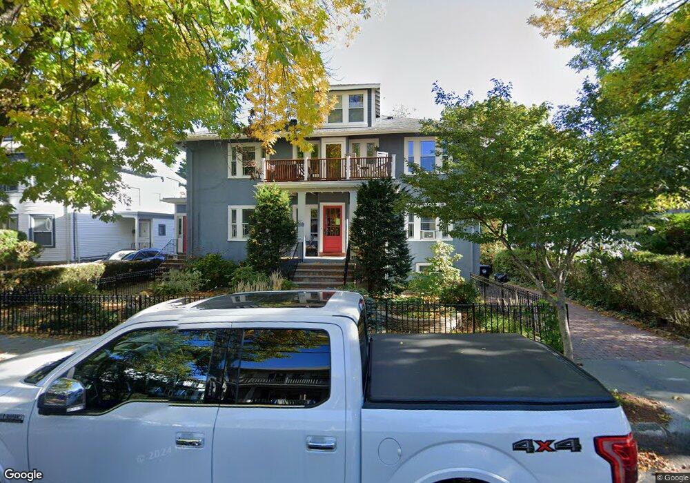
58 Verndale St Unit 58 Brookline, MA 02446
Coolidge Corner NeighborhoodEstimated Value: $1,254,073 - $1,528,000
3
Beds
1
Bath
1,914
Sq Ft
$747/Sq Ft
Est. Value
About This Home
This home is located at 58 Verndale St Unit 58, Brookline, MA 02446 and is currently estimated at $1,429,518, approximately $746 per square foot. 58 Verndale St Unit 58 is a home located in Norfolk County with nearby schools including Match Charter Public School.
Ownership History
Date
Name
Owned For
Owner Type
Purchase Details
Closed on
Aug 13, 2010
Sold by
Krock David E
Bought by
Dulla Christopher G and Dulla Melissa
Current Estimated Value
Home Financials for this Owner
Home Financials are based on the most recent Mortgage that was taken out on this home.
Original Mortgage
$435,000
Outstanding Balance
$288,883
Interest Rate
4.63%
Mortgage Type
Purchase Money Mortgage
Estimated Equity
$1,140,635
Create a Home Valuation Report for This Property
The Home Valuation Report is an in-depth analysis detailing your home's value as well as a comparison with similar homes in the area
Home Values in the Area
Average Home Value in this Area
Purchase History
| Date | Buyer | Sale Price | Title Company |
|---|---|---|---|
| Dulla Christopher G | $580,500 | -- |
Source: Public Records
Mortgage History
| Date | Status | Borrower | Loan Amount |
|---|---|---|---|
| Open | Dulla Christopher G | $435,000 | |
| Closed | Dulla Christopher G | $58,000 |
Source: Public Records
Tax History Compared to Growth
Tax History
| Year | Tax Paid | Tax Assessment Tax Assessment Total Assessment is a certain percentage of the fair market value that is determined by local assessors to be the total taxable value of land and additions on the property. | Land | Improvement |
|---|---|---|---|---|
| 2025 | $10,456 | $1,059,400 | $0 | $1,059,400 |
| 2024 | $10,147 | $1,038,600 | $0 | $1,038,600 |
| 2023 | $9,396 | $942,400 | $0 | $942,400 |
| 2022 | $9,324 | $915,000 | $0 | $915,000 |
| 2021 | $8,878 | $905,900 | $0 | $905,900 |
| 2020 | $8,477 | $897,000 | $0 | $897,000 |
| 2019 | $8,005 | $854,300 | $0 | $854,300 |
| 2018 | $7,697 | $813,600 | $0 | $813,600 |
| 2017 | $7,443 | $753,300 | $0 | $753,300 |
| 2016 | $7,136 | $684,800 | $0 | $684,800 |
| 2015 | $6,649 | $622,600 | $0 | $622,600 |
| 2014 | $6,601 | $579,500 | $0 | $579,500 |
Source: Public Records
Map
Nearby Homes
- 28 Verndale St
- 5 Fiske Terrace
- 200 Winchester St Unit 1
- 85 Brainerd Rd Unit TH7
- 1304 Commonwealth Ave Unit 5
- 239 Kelton St Unit 41
- 245 Kelton St Unit 21
- 150+152 Jordan Rd
- 86 Glenville Ave Unit 2
- 5 Spofford Rd Unit 17
- 116 Thorndike St
- 116 Thorndike St Unit 2
- 116 Thorndike St Unit 1
- 30 Glenville Ave Unit 1
- 83 Glenville Ave
- 188 Mason Terrace Unit 188
- 186 Mason Terrace Unit 186
- 107 Centre St Unit A
- 14 Radcliffe Rd Unit 1
- 249 Corey Rd Unit 404
- 56 Verndale St Unit 58
- 60 Verndale St
- 50 Verndale St Unit 52
- 50 Verndale St Unit 1 BED
- 50 Verndale St Unit 3 BED
- 50 Verndale St Unit 2
- 50 Verndale St
- 51 Kenwood St
- 55 Kenwood St
- 55 Kenwood St Unit U
- 45 Kenwood St
- 45 Kenwood St Unit 2
- 57 Kenwood St
- 64 Verndale St Unit 64
- 64 Verndale St
- 64 Verndale St Unit 1
- 47 Kenwood St Unit 47
- 66 Verndale St
- 66 Verndale St Unit 2
- 46 Verndale St