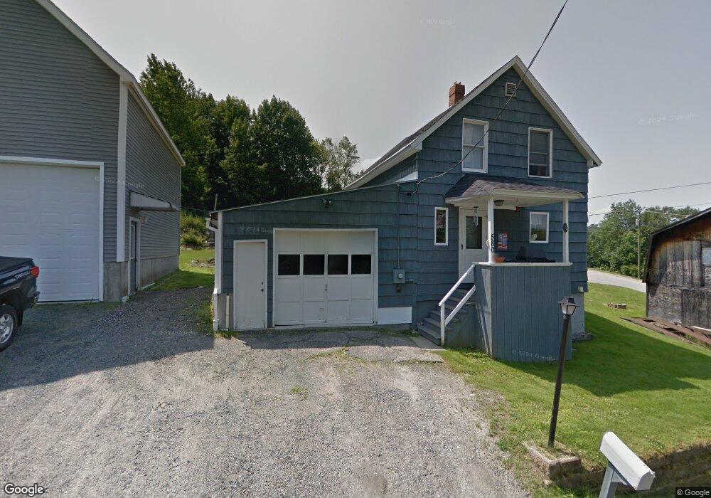
580 Forbush Ave Berlin, NH 03570
Estimated Value: $171,141 - $216,000
3
Beds
1
Bath
840
Sq Ft
$226/Sq Ft
Est. Value
About This Home
This home is located at 580 Forbush Ave, Berlin, NH 03570 and is currently estimated at $189,785, approximately $225 per square foot. 580 Forbush Ave is a home located in Coos County with nearby schools including Berlin Elementary School, Brown Elementary School, and Berlin Middle School.
Ownership History
Date
Name
Owned For
Owner Type
Purchase Details
Closed on
May 27, 2020
Sold by
Poulin Leo R and Poulin Linda A
Bought by
Langlois Roland
Current Estimated Value
Purchase Details
Closed on
Jan 4, 1999
Sold by
Hamel Gerard W and Hamel Paula J
Bought by
Langlois Roland L
Home Financials for this Owner
Home Financials are based on the most recent Mortgage that was taken out on this home.
Original Mortgage
$17,600
Interest Rate
6.84%
Create a Home Valuation Report for This Property
The Home Valuation Report is an in-depth analysis detailing your home's value as well as a comparison with similar homes in the area
Home Values in the Area
Average Home Value in this Area
Purchase History
| Date | Buyer | Sale Price | Title Company |
|---|---|---|---|
| Langlois Roland | $16,000 | None Available | |
| Langlois Roland L | $22,000 | -- |
Source: Public Records
Mortgage History
| Date | Status | Borrower | Loan Amount |
|---|---|---|---|
| Previous Owner | Langlois Roland L | $59,500 | |
| Previous Owner | Langlois Roland L | $19,200 | |
| Previous Owner | Langlois Roland L | $17,600 |
Source: Public Records
Tax History Compared to Growth
Tax History
| Year | Tax Paid | Tax Assessment Tax Assessment Total Assessment is a certain percentage of the fair market value that is determined by local assessors to be the total taxable value of land and additions on the property. | Land | Improvement |
|---|---|---|---|---|
| 2024 | $4,667 | $151,100 | $24,700 | $126,400 |
| 2023 | $4,054 | $150,700 | $24,700 | $126,000 |
| 2022 | $4,108 | $150,700 | $24,700 | $126,000 |
| 2021 | $3,164 | $86,600 | $13,500 | $73,100 |
| 2020 | $3,112 | $86,600 | $13,500 | $73,100 |
| 2018 | $3,059 | $77,900 | $9,700 | $68,200 |
| 2017 | $2,716 | $69,300 | $6,800 | $62,500 |
| 2016 | $2,716 | $69,300 | $6,800 | $62,500 |
Source: Public Records
Map
Nearby Homes
- 646 Trudel St
- 682 Cheshire St
- 669 Hampshire St
- 1378 Napert St
- 638 Rockingham St
- 606 Rockingham St
- 578 Rockingham St
- 608-610 Burgess St
- 604 Burgess St
- Lots Hutchins St Unit M133/L105, M128/L262
- 469 Hillsboro St
- 518 Burgess St
- 416 Burgess St
- 9 Birch St
- 0 Hillsboro St Unit 5046211
- 0 Hillsboro St Unit 5036784
- 18 Peavey Ln
- 421 Champlain St
- 17 Hemlock Ln
- 22 Cambridge St