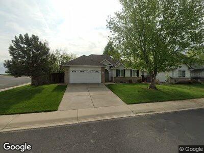
580 Hart St Firestone, CO 80520
Estimated Value: $501,000 - $523,000
3
Beds
3
Baths
3,504
Sq Ft
$145/Sq Ft
Est. Value
About This Home
This home is located at 580 Hart St, Firestone, CO 80520 and is currently estimated at $509,321, approximately $145 per square foot. 580 Hart St is a home with nearby schools including Legacy Elementary School, Coal Ridge Middle School, and Frederick Senior High School.
Ownership History
Date
Name
Owned For
Owner Type
Purchase Details
Closed on
May 6, 1999
Sold by
Timberland Construction Co Llc
Bought by
Byrd Christopher A and Knappe Beverly J
Current Estimated Value
Home Financials for this Owner
Home Financials are based on the most recent Mortgage that was taken out on this home.
Original Mortgage
$110,000
Interest Rate
6.99%
Create a Home Valuation Report for This Property
The Home Valuation Report is an in-depth analysis detailing your home's value as well as a comparison with similar homes in the area
Home Values in the Area
Average Home Value in this Area
Purchase History
| Date | Buyer | Sale Price | Title Company |
|---|---|---|---|
| Byrd Christopher A | $177,506 | -- |
Source: Public Records
Mortgage History
| Date | Status | Borrower | Loan Amount |
|---|---|---|---|
| Closed | Black Stone Minerals Company L | $0 | |
| Open | Byrd Christopher A | $90,600 | |
| Closed | Byrd Christopher A | $35,000 | |
| Closed | Byrd Christopher A | $110,000 | |
| Previous Owner | Timberland Construction Company Llc | $124,575 |
Source: Public Records
Tax History Compared to Growth
Tax History
| Year | Tax Paid | Tax Assessment Tax Assessment Total Assessment is a certain percentage of the fair market value that is determined by local assessors to be the total taxable value of land and additions on the property. | Land | Improvement |
|---|---|---|---|---|
| 2024 | $3,232 | $36,080 | $5,700 | $30,380 |
| 2023 | $3,232 | $36,420 | $5,750 | $30,670 |
| 2022 | $2,811 | $26,970 | $4,870 | $22,100 |
| 2021 | $2,836 | $27,750 | $5,010 | $22,740 |
| 2020 | $2,741 | $27,040 | $3,720 | $23,320 |
| 2019 | $2,781 | $27,040 | $3,720 | $23,320 |
| 2018 | $2,212 | $22,330 | $3,600 | $18,730 |
| 2017 | $2,261 | $22,330 | $3,600 | $18,730 |
| 2016 | $2,100 | $20,400 | $2,230 | $18,170 |
| 2015 | $2,034 | $20,400 | $2,230 | $18,170 |
| 2014 | $1,542 | $15,390 | $2,150 | $13,240 |
Source: Public Records
Map
Nearby Homes
- 266 Wooster Ave
- 201 Monmouth Ave
- 778 2nd St
- 173 Jackson Ave
- 229 Berwick Ave
- 0 Fir 20490-B L12 Thru 15 Blk10 Unit REC6405259
- 629 Mcclure Ave
- 102 Jackson Dr
- 751 Florence Ave
- 509 Evan Ct
- 410 Clover Ct
- 441 Johnson St
- 6912 Poudre St
- 11739 County Road 13
- 449 Dunmire St
- 7231 Clarke Dr
- 205 Hawthorn St
- 7227 Clarke Dr
- 114 Walnut Dr
- 7108 Morrison Dr