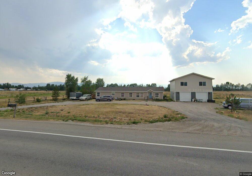
580 N Highway 33 Driggs, ID 83422
Estimated Value: $679,000 - $809,247
4
Beds
3
Baths
2,052
Sq Ft
$360/Sq Ft
Est. Value
About This Home
This home is located at 580 N Highway 33, Driggs, ID 83422 and is currently estimated at $739,062, approximately $360 per square foot. 580 N Highway 33 is a home with nearby schools including Driggs Elementary School, Teton High School, and The Learning Academy of Teton Valley.
Ownership History
Date
Name
Owned For
Owner Type
Purchase Details
Closed on
Oct 19, 2024
Sold by
Mcdonald Daniel Raymond and Mcdonald Christina Rose
Bought by
Wav Ambitions Llc
Current Estimated Value
Home Financials for this Owner
Home Financials are based on the most recent Mortgage that was taken out on this home.
Original Mortgage
$650,000
Outstanding Balance
$545,642
Interest Rate
6.32%
Mortgage Type
Seller Take Back
Estimated Equity
$193,420
Create a Home Valuation Report for This Property
The Home Valuation Report is an in-depth analysis detailing your home's value as well as a comparison with similar homes in the area
Home Values in the Area
Average Home Value in this Area
Purchase History
| Date | Buyer | Sale Price | Title Company |
|---|---|---|---|
| Wav Ambitions Llc | -- | Flying S Title And Escrow |
Source: Public Records
Mortgage History
| Date | Status | Borrower | Loan Amount |
|---|---|---|---|
| Open | Wav Ambitions Llc | $650,000 |
Source: Public Records
Tax History Compared to Growth
Tax History
| Year | Tax Paid | Tax Assessment Tax Assessment Total Assessment is a certain percentage of the fair market value that is determined by local assessors to be the total taxable value of land and additions on the property. | Land | Improvement |
|---|---|---|---|---|
| 2025 | $2,678 | $604,524 | $65,000 | $539,524 |
| 2024 | $1,446 | $433,901 | $65,000 | $368,901 |
| 2023 | $1,446 | $433,901 | $65,000 | $368,901 |
| 2022 | $1,638 | $397,770 | $65,000 | $332,770 |
| 2021 | $2,630 | $397,770 | $65,000 | $332,770 |
| 2020 | $2,809 | $359,095 | $91,040 | $268,055 |
| 2019 | $2,109 | $334,224 | $82,764 | $251,460 |
| 2018 | $875 | $144,804 | $82,764 | $62,040 |
| 2017 | $740 | $133,643 | $78,408 | $55,235 |
| 2016 | $777 | $128,840 | $78,408 | $50,432 |
| 2015 | $1,242 | $97,689 | $49,658 | $48,031 |
| 2011 | -- | $149,030 | $47,045 | $101,985 |
Source: Public Records
Map
Nearby Homes
- 525 N First St Unit F102
- 525 N First St Unit F204
- 525 N First St Unit G103
- 525 N First St Unit B102
- 525 N First St Unit B101
- 525 N First St Unit B104
- 525 N First St Unit F101
- 525 N First St Unit F104
- 525 N First St Unit B202
- 525 N First St Unit F201
- 525 N First St Unit C101
- 525 N First St Unit F202
- 525 N First St Unit C103
- 525 N First St Unit C102
- 525 N First St Unit F103
- 525 N First St Unit G102
- 525 N First St Unit G104
- 525 N First St Unit B203
- TBD N Highway 33
- 177 Idaho 33
- 1350 Idaho 33
- 720 N Highway 33
- 720 N Hwy 33
- 580 N Main St
- 600 N Main St
- 500 N Main St
- 766 N Highway 33
- 855 N Main St
- 860 N Main St
- 478 N Main St
- 504 Primrose St
- 402 W Front St
- 486 Paiute St
- 105 E Ross Ave
- 445 N Main St
- 681 Waterleaf Ave
- 717 Sunflower Ave
- 91 N Highway 33