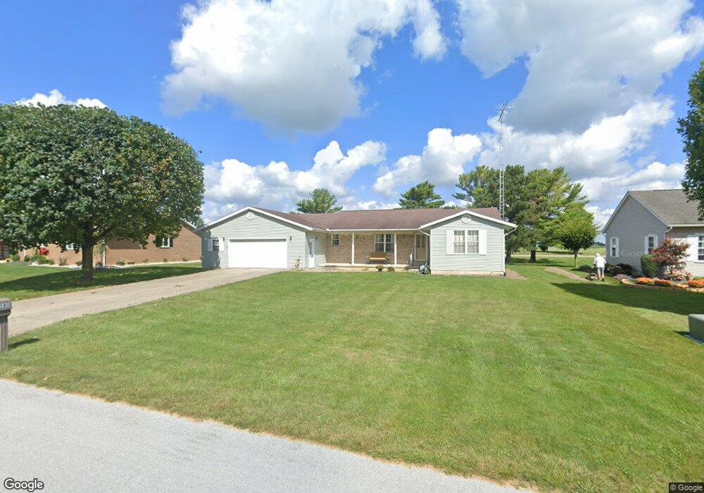
580 Sunset Dr Upper Sandusky, OH 43351
Estimated Value: $299,199 - $346,000
3
Beds
3
Baths
1,702
Sq Ft
$186/Sq Ft
Est. Value
About This Home
This home is located at 580 Sunset Dr, Upper Sandusky, OH 43351 and is currently estimated at $317,300, approximately $186 per square foot. 580 Sunset Dr is a home located in Wyandot County with nearby schools including Upper Sandusky High School and St. Peter Elementary School.
Ownership History
Date
Name
Owned For
Owner Type
Purchase Details
Closed on
Jul 14, 2022
Sold by
Kinley and Deborah
Bought by
Livingston Dennis and Livingston Candy
Current Estimated Value
Home Financials for this Owner
Home Financials are based on the most recent Mortgage that was taken out on this home.
Original Mortgage
$100,000
Outstanding Balance
$94,981
Interest Rate
5.23%
Mortgage Type
New Conventional
Estimated Equity
$222,319
Create a Home Valuation Report for This Property
The Home Valuation Report is an in-depth analysis detailing your home's value as well as a comparison with similar homes in the area
Home Values in the Area
Average Home Value in this Area
Purchase History
| Date | Buyer | Sale Price | Title Company |
|---|---|---|---|
| Livingston Dennis | $12,500 | Potts Patrick J | |
| Livingston Dennis | $12,500 | Potts Patrick J |
Source: Public Records
Mortgage History
| Date | Status | Borrower | Loan Amount |
|---|---|---|---|
| Open | Livingston Dennis | $100,000 | |
| Closed | Livingston Dennis | $100,000 |
Source: Public Records
Tax History
| Year | Tax Paid | Tax Assessment Tax Assessment Total Assessment is a certain percentage of the fair market value that is determined by local assessors to be the total taxable value of land and additions on the property. | Land | Improvement |
|---|---|---|---|---|
| 2025 | $3,137 | $101,780 | $10,330 | $91,450 |
| 2024 | $3,000 | $92,120 | $8,600 | $83,520 |
| 2023 | $3,000 | $92,120 | $8,600 | $83,520 |
| 2022 | $2,653 | $73,180 | $7,170 | $66,010 |
| 2021 | $2,146 | $73,180 | $7,170 | $66,010 |
| 2020 | $2,146 | $73,180 | $7,170 | $66,010 |
| 2019 | $2,142 | $73,180 | $7,170 | $66,010 |
| 2018 | $1,968 | $69,050 | $6,520 | $62,530 |
| 2017 | $1,999 | $69,050 | $6,520 | $62,530 |
| 2016 | -- | $69,050 | $6,520 | $62,530 |
| 2015 | -- | $66,530 | $6,520 | $60,010 |
| 2014 | -- | $66,530 | $6,520 | $60,010 |
| 2013 | -- | $66,530 | $6,520 | $60,010 |
Source: Public Records
Map
Nearby Homes
- 605 Polaris Dr
- 512 N 7th St
- 386 W Finley St
- 479 N 5th St
- 212 N Hazel St
- 333 N 5th St
- 137 N 8th St
- 334 N 4th St
- 314 N 4th St
- 116 E Walker St
- 432 E Bigelow St
- 479 Front St
- 0 Ohio 53
- 9768 County Highway 111
- 225 S Hazel St
- 0 State Route 53 & 67 Unit 11165687
- 326 S 8th St
- 1030 Halbedel St
- 955 Greenbrier Rd
- 387 S Warpole St
Your Personal Tour Guide
Ask me questions while you tour the home.