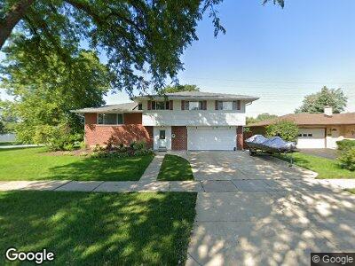
580 W Kathleen Dr Des Plaines, IL 60016
Estimated Value: $444,000 - $496,000
4
Beds
3
Baths
1,986
Sq Ft
$239/Sq Ft
Est. Value
About This Home
This home is located at 580 W Kathleen Dr, Des Plaines, IL 60016 and is currently estimated at $475,106, approximately $239 per square foot. 580 W Kathleen Dr is a home located in Cook County with nearby schools including Brentwood Elementary School, Friendship Jr High School, and Elk Grove High School.
Ownership History
Date
Name
Owned For
Owner Type
Purchase Details
Closed on
Aug 18, 1999
Sold by
Jongleux Sidney C and Jongleux Jeanne N
Bought by
Jongleux Jeanne N and Jeanne N Jongleux Trust
Current Estimated Value
Create a Home Valuation Report for This Property
The Home Valuation Report is an in-depth analysis detailing your home's value as well as a comparison with similar homes in the area
Home Values in the Area
Average Home Value in this Area
Purchase History
| Date | Buyer | Sale Price | Title Company |
|---|---|---|---|
| Jongleux Jeanne N | -- | -- |
Source: Public Records
Mortgage History
| Date | Status | Borrower | Loan Amount |
|---|---|---|---|
| Closed | Turzynski Jacek | $100,000 | |
| Closed | Turzynski Jacek | $219,000 | |
| Closed | Turzynski Jacek | $231,200 | |
| Closed | Turzynski Jacek | $100,000 | |
| Closed | Turzynski Jacek | $241,000 | |
| Closed | Turzynski Jacek | $25,000 |
Source: Public Records
Tax History Compared to Growth
Tax History
| Year | Tax Paid | Tax Assessment Tax Assessment Total Assessment is a certain percentage of the fair market value that is determined by local assessors to be the total taxable value of land and additions on the property. | Land | Improvement |
|---|---|---|---|---|
| 2024 | $8,377 | $38,000 | $10,689 | $27,311 |
| 2023 | $8,377 | $38,000 | $10,689 | $27,311 |
| 2022 | $8,377 | $38,000 | $10,689 | $27,311 |
| 2021 | $7,501 | $30,329 | $7,126 | $23,203 |
| 2020 | $7,399 | $30,329 | $7,126 | $23,203 |
| 2019 | $7,483 | $33,699 | $7,126 | $26,573 |
| 2018 | $8,026 | $32,153 | $5,938 | $26,215 |
| 2017 | $7,896 | $32,153 | $5,938 | $26,215 |
| 2016 | $7,655 | $32,153 | $5,938 | $26,215 |
| 2015 | $6,896 | $27,650 | $5,344 | $22,306 |
| 2014 | $6,834 | $27,650 | $5,344 | $22,306 |
| 2013 | $6,673 | $27,650 | $5,344 | $22,306 |
Source: Public Records
Map
Nearby Homes
- 567 W Dempster St
- 884 Arnold Ct
- 857 Beau Dr Unit 9
- 940 Beau Dr Unit 111
- 745 Dulles Rd Unit C
- 500 W Huntington Commons Rd Unit 152
- 502 W Huntington Commons Rd Unit 136
- 1103 S Hunt Club Dr Unit 127
- 1103 S Hunt Club Dr Unit 325
- 1103 S Hunt Club Dr Unit 331
- 1048 Marshall Dr
- 200 Marshall Dr
- 503 Dempster St
- 1024 S Hunt Club Dr
- 725 W Huntington Commons Rd Unit 407
- 410 Dorothy Dr
- 1302 S Mallard Ln Unit 43
- 1272 Andrea Ln
- 229 Leahy Cir S
- 1101 S Church Rd
- 580 W Kathleen Dr
- 570 W Kathleen Dr
- 560 W Kathleen Dr
- 650 Beau Dr
- 581 W Kathleen Dr
- 591 W Kathleen Dr
- 571 W Kathleen Dr
- 550 W Kathleen Dr
- 561 W Kathleen Dr
- 661 Beau Dr
- 564 Lance Dr
- 620 W Kathleen Dr
- 556 Lance Dr
- 551 W Kathleen Dr
- 540 W Kathleen Dr
- 548 Lance Dr
- 541 W Kathleen Dr
- 630 W Kathleen Dr
- 572 Lance Dr
- 600 Lance Dr