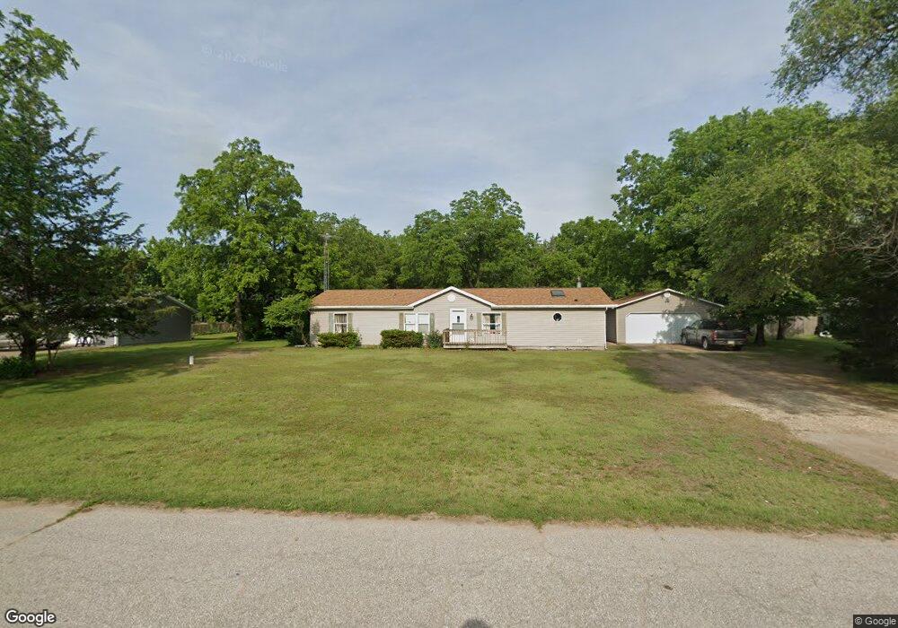
5800 65th Ave W Muscatine, IA 52761
Estimated Value: $251,000 - $302,000
3
Beds
3
Baths
1,880
Sq Ft
$152/Sq Ft
Est. Value
About This Home
This home is located at 5800 65th Ave W, Muscatine, IA 52761 and is currently estimated at $286,677, approximately $152 per square foot. 5800 65th Ave W is a home located in Muscatine County with nearby schools including Louisa-Muscatine Elementary School and Louisa-Muscatine High School.
Ownership History
Date
Name
Owned For
Owner Type
Purchase Details
Closed on
Mar 14, 2008
Sold by
Nationstar Mortgage Llc
Bought by
Allen Travis W
Current Estimated Value
Home Financials for this Owner
Home Financials are based on the most recent Mortgage that was taken out on this home.
Original Mortgage
$80,000
Outstanding Balance
$50,794
Interest Rate
6.1%
Mortgage Type
Future Advance Clause Open End Mortgage
Estimated Equity
$235,883
Create a Home Valuation Report for This Property
The Home Valuation Report is an in-depth analysis detailing your home's value as well as a comparison with similar homes in the area
Home Values in the Area
Average Home Value in this Area
Purchase History
| Date | Buyer | Sale Price | Title Company |
|---|---|---|---|
| Allen Travis W | $74,500 | None Available |
Source: Public Records
Mortgage History
| Date | Status | Borrower | Loan Amount |
|---|---|---|---|
| Open | Allen Travis W | $80,000 |
Source: Public Records
Tax History Compared to Growth
Tax History
| Year | Tax Paid | Tax Assessment Tax Assessment Total Assessment is a certain percentage of the fair market value that is determined by local assessors to be the total taxable value of land and additions on the property. | Land | Improvement |
|---|---|---|---|---|
| 2025 | $4,315 | $261,650 | $29,210 | $232,440 |
| 2024 | $4,315 | $260,490 | $29,210 | $231,280 |
| 2023 | $4,141 | $261,799 | $29,288 | $232,511 |
| 2022 | $3,498 | $227,070 | $27,630 | $199,440 |
| 2021 | $3,478 | $188,760 | $27,630 | $161,130 |
| 2020 | $3,391 | $179,920 | $23,030 | $156,890 |
| 2019 | $2,733 | $0 | $0 | $0 |
| 2018 | $2,630 | $0 | $0 | $0 |
| 2017 | $2,637 | $132,250 | $0 | $0 |
| 2016 | $2,792 | $132,250 | $0 | $0 |
| 2015 | $2,792 | $139,810 | $0 | $0 |
| 2014 | $2,916 | $139,810 | $0 | $0 |
Source: Public Records
Map
Nearby Homes
- 146 North St
- 103 Evergreen Ln
- 5407 Reynolds Ave
- 105 Spencer Ave
- 121 Turkey Rd
- 0 Unit 24-52
- 0 Grandview Ave Parcels Unit 25-533
- 10257 County Road G44x
- 17138 County Road X61
- 1923 280th St
- 1909 Wallace St
- 1908 Sampson St
- 16782 I Ave
- 1708 Schley Ave
- 2108 Breese Ave
- 609 Liberty St
- PARCEL
- 111 Gilbert St
- LOTS 30-34 Evans St
- 0 Towhead Island Unit 23-716
- 5804 65th Ave W
- 5716 65th Ave W
- 5723 65th Ave W
- 5721 65th Ave W
- 5801 65th Ave W
- 5808 65th Ave W
- 5712 65th Ave W
- 5805 65th Ave W
- 5715 65th Ave W
- 5811 67th Ave W
- 5807 67th Ave W
- 5706 65th Ave W
- 5711 65th Ave W
- 5801 67th Ave W
- 5901 67th Ave W
- 6012 65th Ave W
- 5702 65th Ave W
- 5701 65th Ave W
- 6003 65th Ave W
- 5812 63rd Ave W