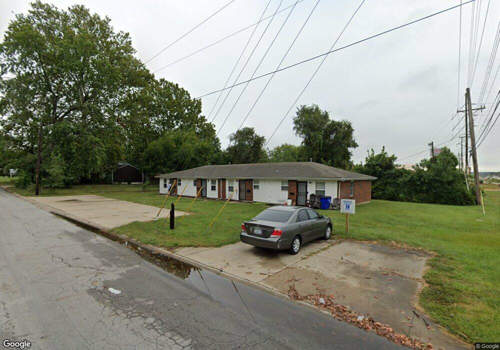
5801 E 133rd St Unit D Grandview, MO 64030
Estimated Value: $144,000 - $344,000
8
Beds
4
Baths
2,494
Sq Ft
$110/Sq Ft
Est. Value
About This Home
This home is located at 5801 E 133rd St Unit D, Grandview, MO 64030 and is currently estimated at $275,333, approximately $110 per square foot. 5801 E 133rd St Unit D is a home located in Jackson County with nearby schools including Meadowmere Elementary School, Grandview Middle, and Grandview High School.
Ownership History
Date
Name
Owned For
Owner Type
Purchase Details
Closed on
Dec 13, 2024
Sold by
Scott Paul Investment Real Estate Llc
Bought by
Everett Scott Properties Llc
Current Estimated Value
Home Financials for this Owner
Home Financials are based on the most recent Mortgage that was taken out on this home.
Original Mortgage
$210,000
Outstanding Balance
$207,942
Interest Rate
6.72%
Mortgage Type
New Conventional
Estimated Equity
$67,391
Purchase Details
Closed on
Jun 25, 2021
Sold by
Btd Enterprises Llc
Bought by
Scott Paul Investment Real Estate Llc
Purchase Details
Closed on
Aug 11, 2012
Sold by
Btd Enterprises Ii
Bought by
Btd Enterprises Llc
Purchase Details
Closed on
Jul 5, 2012
Sold by
Dehmer Family Partnership Lp
Bought by
Btd Enterprises Ii
Create a Home Valuation Report for This Property
The Home Valuation Report is an in-depth analysis detailing your home's value as well as a comparison with similar homes in the area
Home Values in the Area
Average Home Value in this Area
Purchase History
| Date | Buyer | Sale Price | Title Company |
|---|---|---|---|
| Everett Scott Properties Llc | -- | Stewart Title | |
| Scott Paul Investment Real Estate Llc | -- | Kansas City Title | |
| Scott Paul Inv Real Estate Llc | -- | Kansas City Title | |
| Btd Enterprises Llc | -- | None Available | |
| Btd Enterprises Ii | -- | None Available |
Source: Public Records
Mortgage History
| Date | Status | Borrower | Loan Amount |
|---|---|---|---|
| Open | Everett Scott Properties Llc | $210,000 |
Source: Public Records
Tax History
| Year | Tax Paid | Tax Assessment Tax Assessment Total Assessment is a certain percentage of the fair market value that is determined by local assessors to be the total taxable value of land and additions on the property. | Land | Improvement |
|---|---|---|---|---|
| 2025 | $4,103 | $24,624 | $6,262 | $18,362 |
| 2024 | $4,032 | $50,451 | $5,900 | $44,551 |
| 2023 | $4,032 | $50,451 | $5,900 | $44,551 |
| 2022 | $1,599 | $18,620 | $11,068 | $7,552 |
| 2021 | $1,597 | $18,620 | $11,068 | $7,552 |
| 2020 | $1,431 | $17,671 | $11,068 | $6,603 |
| 2019 | $2,390 | $30,600 | $11,068 | $19,532 |
| 2018 | $1,452 | $17,291 | $1,686 | $15,605 |
| 2017 | $1,445 | $17,291 | $1,686 | $15,605 |
| 2016 | $1,445 | $16,857 | $3,171 | $13,686 |
| 2014 | $1,465 | $16,857 | $3,171 | $13,686 |
Source: Public Records
Map
Nearby Homes
- 14925 S U S 71 Hwy
- 13424 Parker Ave
- 13420 Belmead Ave
- 6105 E 136th St
- 13302 11th St
- 13301 10th St
- 13300 10th St
- 13516 12th St
- 12217 Bennington Ave
- 13218 Craig Ave
- 13121 Grandview Rd
- 904 Pinkston Ave
- 12200 Craig Dr
- 6701 E 136th St
- 13620 Bennington Ave
- 807 Highgrove Rd
- 5956 E 129th St
- 13408 Bristol Ave
- 1101 E 137th St
- 13747 Parker Ave
- 5801 E 133rd St Unit C
- 5801 E 133rd St Unit A
- 5801 E 133rd St
- 13300 Spring St
- 13231 S Us Highway 71
- 13231 S Us Highway 71
- 5904 E 133rd St
- 13306 Spring St
- 6001 E 133rd St
- 13299 Spring St
- 13311 Spring St
- 13314 Spring St
- 6003 E 133rd St
- 13291 Spring St
- 13287 Spring St
- 13315 Spring St
- 13307 Spring St
- 1818 E 133rd St
- 13318 Spring St
- 6005 E 133rd St