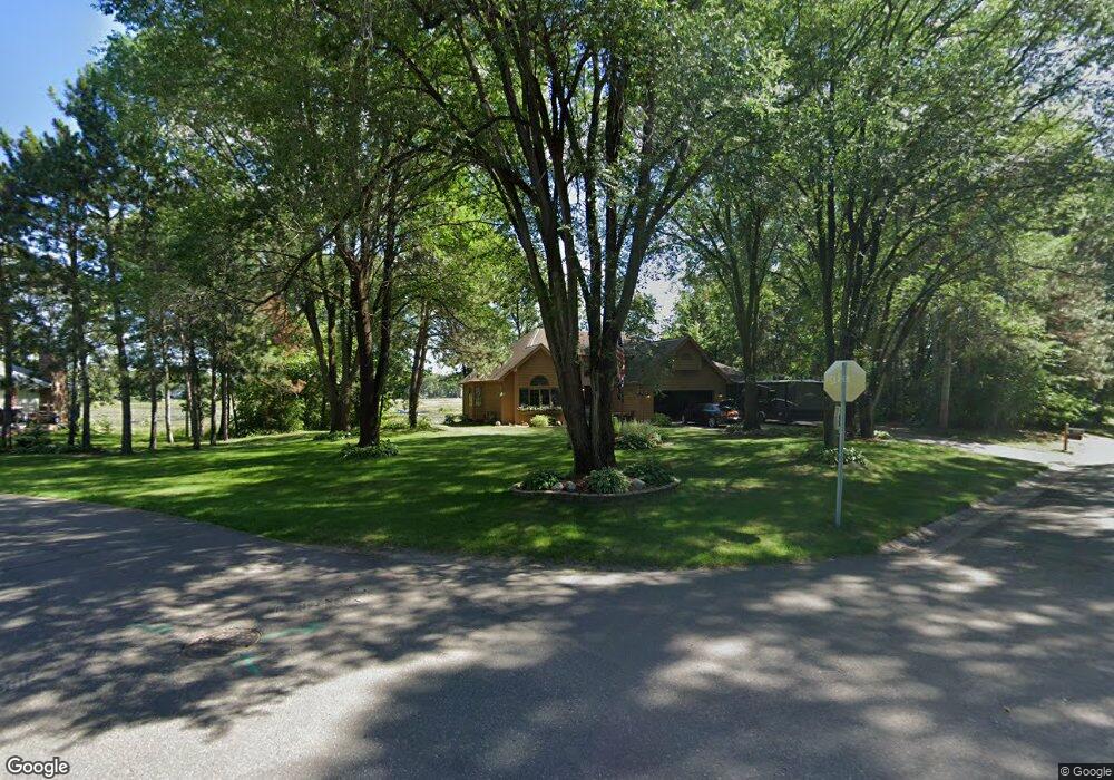
5802 Flint Trail Wyoming, MN 55092
Estimated Value: $455,000 - $489,000
4
Beds
3
Baths
2,511
Sq Ft
$188/Sq Ft
Est. Value
About This Home
This home is located at 5802 Flint Trail, Wyoming, MN 55092 and is currently estimated at $472,517, approximately $188 per square foot. 5802 Flint Trail is a home located in Chisago County with nearby schools including Wyoming Elementary School, Forest Lake Area High School, and Lakes International Language Academy Kinder Center.
Ownership History
Date
Name
Owned For
Owner Type
Purchase Details
Closed on
Jun 14, 2021
Sold by
Pikala Daniel Daniel
Bought by
Downs Randy Randy
Current Estimated Value
Home Financials for this Owner
Home Financials are based on the most recent Mortgage that was taken out on this home.
Original Mortgage
$361,349
Outstanding Balance
$327,462
Interest Rate
2.96%
Estimated Equity
$145,055
Purchase Details
Closed on
Sep 25, 1998
Sold by
Knackstedt Joy and Knackstedt Don
Bought by
Pikala Daniel and Pikala Cynthia
Create a Home Valuation Report for This Property
The Home Valuation Report is an in-depth analysis detailing your home's value as well as a comparison with similar homes in the area
Home Values in the Area
Average Home Value in this Area
Purchase History
| Date | Buyer | Sale Price | Title Company |
|---|---|---|---|
| Downs Randy Randy | $450,000 | -- | |
| Pikala Daniel | $194,900 | -- | |
| Downs Randy Randy | $450,000 | -- |
Source: Public Records
Mortgage History
| Date | Status | Borrower | Loan Amount |
|---|---|---|---|
| Open | Downs Randy Randy | $361,349 | |
| Closed | Downs Randy Randy | -- | |
| Closed | Downs Randy Randy | $361,349 |
Source: Public Records
Tax History Compared to Growth
Tax History
| Year | Tax Paid | Tax Assessment Tax Assessment Total Assessment is a certain percentage of the fair market value that is determined by local assessors to be the total taxable value of land and additions on the property. | Land | Improvement |
|---|---|---|---|---|
| 2023 | $5,688 | $462,600 | $118,900 | $343,700 |
| 2022 | $5,688 | $415,100 | $90,900 | $324,200 |
| 2021 | $4,502 | $330,200 | $0 | $0 |
| 2020 | $4,426 | $308,000 | $65,500 | $242,500 |
| 2019 | $4,658 | $0 | $0 | $0 |
| 2018 | $4,232 | $0 | $0 | $0 |
| 2017 | $4,322 | $0 | $0 | $0 |
| 2016 | $3,346 | $0 | $0 | $0 |
| 2015 | $3,042 | $0 | $0 | $0 |
| 2014 | -- | $200,300 | $0 | $0 |
Source: Public Records
Map
Nearby Homes
- 5747 261st St
- 26237 Forest Blvd N
- 25649 Forest Boulevard Ct
- 25659 Forest Boulevard Ct
- 25686 Euclid Ave
- 6215 Forest Boulevard Trail
- 6326 Goodwin Ln
- 6334 Goodwin Ln
- 6363 Goodwin Ln
- 6318 Goodwin Ln
- 6213 267th Ct
- 25338 Farmstead Ln
- 25874 Emerson Ct
- 5042 258th Ct
- 25840 Emerson Ct
- 25850 Emerson Ct
- 25830 Emerson Ct
- 25152 Firefly Ave
- 25124 Firefly Ave
- 26953 Foxboro Ave