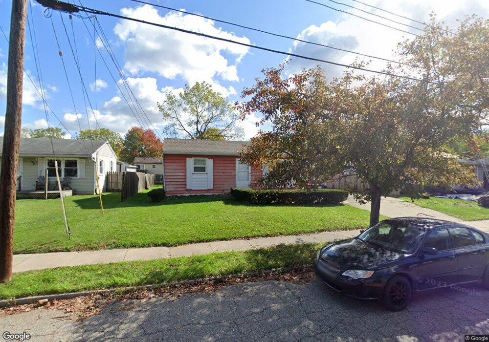
5803 Pheasant Ave Lansing, MI 48911
Southern Lansing NeighborhoodEstimated Value: $103,664 - $133,000
2
Beds
1
Bath
768
Sq Ft
$154/Sq Ft
Est. Value
About This Home
This home is located at 5803 Pheasant Ave, Lansing, MI 48911 and is currently estimated at $118,416, approximately $154 per square foot. 5803 Pheasant Ave is a home located in Ingham County with nearby schools including Reo Elementary School, Attwood School, and Everett High School.
Ownership History
Date
Name
Owned For
Owner Type
Purchase Details
Closed on
Oct 1, 2009
Sold by
Donovan Shaun
Bought by
Bifano Rhonda M
Current Estimated Value
Purchase Details
Closed on
Mar 12, 2009
Sold by
Countrywide Home Loans
Bought by
The Secretary Of Housing & Urban Develop
Purchase Details
Closed on
Sep 15, 2008
Sold by
Mortgage Electronic Registration Systems
Bought by
Countrywide Home Loans
Purchase Details
Closed on
Sep 11, 2008
Sold by
Hansen Eric S
Bought by
Mortgage Electronic Registration Systems
Purchase Details
Closed on
Jun 21, 2007
Sold by
Velasquez Fidencio and Velasquez Pamela
Bought by
Hansen Eric S
Create a Home Valuation Report for This Property
The Home Valuation Report is an in-depth analysis detailing your home's value as well as a comparison with similar homes in the area
Home Values in the Area
Average Home Value in this Area
Purchase History
| Date | Buyer | Sale Price | Title Company |
|---|---|---|---|
| Bifano Rhonda M | $15,000 | None Available | |
| The Secretary Of Housing & Urban Develop | -- | None Available | |
| Countrywide Home Loans | -- | None Available | |
| Mortgage Electronic Registration Systems | $77,661 | None Available | |
| Hansen Eric S | $74,700 | Metropolitan Title Company |
Source: Public Records
Tax History Compared to Growth
Tax History
| Year | Tax Paid | Tax Assessment Tax Assessment Total Assessment is a certain percentage of the fair market value that is determined by local assessors to be the total taxable value of land and additions on the property. | Land | Improvement |
|---|---|---|---|---|
| 2025 | $2,097 | $49,700 | $7,300 | $42,400 |
| 2024 | $17 | $40,500 | $7,300 | $33,200 |
| 2023 | $1,975 | $35,300 | $7,300 | $28,000 |
| 2022 | $1,806 | $30,500 | $5,100 | $25,400 |
| 2021 | $1,764 | $29,800 | $5,100 | $24,700 |
| 2020 | $1,752 | $27,400 | $5,100 | $22,300 |
| 2019 | $1,691 | $24,600 | $5,100 | $19,500 |
| 2018 | $1,605 | $21,200 | $5,100 | $16,100 |
| 2017 | $1,544 | $21,200 | $5,100 | $16,100 |
| 2016 | $2,749 | $20,300 | $5,100 | $15,200 |
| 2015 | $2,749 | $19,600 | $10,132 | $9,468 |
| 2014 | $2,749 | $19,400 | $15,762 | $3,638 |
Source: Public Records
Map
Nearby Homes
- 6030 Piper Ave
- 5838 S Martin Luther King Junior Blvd
- 2045 Moffitt St
- 2416 Midwood St
- 6037 Hughes Rd
- 5750 Ashley Dr
- 0 Midwood St
- 4828 Ingham St
- 1020 R G Curtiss Ave
- 4809 Ballard Rd
- 1119 W Miller Rd
- 1014 W Northrup St
- 4628 Pleasant Grove Rd
- 4916 Tressa Dr
- 4620 Christiansen Rd
- 5100 Wexford Rd
- 1324 N Briarfield Dr
- 3814 Coachlight Common St
- 1729 Reo Rd
- 0 W Jolly Rd
- 5809 Pheasant Ave
- 5736 Piper Ave
- 5742 Piper Ave
- 5815 Pheasant Ave
- 5719 Pheasant Ave
- 5730 Piper Ave
- 5748 Piper Ave
- 5802 Pheasant Ave
- 5724 Piper Ave
- 5726 Pheasant Ave
- 5713 Pheasant Ave
- 5825 Pheasant Ave
- 2301 Radford Rd
- 5718 Piper Ave
- 2308 Radford Rd
- 5818 Pheasant Ave
- 5810 Piper Ave
- 5718 Pheasant Ave
- 2128 Desoto St
- 5737 Piper Ave