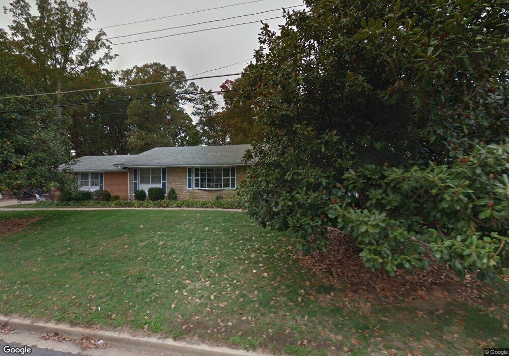
5808 Arbroath Dr Clinton, MD 20735
Estimated Value: $424,489 - $558,000
Studio
3
Baths
2,142
Sq Ft
$226/Sq Ft
Est. Value
About This Home
This home is located at 5808 Arbroath Dr, Clinton, MD 20735 and is currently estimated at $483,122, approximately $225 per square foot. 5808 Arbroath Dr is a home located in Prince George's County with nearby schools including James Ryder Randall Elementary School, Stephen Decatur Middle School, and Surrattsville High School.
Ownership History
Date
Name
Owned For
Owner Type
Purchase Details
Closed on
Nov 12, 1993
Sold by
Newman Est (By Pr) S E
Bought by
Proctor James W
Current Estimated Value
Home Financials for this Owner
Home Financials are based on the most recent Mortgage that was taken out on this home.
Original Mortgage
$163,850
Interest Rate
6.79%
Create a Home Valuation Report for This Property
The Home Valuation Report is an in-depth analysis detailing your home's value as well as a comparison with similar homes in the area
Home Values in the Area
Average Home Value in this Area
Purchase History
| Date | Buyer | Sale Price | Title Company |
|---|---|---|---|
| Proctor James W | $172,500 | -- |
Source: Public Records
Mortgage History
| Date | Status | Borrower | Loan Amount |
|---|---|---|---|
| Closed | Proctor James W | $163,850 |
Source: Public Records
Tax History
| Year | Tax Paid | Tax Assessment Tax Assessment Total Assessment is a certain percentage of the fair market value that is determined by local assessors to be the total taxable value of land and additions on the property. | Land | Improvement |
|---|---|---|---|---|
| 2025 | $5,269 | $450,700 | $102,300 | $348,400 |
| 2024 | $5,269 | $413,000 | -- | -- |
| 2023 | $5,003 | $375,300 | $0 | $0 |
| 2022 | $3,754 | $337,600 | $102,300 | $235,300 |
| 2021 | $4,553 | $332,833 | $0 | $0 |
| 2020 | $4,505 | $328,067 | $0 | $0 |
| 2019 | $4,433 | $323,300 | $101,100 | $222,200 |
| 2018 | $4,311 | $313,033 | $0 | $0 |
| 2017 | $3,628 | $302,767 | $0 | $0 |
| 2016 | -- | $292,500 | $0 | $0 |
| 2015 | $3,662 | $286,667 | $0 | $0 |
| 2014 | $3,662 | $280,833 | $0 | $0 |
Source: Public Records
Map
Nearby Homes
- 5913 Woodland Ln
- 5904 Mardella Blvd
- 6106 Manor Rd
- 6003 Plata St
- 6005 Plata St
- 7400 Pembroke Dr
- 6316 Springbrook Ln
- 6004 Butterfield Dr
- 7300 Roselynn Ln
- 7301 Sheffield Dr
- 7206 Sheffield Dr
- 5715 Butterfield Dr
- 7704 Tinkers Creek Dr
- 5704 San Juan Dr
- 5801 San Juan Dr
- 5209 Sumter Ct
- 6807 Robinia Rd
- 7107 Loch Raven Rd
- 8801 Christina Ln
- 7811 Heflin Dr
- 5806 Arbroath Dr
- 5812 Arbroath Dr
- 5809 Arbroath Dr
- 5807 Woodland Ln
- 5807 Arbroath Dr
- 5804 Arbroath Dr
- 5814 Arbroath Dr
- 5813 Arbroath Dr
- 7903 Arbroath Ct
- 5805 Arbroath Dr
- 5802 Arbroath Dr
- 5801 Woodland Ln
- 7902 Hastings Ln
- 7806 Pinewood Dr
- 7804 Pinewood Dr
- 5816 Arbroath Dr
- 7902 Arbroath Ct
- 5815 Arbroath Dr
- 7802 Pinewood Dr
- 7903 Hastings Ln
Your Personal Tour Guide
Ask me questions while you tour the home.