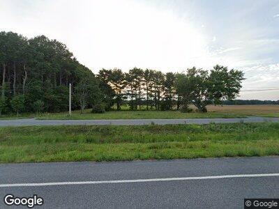
5809 Worcester Hwy Snow Hill, MD 21863
Estimated Value: $194,796
3
Beds
2
Baths
1,528
Sq Ft
$127/Sq Ft
Est. Value
About This Home
This home is located at 5809 Worcester Hwy, Snow Hill, MD 21863 and is currently estimated at $194,796, approximately $127 per square foot. 5809 Worcester Hwy is a home located in Worcester County with nearby schools including Snow Hill Elementary School, Snow Hill Middle School, and Snow Hill High School.
Ownership History
Date
Name
Owned For
Owner Type
Purchase Details
Closed on
Mar 5, 2025
Sold by
Department Of Transportation
Bought by
Brittingham Kristi and Brittingham Brooks
Current Estimated Value
Purchase Details
Closed on
Feb 29, 2016
Sold by
Shockley Donald L
Bought by
Shockley Scot L
Purchase Details
Closed on
Feb 10, 2012
Sold by
Willoughby Dona May and Lawley Misha
Bought by
Shockley Donald L and Shockley Scot L
Purchase Details
Closed on
Sep 10, 2008
Sold by
Northam Paul E
Bought by
Willoughby Dona May
Purchase Details
Closed on
Aug 27, 2008
Sold by
Northam Paul E
Bought by
Willoughby Dona May
Create a Home Valuation Report for This Property
The Home Valuation Report is an in-depth analysis detailing your home's value as well as a comparison with similar homes in the area
Home Values in the Area
Average Home Value in this Area
Purchase History
| Date | Buyer | Sale Price | Title Company |
|---|---|---|---|
| Brittingham Kristi | $64,000 | Mid Atlantic Title | |
| Brittingham Kristi | $64,000 | Mid Atlantic Title | |
| Shockley Scot L | -- | None Available | |
| Shockley Donald L | $100,000 | None Available | |
| Willoughby Dona May | $192,450 | -- | |
| Willoughby Dona May | $192,450 | -- |
Source: Public Records
Tax History Compared to Growth
Tax History
| Year | Tax Paid | Tax Assessment Tax Assessment Total Assessment is a certain percentage of the fair market value that is determined by local assessors to be the total taxable value of land and additions on the property. | Land | Improvement |
|---|---|---|---|---|
| 2024 | -- | $55,667 | $0 | $0 |
| 2023 | $0 | $54,333 | $0 | $0 |
| 2022 | $0 | $53,000 | $53,000 | $0 |
| 2021 | $1,186 | $53,000 | $53,000 | $0 |
| 2020 | $0 | $53,000 | $53,000 | $0 |
| 2019 | $0 | $53,000 | $53,000 | $0 |
| 2018 | $0 | $53,000 | $53,000 | $0 |
| 2017 | $60 | $125,200 | $0 | $0 |
| 2016 | $62 | $133,300 | $0 | $0 |
| 2015 | $1,254 | $133,300 | $0 | $0 |
| 2014 | $1,254 | $133,300 | $0 | $0 |
Source: Public Records
Map
Nearby Homes
- 6060 Worcester Hwy
- 0 Cedartown Rd
- 306 Park Row
- 220 E Federal St
- 207 Purnell St
- 217 E Federal St
- 210 Walnut St
- 111 Purnell St
- 0 W Market St
- 101 S Church St
- 109 Powell St
- 249 S Washington St
- 106 N Morris St
- 209 W Federal St
- 0 Maryland 12
- 105 N Ross St
- 0 Stevens Rd
- 213 S Ross St
- 507 S Church St
- 0 S Ross St
- 5809 Worcester Hwy
- 5793 Worcester Hwy
- 5843 Worcester Hwy
- 5860 Worcester Hwy
- 5850 Worcester Hwy
- 5844 Worcester Hwy
- 5761 Worcester Hwy
- 5870 Worcester Hwy
- 5880 Worcester Hwy
- 5764 Worcester Hwy
- 6215 Timmons Rd
- 6217 Timmons Rd
- 5911 Worcester Hwy
- 5742 Blake Rd
- 5915 Worcester Hwy
- 6232 Timmons Rd
- 5927 Worcester Hwy
- 6246 Timmons Rd
- 5734 Blake Rd
- 5914 Worcester Hwy
