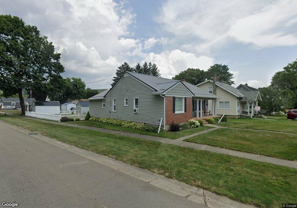
581 Freeman St Corning, NY 14830
Estimated Value: $172,000 - $219,000
2
Beds
2
Baths
1,536
Sq Ft
$124/Sq Ft
Est. Value
About This Home
This home is located at 581 Freeman St, Corning, NY 14830 and is currently estimated at $190,045, approximately $123 per square foot. 581 Freeman St is a home located in Steuben County with nearby schools including Hugh W. Gregg Elementary School, Corning-Painted Post Middle School, and Corning-Painted Post High School.
Ownership History
Date
Name
Owned For
Owner Type
Purchase Details
Closed on
Aug 9, 2017
Sold by
Deats Megan A
Bought by
Underwood Ray L
Current Estimated Value
Home Financials for this Owner
Home Financials are based on the most recent Mortgage that was taken out on this home.
Original Mortgage
$65,000
Outstanding Balance
$54,237
Interest Rate
3.96%
Mortgage Type
Unknown
Estimated Equity
$135,808
Purchase Details
Closed on
Aug 28, 2015
Sold by
Moshier Travis
Bought by
Deats Megan A
Home Financials for this Owner
Home Financials are based on the most recent Mortgage that was taken out on this home.
Original Mortgage
$104,000
Interest Rate
4.07%
Mortgage Type
Purchase Money Mortgage
Purchase Details
Closed on
Sep 11, 2001
Sold by
Ormsby
Bought by
Moshier Travis
Purchase Details
Closed on
Aug 31, 2001
Sold by
Iverson Marian E
Bought by
Moshier Travis P Rachel L
Create a Home Valuation Report for This Property
The Home Valuation Report is an in-depth analysis detailing your home's value as well as a comparison with similar homes in the area
Home Values in the Area
Average Home Value in this Area
Purchase History
| Date | Buyer | Sale Price | Title Company |
|---|---|---|---|
| Underwood Ray L | $140,000 | None Available | |
| Deats Megan A | $130,000 | Jeff Evans | |
| Moshier Travis | -- | -- | |
| Moshier Travis P Rachel L | $63,000 | Richard P Rossettie |
Source: Public Records
Mortgage History
| Date | Status | Borrower | Loan Amount |
|---|---|---|---|
| Open | Underwood Ray L | $65,000 | |
| Previous Owner | Deats Megan A | $104,000 | |
| Previous Owner | Underwood Ray L | $20,000 | |
| Previous Owner | Underwood Ray L | $71,000 |
Source: Public Records
Tax History
| Year | Tax Paid | Tax Assessment Tax Assessment Total Assessment is a certain percentage of the fair market value that is determined by local assessors to be the total taxable value of land and additions on the property. | Land | Improvement |
|---|---|---|---|---|
| 2024 | $5,314 | $155,000 | $22,000 | $133,000 |
| 2023 | $5,282 | $155,000 | $22,000 | $133,000 |
| 2022 | $5,015 | $155,000 | $22,000 | $133,000 |
| 2021 | $4,647 | $125,000 | $11,200 | $113,800 |
| 2020 | $2,280 | $125,000 | $11,200 | $113,800 |
| 2019 | $2,965 | $125,000 | $11,200 | $113,800 |
| 2018 | $2,965 | $125,000 | $11,200 | $113,800 |
| 2017 | $3,556 | $86,600 | $8,400 | $78,200 |
| 2016 | $3,556 | $86,600 | $8,400 | $78,200 |
| 2015 | -- | $86,600 | $8,400 | $78,200 |
| 2014 | -- | $86,600 | $8,400 | $78,200 |
Source: Public Records
Map
Nearby Homes
- 181 Dwight Ave
- 82 Riverside Cir
- 350 E High St
- 340 E High St
- 180 W Pulteney St
- 369 Delaware Ave
- 376 Imperial Ave
- 176 N Franklin St
- 229 Dodge Ave
- 307 Princeton Avenue Extension
- 138 W William St
- 28 Hamilton Rd
- 10387 Hamilton Rd
- 10237 Oakwood Dr Unit 41
- 59 Griffith St
- 63 Sterling St
- 179 Sly Ave
- 108 Grace Blvd
- 184 Sly Ave
- 24 Hillcrest Dr
- 583 Freeman St
- 579 Freeman St
- 585 Freeman St
- 0 Balcolm Ave
- 35 Balcom Ave
- 587 Freeman St
- 577 Freeman St
- 580 Frederick St
- 21-25 Balcom St
- 582 Frederick St
- 582 Freeman St
- 589 Freeman St
- 575 Freeman St
- 39 Balcom Ave
- 578 Freeman St
- 584 Frederick St
- 26 Taylor St
- 576 Frederick St
- 24 Balcom Ave
- 40 Townsend Ave
Your Personal Tour Guide
Ask me questions while you tour the home.