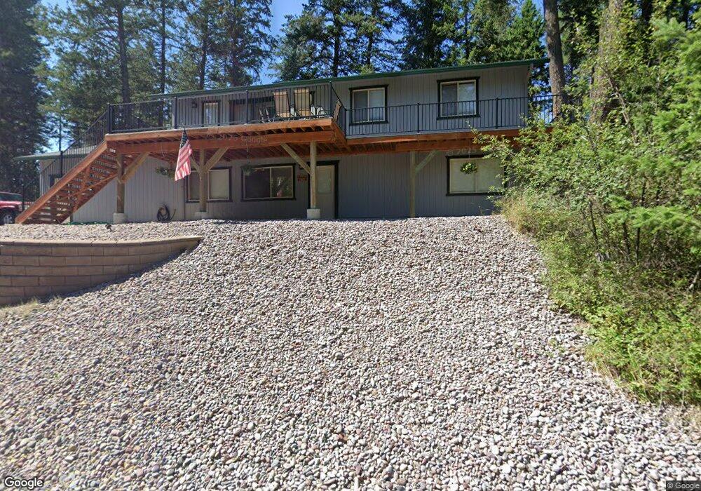
581 Peaceful Dr Bigfork, MT 59911
Estimated Value: $624,024 - $748,000
3
Beds
3
Baths
1,230
Sq Ft
$550/Sq Ft
Est. Value
About This Home
This home is located at 581 Peaceful Dr, Bigfork, MT 59911 and is currently estimated at $676,256, approximately $549 per square foot. 581 Peaceful Dr is a home located in Flathead County with nearby schools including Bigfork Elementary School, Bigfork Middle School, and Bigfork High School.
Ownership History
Date
Name
Owned For
Owner Type
Purchase Details
Closed on
Dec 18, 2024
Sold by
Degele Robert George and Degele Robert G
Bought by
Degele Family Trust and Degele
Current Estimated Value
Purchase Details
Closed on
Dec 23, 2005
Sold by
Powell Dennis J and Powell Hendi
Bought by
Plr Closing Services Llc
Create a Home Valuation Report for This Property
The Home Valuation Report is an in-depth analysis detailing your home's value as well as a comparison with similar homes in the area
Home Values in the Area
Average Home Value in this Area
Purchase History
| Date | Buyer | Sale Price | Title Company |
|---|---|---|---|
| Degele Family Trust | -- | None Listed On Document | |
| Plr Closing Services Llc | -- | None Available |
Source: Public Records
Tax History Compared to Growth
Tax History
| Year | Tax Paid | Tax Assessment Tax Assessment Total Assessment is a certain percentage of the fair market value that is determined by local assessors to be the total taxable value of land and additions on the property. | Land | Improvement |
|---|---|---|---|---|
| 2025 | $2,117 | $637,200 | $0 | $0 |
| 2024 | $2,268 | $450,300 | $0 | $0 |
| 2023 | $2,384 | $450,300 | $0 | $0 |
| 2022 | $2,258 | $337,800 | $0 | $0 |
| 2021 | $2,476 | $337,800 | $0 | $0 |
| 2020 | $2,214 | $279,400 | $0 | $0 |
| 2019 | $2,133 | $279,400 | $0 | $0 |
| 2018 | $1,929 | $237,900 | $0 | $0 |
| 2017 | $1,861 | $237,900 | $0 | $0 |
| 2016 | $1,788 | $229,400 | $0 | $0 |
| 2015 | $1,636 | $229,400 | $0 | $0 |
| 2014 | $1,450 | $121,529 | $0 | $0 |
Source: Public Records
Map
Nearby Homes
- 32 Peaceful Ct
- 34 Grizzly Ct
- 7945 Mt Highway 35
- 29 Bearpaw Loop
- 1173 Cygnet Trail
- 394 Windsor Ct
- 7925 Montana Highway 35
- 262 Lake Hills Dr
- 615 Swan Hill Dr
- 324 Lake Hills Dr
- 37 Red Tail Ridge
- 123 Lake Hills Dr
- 351 Chapman Ln
- 344 Chapman Ln
- 138 Jewel Basin Ct
- 130 Shawnee Dr
- 224 Crestview Dr
- 239 Stage Ridge Rd
- 39 Gage Terrace
- 486 Hogue Dr
- 441 Peaceful Dr
- 576 Peaceful Dr
- 600 Peaceful Dr
- 609 Peaceful Dr
- 429 Peaceful Dr
- 455 Peaceful Dr
- 564 Peaceful Dr
- 612 Peaceful Dr
- 1372 Bigfork Stage Rd
- 1372 Bigfork Stage
- Lot 27 Bigfork Stage
- Lot 23 Bigfork Stage
- 1364 Bigfork Stage Rd
- 425 Peaceful Dr
- 621 Peaceful Dr
- 552 Peaceful Dr
- 552 Peaceful Dr
- 420 Peaceful Dr
- 408 Peaceful Dr
- 1380 Bigfork Stage Rd