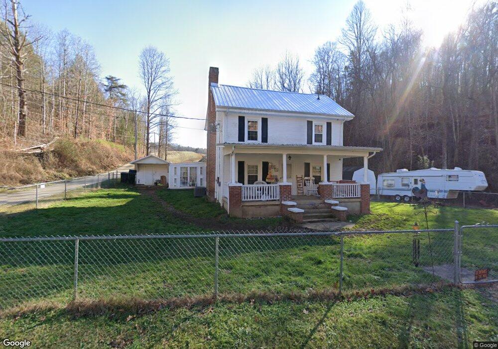
581 Toll Branch Rd Johnson City, TN 37601
Estimated Value: $247,000 - $329,000
--
Bed
3
Baths
1,956
Sq Ft
$151/Sq Ft
Est. Value
About This Home
This home is located at 581 Toll Branch Rd, Johnson City, TN 37601 and is currently estimated at $294,893, approximately $150 per square foot. 581 Toll Branch Rd is a home located in Carter County.
Ownership History
Date
Name
Owned For
Owner Type
Purchase Details
Closed on
May 13, 2022
Sold by
Jackson David J and Jackson Kerry A
Bought by
Pruitt M B
Current Estimated Value
Purchase Details
Closed on
Mar 8, 1999
Sold by
Warren Torbett F
Bought by
Jackson David
Home Financials for this Owner
Home Financials are based on the most recent Mortgage that was taken out on this home.
Original Mortgage
$85,000
Interest Rate
6.74%
Purchase Details
Closed on
Mar 13, 1997
Bought by
Torbett Warren F and Torbett Vickie E
Purchase Details
Closed on
Feb 10, 1989
Bought by
Parsons Colbert Gene
Purchase Details
Closed on
May 23, 1986
Bought by
Wildroot Family Trust
Create a Home Valuation Report for This Property
The Home Valuation Report is an in-depth analysis detailing your home's value as well as a comparison with similar homes in the area
Home Values in the Area
Average Home Value in this Area
Purchase History
| Date | Buyer | Sale Price | Title Company |
|---|---|---|---|
| Pruitt M B | $181,000 | Reliable Title & Escrow | |
| Jackson David | $90,000 | -- | |
| Torbett Warren F | $30,000 | -- | |
| Parsons Colbert Gene | $50,800 | -- | |
| Wildroot Family Trust | $52,000 | -- |
Source: Public Records
Mortgage History
| Date | Status | Borrower | Loan Amount |
|---|---|---|---|
| Previous Owner | Wildroot Family Trust | $85,000 |
Source: Public Records
Tax History Compared to Growth
Tax History
| Year | Tax Paid | Tax Assessment Tax Assessment Total Assessment is a certain percentage of the fair market value that is determined by local assessors to be the total taxable value of land and additions on the property. | Land | Improvement |
|---|---|---|---|---|
| 2024 | $986 | $45,250 | $10,900 | $34,350 |
| 2023 | $986 | $45,250 | $0 | $0 |
| 2022 | $919 | $45,250 | $10,900 | $34,350 |
| 2021 | $919 | $45,250 | $10,900 | $34,350 |
| 2020 | $934 | $45,250 | $10,900 | $34,350 |
| 2019 | $934 | $37,825 | $8,375 | $29,450 |
| 2018 | $934 | $37,825 | $8,375 | $29,450 |
| 2017 | $934 | $37,825 | $8,375 | $29,450 |
| 2016 | $927 | $37,825 | $8,375 | $29,450 |
| 2015 | $927 | $37,825 | $8,375 | $29,450 |
| 2014 | $920 | $37,550 | $9,325 | $28,225 |
Source: Public Records
Map
Nearby Homes
- 665 Laurels Rd
- 167 Sheets Hollow Rd
- Tbd Fire Station Rd
- 225 Sheets Hollow Rd
- 1883 Powder Branch Rd
- 366 Toll Branch Rd
- 157 Pfeiffer Ridge Rd
- 114 Whisperwood Ln
- Tr 15.01 Pine Forest Ln
- Tr 15 Pine Forest Ln
- Tr 14 Pine Forest Ln
- 57/Ac Tbd Powder Branch Rd
- 0 Tbd Powder Branch Rd Unit LotWP001 22557687
- 236 Rock House Rd
- 144 Blue Bird Dr
- 391 McKeehan Ridge Rd
- Tbd Whispering Pines Rd
- Tr 9 Mountain Laurel Ct
- Tr 15 Mountain Laurel Ct
- Tr 7 Mountain Laurel Ct
- 584 Toll Branch Rd
- 584 Toll Branch Rd
- 0 Tbd Toll Branch Rd Unit 420300
- 0 Tbd Toll Branch Rd Unit 9940012
- 600 Toll Branch Rd
- 106 Sheets Hollow Rd
- 612 Toll Branch Rd
- 611 Toll Branch Rd
- 110 Sheets Hollow Rd
- 550 Toll Branch Rd
- 103 Sheets Hollow Rd
- 130 Treadway Dr
- 631 Toll Branch Rd
- 111 Sheets Hollow Rd
- 115 Sheets Hollow Rd
- 118 Treadway Dr
- 104 Treadway Ln
- 120 Treadway Dr
- 124 Treadway Dr
- 126 Treadway Dr