
5810 S Killackey Rd Sault Ste Marie, MI 49783
Estimated Value: $95,286 - $107,000
10
Acres
$10,114
Price per Acre
435,600
Sq Ft Lot
About This Lot
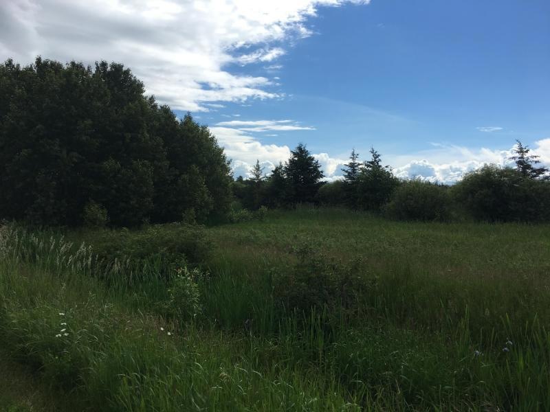
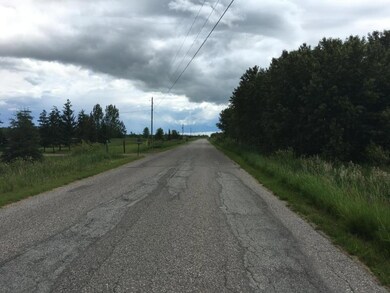
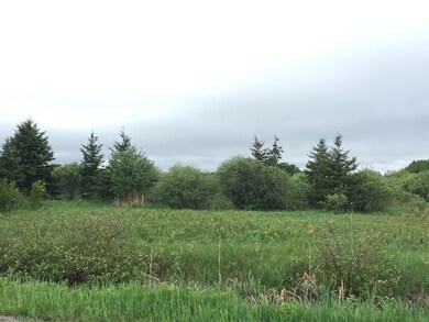
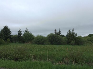
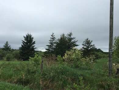
As of November 2018This 10-acre parcel just outside of Sault Ste. Marie might be an ideal building site now or in the future. Mainly flat, some trees.
Last Agent to Sell the Property
John Anderson, Assoc Broker
RE/MAX NorthStar Realty License #6502431999 Listed on: 11/27/2018
Last Buyer's Agent
John Anderson
RE/MAX Eagle Properties
Property Details
Property Type
- Land
Est. Annual Taxes
- $335
Lot Details
- 10 Acre Lot
- Level Lot
Farming
- Farm
Ownership History
Date
Name
Owned For
Owner Type
Purchase Details
Closed on
Jan 29, 2016
Sold by
Perrault John Franklin
Bought by
Morrow Darcy R
Total Days on Market
0
Current Estimated Value
Similar Property in the area
Create a Home Valuation Report for This Property
The Home Valuation Report is an in-depth analysis detailing your home's value as well as a comparison with similar homes in the area
Home Values in the Area
Average Home Value in this Area
Purchase History
| Date | Buyer | Sale Price | Title Company |
|---|---|---|---|
| Morrow Darcy R | -- | None Available |
Source: Public Records
Property History
| Date | Event | Price | Change | Sq Ft Price |
|---|---|---|---|---|
| 11/27/2018 11/27/18 | Sold | $12,500 | -- | -- |
Source: Eastern Upper Peninsula Board of REALTORS®
Tax History Compared to Growth
Tax History
| Year | Tax Paid | Tax Assessment Tax Assessment Total Assessment is a certain percentage of the fair market value that is determined by local assessors to be the total taxable value of land and additions on the property. | Land | Improvement |
|---|---|---|---|---|
| 2024 | $335 | $30,000 | $0 | $0 |
| 2023 | $303 | $27,000 | $0 | $0 |
| 2022 | $303 | $25,700 | $0 | $0 |
| 2021 | $565 | $14,500 | $0 | $0 |
| 2020 | $555 | $14,500 | $0 | $0 |
| 2019 | $544 | $13,800 | $0 | $0 |
| 2018 | $160 | $13,200 | $0 | $0 |
| 2017 | $160 | $13,200 | $0 | $0 |
| 2016 | $139 | $13,200 | $0 | $0 |
| 2011 | $129 | $10,800 | $0 | $0 |
Source: Public Records
Agents Affiliated with this Home
-
J
Seller's Agent in 2018
John Anderson, Assoc Broker
RE/MAX Michigan
-
J
Buyer's Agent in 2018
John Anderson
RE/MAX Eagle Properties
-
S
Buyer's Agent in 2018
SUZANNE LEACH
COLDWELL BANKER SCHMIDT - CEDARVILLE
Map
Source: Eastern Upper Peninsula Board of REALTORS®
MLS Number: 18-527
APN: 012-031-022-00
Nearby Homes
- 40Ac M/L S M-129
- 40Ac M/L S M-129 Unit 40Ac M/L
- 0 W Cedar Dr Unit 24-1105
- 647 W Ford Dr
- 647 W Ford Dr Unit 647
- 3357 S Oakwood Dr
- 620 W Osborn Dr
- 620 W Osborn Dr Unit 620
- 6647 S Riverside Dr
- 6647 S Riverside Dr Unit 6647
- 1695 E 3 Mile Rd
- 3032 S Frances Ave
- 198 E 26th Ave
- 198 E 26th Ave Unit 198
- 3805 I 75 Business Spur
- 322 25th Ave E Unit 322E
- 3601 S Radar Rd
- 2824 E 3 Mile Rd
- 107 Blue Water Dr
- 0 S Maplewood Dr
- 5810 S Killackey Rd
- 5759 S Killackey Rd
- 5685 S Killackey Rd
- 5702 S Killackey Rd
- 5832 S Killackey Rd
- 5967 S Killackey Rd
- 5960 S Killackey Rd
- 5810 S Kilackey Rd Unit 5810
- 0 S Kilackey Rd
- 40 Ac S Kilackey Rd
- 5847 S Killackey Rd
- 5835 S Killackey Rd
- 5840 S Killackey Rd
- 5829 S M 129
- 5829 Michigan 129
- 5547 S Killackey Rd
- 5526 S Killackey Rd
- 5496 S Killackey Rd
- 6096 S Killackey Rd
- 6022 S Killackey Rd