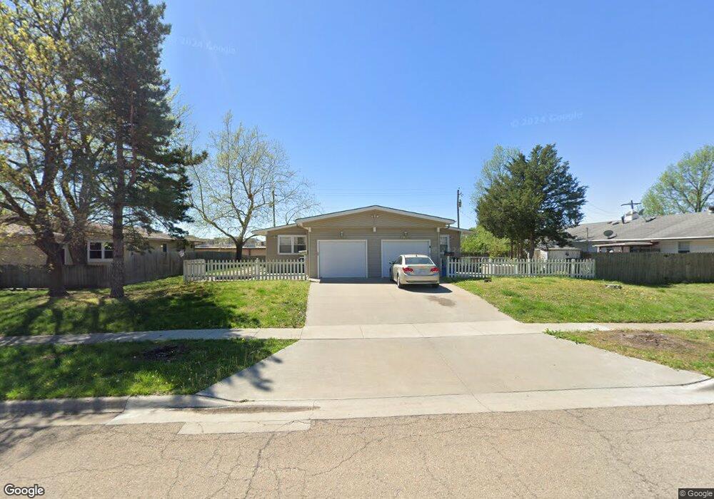
5811 SW 20th St Topeka, KS 66604
West Topeka NeighborhoodEstimated Value: $217,098 - $266,000
4
Beds
4
Baths
1,920
Sq Ft
$122/Sq Ft
Est. Value
About This Home
This home is located at 5811 SW 20th St, Topeka, KS 66604 and is currently estimated at $234,525, approximately $122 per square foot. 5811 SW 20th St is a home located in Shawnee County with nearby schools including McCarter Elementary School, Marjorie French Middle School, and Topeka West High School.
Ownership History
Date
Name
Owned For
Owner Type
Purchase Details
Closed on
Feb 1, 2016
Sold by
Blue Chips Limited Partnership
Bought by
Welcome Home Rentals Llc
Current Estimated Value
Purchase Details
Closed on
Dec 8, 2014
Sold by
Ellis Patricia Lynn and Robbins Patricia Ann
Bought by
Blue Chips Limited Partnership
Home Financials for this Owner
Home Financials are based on the most recent Mortgage that was taken out on this home.
Original Mortgage
$110,000
Interest Rate
3.99%
Mortgage Type
Future Advance Clause Open End Mortgage
Purchase Details
Closed on
Apr 12, 2013
Sold by
Anguiano Rosendo S and Anguiano Rosendo S
Bought by
Robbins Patricia Ann
Purchase Details
Closed on
Jul 5, 2005
Sold by
Vausbinder Trent E and Vausbinder Kimberly J
Bought by
Jensen Dana A
Create a Home Valuation Report for This Property
The Home Valuation Report is an in-depth analysis detailing your home's value as well as a comparison with similar homes in the area
Home Values in the Area
Average Home Value in this Area
Purchase History
| Date | Buyer | Sale Price | Title Company |
|---|---|---|---|
| Welcome Home Rentals Llc | -- | Kansas Secured Title | |
| Blue Chips Limited Partnership | -- | Kansas Secured Title | |
| Robbins Patricia Ann | -- | None Available | |
| Jensen Dana A | -- | Lawyers Title Of Topeka Inc |
Source: Public Records
Mortgage History
| Date | Status | Borrower | Loan Amount |
|---|---|---|---|
| Previous Owner | Blue Chips Limited Partnership | $110,000 |
Source: Public Records
Tax History Compared to Growth
Tax History
| Year | Tax Paid | Tax Assessment Tax Assessment Total Assessment is a certain percentage of the fair market value that is determined by local assessors to be the total taxable value of land and additions on the property. | Land | Improvement |
|---|---|---|---|---|
| 2025 | $3,677 | $26,368 | -- | -- |
| 2023 | $3,677 | $25,344 | $0 | $0 |
| 2022 | $3,376 | $22,428 | $0 | $0 |
| 2021 | $3,076 | $19,503 | $0 | $0 |
| 2020 | $2,895 | $18,574 | $0 | $0 |
| 2019 | $2,798 | $17,860 | $0 | $0 |
| 2018 | $2,719 | $17,340 | $0 | $0 |
| 2017 | $2,670 | $17,000 | $0 | $0 |
| 2014 | $2,047 | $12,972 | $0 | $0 |
Source: Public Records
Map
Nearby Homes
- 1906 SW Village Dr
- 0000 SW 22nd Terrace
- 5859 SW 22nd Terrace Unit 3
- 5324 SW 24th St
- 1728 SW Fairlawn Rd
- 2124 SW Meadow Ln
- 000 U S 75
- 5802 SW Sterling Ln
- 8008 SW 26th Terrace Unit Lot 8, Block B
- 8016 SW 26th Terrace Unit Lot 10, Block B
- 2401 SW Crest Dr
- 5518 SW Avalon Ln
- 5618 SW 14th St
- 1306 SW Glendale Dr
- 1944 SW Quivira Dr
- 6040 SW 25th St
- 5719 SW 27th St
- 6054 SW 25th St
- 5218 SW 28th St
- 5452 SW 12th Terrace Unit 3
- 5803 SW 20th St
- 2000 SW Arrowhead Rd
- 5801 SW 20th St
- 5731 SW 20th St
- 5810 SW 20th St
- 5800 SW 20th St
- 5820 SW 20th St
- 5725 SW 20th St
- 1966 SW Arrowhead Rd
- 5720 SW 21st St
- 1945 SW Navajo Ln
- 5720 SW 20th St
- 2001 SW Arrowhead Rd
- 1939 SW Navajo Ln
- 5715 SW 20th St
- 1973 SW Arrowhead Rd
- 2021 SW Arrowhead Rd
- 1960 SW Arrowhead Rd
- 1956 SW Navajo Ln
- 5710 SW 20th St