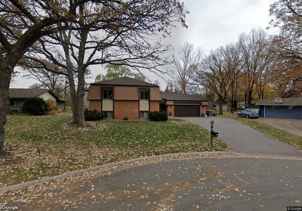
5814 Michael Ct Saint Cloud, MN 56303
Estimated Value: $294,000 - $326,000
4
Beds
2
Baths
1,305
Sq Ft
$235/Sq Ft
Est. Value
About This Home
This home is located at 5814 Michael Ct, Saint Cloud, MN 56303 and is currently estimated at $306,225, approximately $234 per square foot. 5814 Michael Ct is a home located in Stearns County with nearby schools including Westwood Elementary School, North Junior High School, and Apollo Senior High School.
Ownership History
Date
Name
Owned For
Owner Type
Purchase Details
Closed on
May 22, 2017
Sold by
Gustafson Katy L and Gustafson Jamie D
Bought by
Maertans Adam S and Martenes Dina M
Current Estimated Value
Create a Home Valuation Report for This Property
The Home Valuation Report is an in-depth analysis detailing your home's value as well as a comparison with similar homes in the area
Purchase History
| Date | Buyer | Sale Price | Title Company |
|---|---|---|---|
| Maertans Adam S | $196,500 | Quarry Title & Closing |
Source: Public Records
Tax History
| Year | Tax Paid | Tax Assessment Tax Assessment Total Assessment is a certain percentage of the fair market value that is determined by local assessors to be the total taxable value of land and additions on the property. | Land | Improvement |
|---|---|---|---|---|
| 2025 | $3,222 | $276,600 | $60,000 | $216,600 |
| 2024 | $3,222 | $260,600 | $60,000 | $200,600 |
| 2023 | $2,980 | $260,600 | $45,000 | $215,600 |
| 2022 | $2,410 | $185,100 | $45,000 | $140,100 |
| 2021 | $2,288 | $185,100 | $45,000 | $140,100 |
| 2020 | $2,188 | $177,200 | $45,000 | $132,200 |
| 2019 | $2,162 | $166,300 | $45,000 | $121,300 |
| 2018 | $2,082 | $156,100 | $45,000 | $111,100 |
| 2017 | $1,924 | $141,900 | $45,000 | $96,900 |
| 2016 | $1,812 | $0 | $0 | $0 |
| 2015 | $1,858 | $0 | $0 | $0 |
| 2014 | -- | $0 | $0 | $0 |
Source: Public Records
Map
Nearby Homes
- 5860 Rolling Ridge Rd
- 5815 Rivers Edge Dr
- 611 Brookwood Ln
- 1314 W Oakes Dr
- 1225 County Road 134
- 1540 Timberdoodle Dr
- 6319 Westwood Pkwy
- 144 Glenview Loop
- 1804 Amblewood Dr
- 939 Cypress Rd Unit 4
- 939 Cypress Rd Unit 42
- 939 Cypress Rd Unit 27
- 939 Cypress Rd Unit 25
- 1766 Cottonwood Cir
- 6545 Westwood Pkwy
- 6625 Westwood Pkwy
- 1443 County Road 134
- 1820 Case Ln
- 6536 Kenwood Rd
- 1631 Devon Rd
- 5815 Michael Ct
- 5813 Michael Ct
- 5812 Michael Ct
- 5817 Michael Ct
- 927 Brenda Lee Dr
- 929 Brenda Lee Dr
- 5811 Michael Ct
- 910 Gloria Dr
- 925 Brenda Lee Dr
- 919 Brenda Lee Dr
- 905 Gloria Dr
- 913 Brenda Lee Dr
- 902 Gloria Dr
- 5818 Michael Ct
- 5821 Michael Ct
- 5841 Ridgewood Rd
- 920 Brenda Lee Dr
- 926 Brenda Lee Dr
- 901 Gloria Dr
- 5833 Ridgewood Rd
Your Personal Tour Guide
Ask me questions while you tour the home.