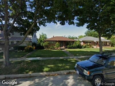
5816 Carol Ave Morton Grove, IL 60053
Estimated Value: $362,016 - $448,000
2
Beds
1
Bath
1,062
Sq Ft
$380/Sq Ft
Est. Value
About This Home
This home is located at 5816 Carol Ave, Morton Grove, IL 60053 and is currently estimated at $403,254, approximately $379 per square foot. 5816 Carol Ave is a home located in Cook County with nearby schools including Park View Elementary School, Niles West High School, and Arie Crown Hebrew Day School.
Ownership History
Date
Name
Owned For
Owner Type
Purchase Details
Closed on
Jun 30, 1995
Sold by
Monoscalco Judy L
Bought by
Monoscalco Louis M
Current Estimated Value
Home Financials for this Owner
Home Financials are based on the most recent Mortgage that was taken out on this home.
Original Mortgage
$96,000
Interest Rate
7.79%
Create a Home Valuation Report for This Property
The Home Valuation Report is an in-depth analysis detailing your home's value as well as a comparison with similar homes in the area
Home Values in the Area
Average Home Value in this Area
Purchase History
| Date | Buyer | Sale Price | Title Company |
|---|---|---|---|
| Monoscalco Louis M | -- | Lawyers Title Insurance Corp |
Source: Public Records
Mortgage History
| Date | Status | Borrower | Loan Amount |
|---|---|---|---|
| Closed | Monoscalco Louis M | $141,000 | |
| Closed | Monoscalco Louis M | $144,000 | |
| Closed | Monoscalco Louis M | $147,800 | |
| Closed | Monoscalco Louis M | $149,000 | |
| Closed | Monoscalco Louis M | $93,000 | |
| Closed | Monoscalco Louis M | $96,000 |
Source: Public Records
Tax History Compared to Growth
Tax History
| Year | Tax Paid | Tax Assessment Tax Assessment Total Assessment is a certain percentage of the fair market value that is determined by local assessors to be the total taxable value of land and additions on the property. | Land | Improvement |
|---|---|---|---|---|
| 2024 | $3,335 | $29,252 | $7,254 | $21,998 |
| 2023 | $3,335 | $29,252 | $7,254 | $21,998 |
| 2022 | $3,335 | $29,252 | $7,254 | $21,998 |
| 2021 | $3,785 | $26,035 | $4,464 | $21,571 |
| 2020 | $3,432 | $26,035 | $4,464 | $21,571 |
| 2019 | $3,402 | $29,253 | $4,464 | $24,789 |
| 2018 | $3,841 | $23,615 | $4,045 | $19,570 |
| 2017 | $3,802 | $23,615 | $4,045 | $19,570 |
| 2016 | $4,429 | $23,615 | $4,045 | $19,570 |
| 2015 | $5,004 | $20,072 | $3,487 | $16,585 |
| 2014 | $4,894 | $20,072 | $3,487 | $16,585 |
| 2013 | $4,896 | $20,072 | $3,487 | $16,585 |
Source: Public Records
Map
Nearby Homes
- 8907 Mason Ave
- 8525 Major Ave
- 8909 Austin Ave
- 8941 Menard Ave
- 9008 Menard Ave
- 8627 School St
- 5506 Lincoln Ave Unit A211
- 5510 Lincoln Ave Unit B202
- 9119 Mango Ave
- 8308 Mango Ave
- 9032 Luna Ave
- 9037 Moody Ave
- 5829 Madison St
- 8615 Callie Ave
- 5451 Main St
- 9134 Central Ave
- 9207 Menard Ave
- 8703 Ferris Ave
- 8650 Ferris Ave Unit 505
- 8440 Callie Ave Unit C201
- 5816 Carol Ave
- 5810 Carol Ave
- 5820 Carol Ave
- 5808 Carol Ave
- 5808 Carol Ave
- 5826 Carol Ave
- 5811 Dempster St
- 5811 Dempster St Unit 101
- 5811 Dempster St Unit 103
- 5802 Carol Ave
- 5802 Carol Ave
- 5834 Carol Ave
- 5834 Carol Ave
- 5813 Carol Ave
- 5813 Carol Ave
- 5801 Dempster St
- 5811 W Dempster St
- 5819 Carol Ave
- 5821 Carol Ave
- 5805 Carol Ave