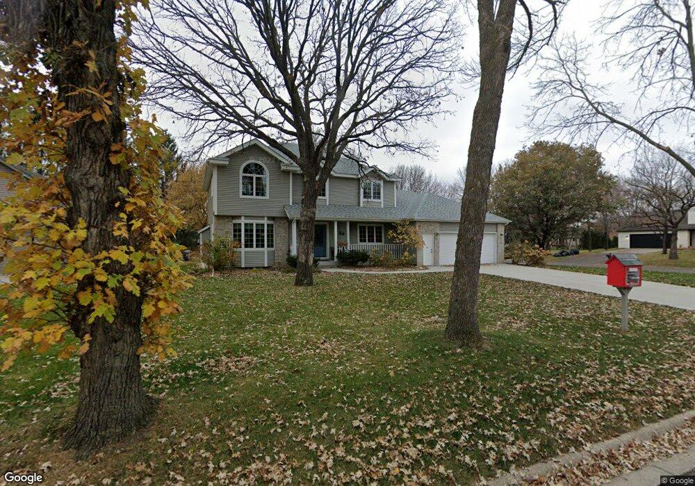
5822 Michael Ct Saint Cloud, MN 56303
Estimated Value: $363,263 - $408,000
4
Beds
4
Baths
2,504
Sq Ft
$154/Sq Ft
Est. Value
About This Home
This home is located at 5822 Michael Ct, Saint Cloud, MN 56303 and is currently estimated at $385,316, approximately $153 per square foot. 5822 Michael Ct is a home located in Stearns County with nearby schools including Westwood Elementary School, North Junior High School, and Apollo Senior High School.
Create a Home Valuation Report for This Property
The Home Valuation Report is an in-depth analysis detailing your home's value as well as a comparison with similar homes in the area
Tax History
| Year | Tax Paid | Tax Assessment Tax Assessment Total Assessment is a certain percentage of the fair market value that is determined by local assessors to be the total taxable value of land and additions on the property. | Land | Improvement |
|---|---|---|---|---|
| 2025 | $4,268 | $373,600 | $60,000 | $313,600 |
| 2024 | $4,316 | $332,700 | $60,000 | $272,700 |
| 2023 | $4,114 | $332,700 | $45,000 | $287,700 |
| 2022 | $3,688 | $267,000 | $45,000 | $222,000 |
| 2021 | $3,492 | $267,000 | $45,000 | $222,000 |
| 2020 | $3,330 | $254,400 | $45,000 | $209,400 |
| 2019 | $3,284 | $237,100 | $45,000 | $192,100 |
| 2018 | $3,150 | $220,900 | $45,000 | $175,900 |
| 2017 | $3,084 | $209,200 | $45,000 | $164,200 |
| 2016 | $2,894 | $0 | $0 | $0 |
| 2015 | $2,966 | $0 | $0 | $0 |
| 2014 | -- | $0 | $0 | $0 |
Source: Public Records
Map
Nearby Homes
- 5860 Rolling Ridge Rd
- 611 Brookwood Ln
- 5815 Rivers Edge Dr
- 1314 W Oakes Dr
- 6319 Westwood Pkwy
- 939 Cypress Rd Unit 4
- 939 Cypress Rd Unit 42
- 939 Cypress Rd Unit 27
- 939 Cypress Rd Unit 25
- 1225 County Road 134
- 6545 Westwood Pkwy
- 6625 Westwood Pkwy
- 144 Glenview Loop
- 1766 Cottonwood Cir
- 1540 Timberdoodle Dr
- 1804 Amblewood Dr
- 6536 Kenwood Rd
- 1443 County Road 134
- 1820 Case Ln
- 6704 & 6868 Old Highway 52
Your Personal Tour Guide
Ask me questions while you tour the home.