Estimated Value: $492,000 - $515,000
3
Beds
2
Baths
1,728
Sq Ft
$293/Sq Ft
Est. Value
About This Home
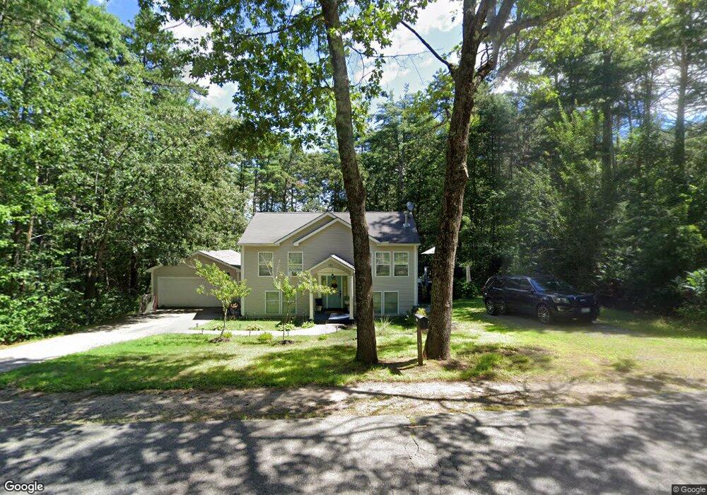
This home is located at 583 Perry Oliver Rd, Wells, ME 04090 and is currently estimated at $506,724, approximately $293 per square foot. 583 Perry Oliver Rd is a home located in York County with nearby schools including Wells Elementary School, Wells Junior High School, and Wells High School.
Ownership History
Date
Name
Owned For
Owner Type
Purchase Details
Closed on
Dec 24, 2009
Sold by
Macdonald Thomas
Bought by
Cornish Richard W and Cornish Carrie L
Current Estimated Value
Home Financials for this Owner
Home Financials are based on the most recent Mortgage that was taken out on this home.
Original Mortgage
$215,033
Outstanding Balance
$144,607
Interest Rate
4.92%
Mortgage Type
FHA
Estimated Equity
$362,117
Create a Home Valuation Report for This Property
The Home Valuation Report is an in-depth analysis detailing your home's value as well as a comparison with similar homes in the area
Home Values in the Area
Average Home Value in this Area
Purchase History
| Date | Buyer | Sale Price | Title Company |
|---|---|---|---|
| Cornish Richard W | -- | -- | |
| Cornish Richard W | -- | -- |
Source: Public Records
Mortgage History
| Date | Status | Borrower | Loan Amount |
|---|---|---|---|
| Open | Cornish Richard W | $215,033 | |
| Closed | Cornish Richard W | $215,033 |
Source: Public Records
Tax History Compared to Growth
Tax History
| Year | Tax Paid | Tax Assessment Tax Assessment Total Assessment is a certain percentage of the fair market value that is determined by local assessors to be the total taxable value of land and additions on the property. | Land | Improvement |
|---|---|---|---|---|
| 2024 | $2,380 | $391,480 | $122,160 | $269,320 |
| 2023 | $2,333 | $391,480 | $122,160 | $269,320 |
| 2022 | $2,255 | $215,610 | $55,570 | $160,040 |
| 2021 | $2,268 | $215,610 | $55,570 | $160,040 |
| 2020 | $2,260 | $215,610 | $55,570 | $160,040 |
| 2019 | $2,244 | $215,370 | $55,570 | $159,800 |
| 2018 | $2,223 | $215,370 | $55,570 | $159,800 |
| 2017 | $2,188 | $215,370 | $55,570 | $159,800 |
| 2016 | $2,167 | $215,370 | $55,570 | $159,800 |
| 2015 | $2,143 | $215,370 | $55,570 | $159,800 |
| 2013 | $1,964 | $215,370 | $55,570 | $159,800 |
Source: Public Records
Map
Nearby Homes
- Lot 11 Laney Ln
- Lot 13 Laney Ln
- 761 Quarry Rd
- 43 Michaels Rd
- 86 Moose Bog Ln
- 45 Grace Ln
- 94 Perry Oliver Rd
- 1229 Bragdon Rd
- 469 High St
- Lot 4 Tbd Lentago Ln Unit Lot 4
- 22 Lentago Ln
- Lot 3 Lentago Ln
- 42 Bernice Ave
- lot 6 Bragdon Rd
- 202 High St
- 233 Wells St
- 41 Sunny Ln
- 122 Country Club 3 Rd
- 38 High St
- 30 Riverview Dr Unit D
- 99 Minuteman Dr
- 597 Perry Oliver Rd
- 571 Perry Oliver Rd
- 111 Minuteman Dr
- 75 Minuteman Dr
- 619 Perry Oliver Rd
- 561 Perry Oliver Rd
- 132 Minuteman Dr
- 100 Minuteman Dr
- 65 Minuteman Dr
- 90 Minuteman Dr
- 2A-5 Redcoat Ln
- 76 Minuteman Dr
- 112 Minuteman Dr
- 0 Red Coat Ln
- 0 Redcoat Ln
- 626 Perry Oliver Rd
- 0 Minuteman Dr
- 3 Minuteman Dr
- 541 Perry Oliver Rd