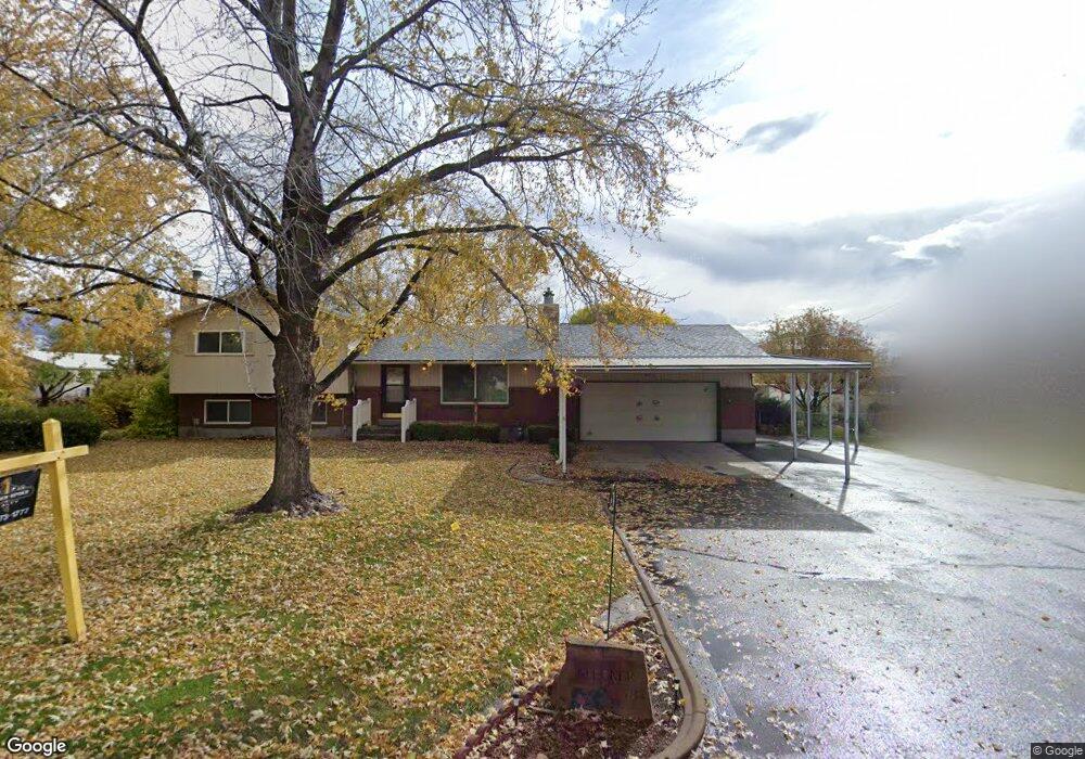
583 Weaver Ln Layton, UT 84041
Estimated Value: $470,000 - $606,000
3
Beds
2
Baths
1,789
Sq Ft
$299/Sq Ft
Est. Value
About This Home
This home is located at 583 Weaver Ln, Layton, UT 84041 and is currently estimated at $535,053, approximately $299 per square foot. 583 Weaver Ln is a home located in Davis County with nearby schools including Layton Elementary School, Fairfield Junior High School, and Layton High School.
Ownership History
Date
Name
Owned For
Owner Type
Purchase Details
Closed on
Nov 16, 2022
Sold by
Livi John J and Livi Marion
Bought by
Peterson Devin
Current Estimated Value
Home Financials for this Owner
Home Financials are based on the most recent Mortgage that was taken out on this home.
Original Mortgage
$270,000
Outstanding Balance
$261,628
Interest Rate
6.95%
Mortgage Type
New Conventional
Estimated Equity
$273,425
Purchase Details
Closed on
Jan 7, 2004
Sold by
Klecker John J and Klecker Marion M
Bought by
Klecker John J and Klecker Marion M
Purchase Details
Closed on
May 9, 2003
Sold by
Layton Land Partners Llc
Bought by
Klecker John J and Klecker Marion M
Create a Home Valuation Report for This Property
The Home Valuation Report is an in-depth analysis detailing your home's value as well as a comparison with similar homes in the area
Home Values in the Area
Average Home Value in this Area
Purchase History
| Date | Buyer | Sale Price | Title Company |
|---|---|---|---|
| Peterson Devin | -- | Frontier Title | |
| Klecker John J | -- | -- | |
| Klecker John J | -- | Guardian Title Company |
Source: Public Records
Mortgage History
| Date | Status | Borrower | Loan Amount |
|---|---|---|---|
| Open | Peterson Devin | $270,000 |
Source: Public Records
Tax History
| Year | Tax Paid | Tax Assessment Tax Assessment Total Assessment is a certain percentage of the fair market value that is determined by local assessors to be the total taxable value of land and additions on the property. | Land | Improvement |
|---|---|---|---|---|
| 2025 | $2,594 | $272,250 | $185,505 | $86,745 |
| 2024 | $2,517 | $266,200 | $202,974 | $63,226 |
| 2023 | $2,398 | $447,000 | $254,102 | $192,898 |
| 2022 | $1,290 | $244,200 | $123,302 | $120,898 |
| 2021 | $951 | $344,000 | $184,750 | $159,250 |
| 2020 | $693 | $298,000 | $164,259 | $133,741 |
| 2019 | $670 | $289,000 | $147,042 | $141,958 |
| 2018 | $482 | $258,000 | $131,219 | $126,781 |
| 2016 | $227 | $117,976 | $63,036 | $54,940 |
| 2015 | $1,523 | $106,206 | $63,036 | $43,170 |
| 2014 | $121 | $107,881 | $63,036 | $44,845 |
| 2013 | -- | $107,695 | $49,799 | $57,896 |
Source: Public Records
Map
Nearby Homes
Your Personal Tour Guide
Ask me questions while you tour the home.