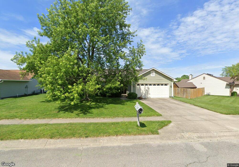
5832 Saint Simons Dr Indianapolis, IN 46237
South Emerson NeighborhoodEstimated Value: $247,000 - $258,000
3
Beds
2
Baths
1,506
Sq Ft
$167/Sq Ft
Est. Value
About This Home
This home is located at 5832 Saint Simons Dr, Indianapolis, IN 46237 and is currently estimated at $251,812, approximately $167 per square foot. 5832 Saint Simons Dr is a home located in Marion County with nearby schools including Mary Bryan Elementary School, Southport 6th Grade Academy, and Southport Middle School.
Ownership History
Date
Name
Owned For
Owner Type
Purchase Details
Closed on
Nov 21, 2006
Sold by
Secrest Staci C
Bought by
Meilaender Ellen H
Current Estimated Value
Home Financials for this Owner
Home Financials are based on the most recent Mortgage that was taken out on this home.
Original Mortgage
$103,275
Outstanding Balance
$61,977
Interest Rate
6.47%
Mortgage Type
New Conventional
Estimated Equity
$189,835
Create a Home Valuation Report for This Property
The Home Valuation Report is an in-depth analysis detailing your home's value as well as a comparison with similar homes in the area
Home Values in the Area
Average Home Value in this Area
Purchase History
| Date | Buyer | Sale Price | Title Company |
|---|---|---|---|
| Meilaender Ellen H | -- | None Available |
Source: Public Records
Mortgage History
| Date | Status | Borrower | Loan Amount |
|---|---|---|---|
| Open | Meilaender Ellen H | $103,275 |
Source: Public Records
Tax History Compared to Growth
Tax History
| Year | Tax Paid | Tax Assessment Tax Assessment Total Assessment is a certain percentage of the fair market value that is determined by local assessors to be the total taxable value of land and additions on the property. | Land | Improvement |
|---|---|---|---|---|
| 2024 | $2,730 | $217,800 | $26,400 | $191,400 |
| 2023 | $2,730 | $211,100 | $26,400 | $184,700 |
| 2022 | $2,534 | $192,900 | $26,400 | $166,500 |
| 2021 | $2,076 | $157,500 | $26,400 | $131,100 |
| 2020 | $1,917 | $145,400 | $26,400 | $119,000 |
| 2019 | $1,678 | $131,200 | $20,500 | $110,700 |
| 2018 | $1,517 | $122,300 | $20,500 | $101,800 |
| 2017 | $1,264 | $109,800 | $20,500 | $89,300 |
| 2016 | $1,229 | $107,200 | $20,500 | $86,700 |
| 2014 | $1,006 | $104,400 | $20,500 | $83,900 |
| 2013 | $1,047 | $102,700 | $20,500 | $82,200 |
Source: Public Records
Map
Nearby Homes
- 3916 Jekyll Ct
- 4407 Stone Mill Dr
- 5502 Black Cherry Cir
- 4038 Gray Arbor Way
- 4555 Blackstone Dr
- 5836 S Gale St
- 3502 Ferncliff Ave
- 3136 E Edgewood Ave
- 5321 S Linwood Ave
- 5150 Arling Dr
- 3305 E Dudley Ave
- 5133 Gray Rd
- 5051 Arling Ct
- 6332 Bryan Dr
- 5039 Arling Ct
- 4124 Shelbyville Rd
- 3905 Shelbyville Rd
- 5003 Amber Creek Place Unit 207
- 5617 S Emerson Ave
- 3030 Fairhope Dr
- 5838 St Simons Dr
- 5838 Saint Simons Dr
- 5816 Saint Simons Dr
- 4010 E Brunswick Ave
- 5774 Saint Simons Dr
- 4004 E Brunswick Ave
- 5831 Saint Simons Dr
- 5764 Saint Simons Dr
- 5825 Saint Simons Dr
- 5837 Saint Simons Dr
- 5764 St Simons Dr
- 5813 Saint Simons Dr
- 3950 E Brunswick Ave
- 5819 Saint Simons Dr
- 4009 E Brunswick Ave
- 4038 Maple Manor Dr
- 5758 Saint Simons Dr
- 5758 Saint Simons Dr
- 5805 Saint Simons Dr
- 4003 E Brunswick Ave