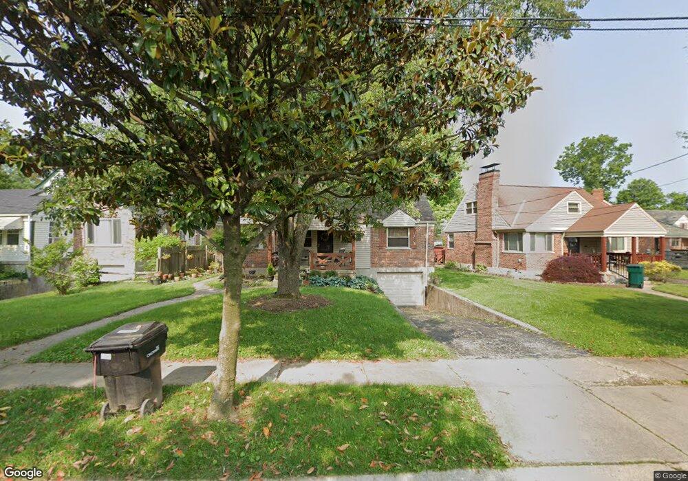
5835 Pointer Ln Cincinnati, OH 45213
Kennedy Heights NeighborhoodEstimated Value: $210,000 - $318,000
2
Beds
1
Bath
1,643
Sq Ft
$165/Sq Ft
Est. Value
About This Home
This home is located at 5835 Pointer Ln, Cincinnati, OH 45213 and is currently estimated at $270,965, approximately $164 per square foot. 5835 Pointer Ln is a home located in Hamilton County with nearby schools including John P. Parker School, Shroder High School, and Clark Montessori High School.
Ownership History
Date
Name
Owned For
Owner Type
Purchase Details
Closed on
Nov 10, 1999
Sold by
Riddle Sharon R
Bought by
Tatum Teri L
Current Estimated Value
Home Financials for this Owner
Home Financials are based on the most recent Mortgage that was taken out on this home.
Original Mortgage
$88,957
Outstanding Balance
$25,825
Interest Rate
8.02%
Mortgage Type
FHA
Estimated Equity
$245,140
Purchase Details
Closed on
Jan 14, 1998
Sold by
Davidson Elizabeth A
Bought by
Riddle Sharon R
Home Financials for this Owner
Home Financials are based on the most recent Mortgage that was taken out on this home.
Original Mortgage
$92,659
Interest Rate
7.24%
Mortgage Type
FHA
Create a Home Valuation Report for This Property
The Home Valuation Report is an in-depth analysis detailing your home's value as well as a comparison with similar homes in the area
Home Values in the Area
Average Home Value in this Area
Purchase History
| Date | Buyer | Sale Price | Title Company |
|---|---|---|---|
| Tatum Teri L | $100,000 | -- | |
| Riddle Sharon R | $95,000 | -- |
Source: Public Records
Mortgage History
| Date | Status | Borrower | Loan Amount |
|---|---|---|---|
| Open | Tatum Teri L | $88,957 | |
| Previous Owner | Riddle Sharon R | $92,659 |
Source: Public Records
Tax History
| Year | Tax Paid | Tax Assessment Tax Assessment Total Assessment is a certain percentage of the fair market value that is determined by local assessors to be the total taxable value of land and additions on the property. | Land | Improvement |
|---|---|---|---|---|
| 2025 | $3,620 | $58,591 | $14,151 | $44,440 |
| 2023 | $3,589 | $58,591 | $14,151 | $44,440 |
| 2022 | $2,843 | $41,560 | $10,658 | $30,902 |
| 2021 | $2,732 | $41,560 | $10,658 | $30,902 |
| 2020 | $2,812 | $41,560 | $10,658 | $30,902 |
| 2019 | $2,720 | $36,779 | $9,433 | $27,346 |
| 2018 | $2,725 | $36,779 | $9,433 | $27,346 |
| 2017 | $2,588 | $36,779 | $9,433 | $27,346 |
| 2016 | $3,100 | $43,474 | $9,289 | $34,185 |
| 2015 | $2,795 | $43,474 | $9,289 | $34,185 |
| 2014 | $2,815 | $43,474 | $9,289 | $34,185 |
| 2013 | $2,728 | $41,405 | $8,848 | $32,557 |
Source: Public Records
Map
Nearby Homes
- 3817 Davenant Ave
- 3921 Cedarwood Place
- 6097 W Fordham Place
- 3946 Cedarwood Place
- 6207 Coleridge Ave
- 3962 S Fordham Place
- 6201 Kennedy Ave
- 6221 Hedge Ave
- 6218 Kennedy Ave
- 3824 Standish Ave
- 3906 Standish Ave
- 3625 Zinsle Ave
- 3370 Woodford Rd
- 6501 Coleridge Ave
- 3523 Mary Ann Ln
- 3964 Zinsle Ave
- 6006 Grand Vista Ave
- 6508 Coleridge Ave
- 3264 Ashwood Dr
- 6256 Rogers Park Place
- 5831 Pointer Ln
- 5843 Pointer Ln
- 3816 Aikenside Ave
- 5847 Pointer Ln
- 5834 Pointer Ln
- 5838 Pointer Ln
- 5849 Pointer Ln
- 5830 Pointer Ln
- 3819 Aikenside Ave
- 5842 Pointer Ln
- 3784 Aikenside Ave
- 3827 Aikenside Ave
- 3780 Aikenside Ave
- 3815 Aikenside Ave
- 3776 Aikenside Ave
- 5846 Pointer Ln
- 3831 Aikenside Ave
- 5851 Pointer Ln
- 3809 Aikenside Ave
- 3770 Aikenside Ave
Your Personal Tour Guide
Ask me questions while you tour the home.