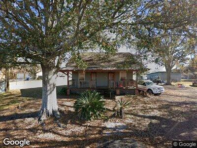
5838 Andre Ln Port Allen, LA 70767
West Baton Rouge Parish NeighborhoodEstimated Value: $181,000 - $285,414
--
Bed
--
Bath
1,690
Sq Ft
$143/Sq Ft
Est. Value
About This Home
This home is located at 5838 Andre Ln, Port Allen, LA 70767 and is currently estimated at $241,104, approximately $142 per square foot. 5838 Andre Ln is a home located in West Baton Rouge Parish with nearby schools including Chamberlin Elementary School, Devall Middle School, and Port Allen High School.
Ownership History
Date
Name
Owned For
Owner Type
Purchase Details
Closed on
Sep 28, 2018
Sold by
Chustz-Altazan Mary
Bought by
Smith Destin K
Current Estimated Value
Home Financials for this Owner
Home Financials are based on the most recent Mortgage that was taken out on this home.
Original Mortgage
$136,363
Outstanding Balance
$120,368
Interest Rate
4.5%
Mortgage Type
Purchase Money Mortgage
Estimated Equity
$76,792
Create a Home Valuation Report for This Property
The Home Valuation Report is an in-depth analysis detailing your home's value as well as a comparison with similar homes in the area
Home Values in the Area
Average Home Value in this Area
Purchase History
| Date | Buyer | Sale Price | Title Company |
|---|---|---|---|
| Smith Destin K | $135,000 | -- |
Source: Public Records
Mortgage History
| Date | Status | Borrower | Loan Amount |
|---|---|---|---|
| Open | Smith Destin K | $136,363 | |
| Previous Owner | Altazan Edward Jules | $108,000 | |
| Previous Owner | Chustz Mary Michlyn | $108,800 | |
| Previous Owner | Scalise Michael B | $95,000 |
Source: Public Records
Tax History Compared to Growth
Tax History
| Year | Tax Paid | Tax Assessment Tax Assessment Total Assessment is a certain percentage of the fair market value that is determined by local assessors to be the total taxable value of land and additions on the property. | Land | Improvement |
|---|---|---|---|---|
| 2024 | $649 | $14,200 | $5,850 | $8,350 |
| 2023 | $485 | $12,170 | $4,380 | $7,790 |
| 2022 | $1,276 | $12,170 | $4,380 | $7,790 |
| 2021 | $1,305 | $12,170 | $4,380 | $7,790 |
| 2020 | $1,186 | $10,950 | $3,940 | $7,010 |
| 2019 | $1,203 | $10,660 | $4,050 | $6,610 |
| 2018 | $1,225 | $10,660 | $4,050 | $6,610 |
| 2017 | $1,131 | $10,660 | $4,050 | $6,610 |
| 2015 | $899 | $10,470 | $3,860 | $6,610 |
| 2014 | $812 | $9,610 | $3,860 | $5,750 |
| 2013 | $549 | $6,500 | $3,860 | $2,640 |
Source: Public Records
Map
Nearby Homes
- 5726 Flynn Rd
- 11436 Tonawanda St
- 1053 Poydras Bayou Rd
- 5232, 5252 Elm Grove Rd
- 12634 Balis St
- 6229 Rougon Rd
- TBD Oakland Rd
- Tract E Rougon Rd
- 3638 Oakland Rd Unit 6
- lot 22 St Clara Ave
- 3446 Oakland Rd
- 9765 Skynet Ln
- 9766 Skynet Ln
- 7000 Bueche Rd
- 5743 Wye Rd
- 8330 Bueche Rd
- 4454 Treuil Rd
- 8958 Singleton Rd
- 4985 Bueche Rd
- 7231 Bueche Rd