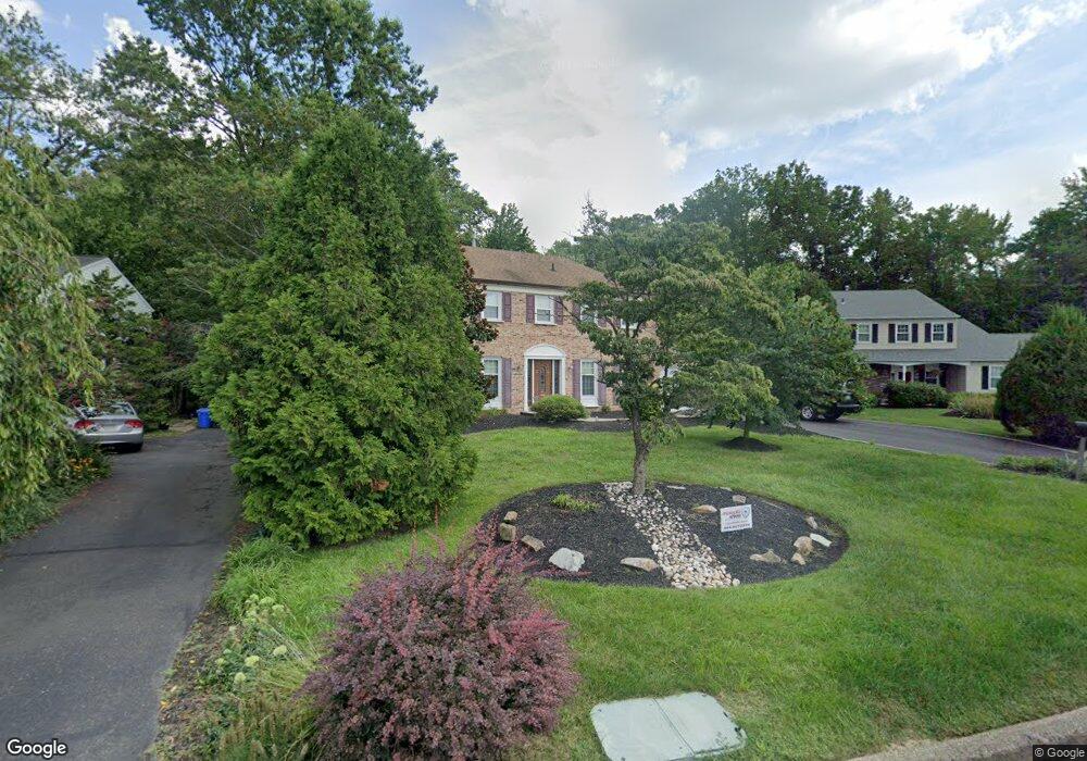
584 Croasdale Dr Langhorne, PA 19047
Estimated Value: $761,000 - $866,000
4
Beds
3
Baths
2,670
Sq Ft
$299/Sq Ft
Est. Value
About This Home
This home is located at 584 Croasdale Dr, Langhorne, PA 19047 and is currently estimated at $798,293, approximately $298 per square foot. 584 Croasdale Dr is a home located in Bucks County with nearby schools including Pearl S. Buck Elementary School, Maple Point Middle School, and Neshaminy High School.
Ownership History
Date
Name
Owned For
Owner Type
Purchase Details
Closed on
Nov 15, 2007
Sold by
Stipandic Edward A and Stipandic Barbara A
Bought by
Misnik Benedick J and Misnik Ellen P
Current Estimated Value
Home Financials for this Owner
Home Financials are based on the most recent Mortgage that was taken out on this home.
Original Mortgage
$350,000
Interest Rate
6.27%
Mortgage Type
Purchase Money Mortgage
Purchase Details
Closed on
May 26, 1992
Bought by
Stipandic Edward A and Stipandic Barbara A
Create a Home Valuation Report for This Property
The Home Valuation Report is an in-depth analysis detailing your home's value as well as a comparison with similar homes in the area
Home Values in the Area
Average Home Value in this Area
Purchase History
| Date | Buyer | Sale Price | Title Company |
|---|---|---|---|
| Misnik Benedick J | $510,000 | None Available | |
| Stipandic Edward A | $231,000 | -- |
Source: Public Records
Mortgage History
| Date | Status | Borrower | Loan Amount |
|---|---|---|---|
| Previous Owner | Misnik Benedick J | $350,000 |
Source: Public Records
Tax History Compared to Growth
Tax History
| Year | Tax Paid | Tax Assessment Tax Assessment Total Assessment is a certain percentage of the fair market value that is determined by local assessors to be the total taxable value of land and additions on the property. | Land | Improvement |
|---|---|---|---|---|
| 2025 | $9,666 | $44,400 | $6,440 | $37,960 |
| 2024 | $9,666 | $44,400 | $6,440 | $37,960 |
| 2023 | $9,513 | $44,400 | $6,440 | $37,960 |
| 2022 | $9,263 | $44,400 | $6,440 | $37,960 |
| 2021 | $9,263 | $44,400 | $6,440 | $37,960 |
| 2020 | $9,152 | $44,400 | $6,440 | $37,960 |
| 2019 | $8,947 | $44,400 | $6,440 | $37,960 |
| 2018 | $8,783 | $44,400 | $6,440 | $37,960 |
| 2017 | $8,559 | $44,400 | $6,440 | $37,960 |
| 2016 | $8,559 | $44,400 | $6,440 | $37,960 |
| 2015 | $8,955 | $44,400 | $6,440 | $37,960 |
| 2014 | $8,955 | $44,400 | $6,440 | $37,960 |
Source: Public Records
Map
Nearby Homes
- 2703 Lynbrooke Dr Unit 81
- 2602 Waterford Rd Unit 96
- 181 Fillmore Way
- 462 Scott Ct
- 2007 Waterford Rd Unit 81
- 28130 Hickory Ln
- 30139 Hickory Ln
- 2908 Brookhaven Dr
- 1749 Locust Dr
- 195 Roosevelt Dr
- 164 Tyler Way
- 1948 Satter Ct
- 81 Lavender Dr
- 5801 Spruce Mill Dr Unit 450
- 1651 Covington Rd Unit 26
- 654A Woodford Ln
- 604 Wrensong Rd
- 647A Rose Hollow Dr Unit B
- 30 Tupelo Ln
- 1977 4th St
- 592 Croasdale Dr
- 582 Croasdale Dr
- 602 Croasdale Dr
- 593 Croasdale Dr
- 583 Croasdale Dr
- 574 Croasdale Dr
- 612 Croasdale Dr
- 573 Croasdale Dr
- 572 Croasdale Dr
- 613 Croasdale Dr
- 622 Croasdale Dr
- 563 Croasdale Dr
- 562 Croasdale Dr
- 623 Croasdale Dr
- 530 Atkinson Ln
- 540 Atkinson Ln
- 520 Atkinson Ln
- 552 Croasdale Dr
- 633 Croasdale Dr
- 632 Croasdale Dr