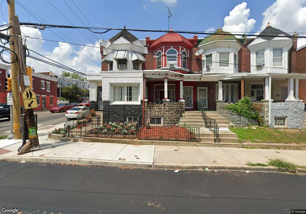
5847 Lansdowne Ave Philadelphia, PA 19131
Overbrook NeighborhoodEstimated Value: $164,000 - $247,000
4
Beds
2
Baths
1,691
Sq Ft
$122/Sq Ft
Est. Value
About This Home
This home is located at 5847 Lansdowne Ave, Philadelphia, PA 19131 and is currently estimated at $206,353, approximately $122 per square foot. 5847 Lansdowne Ave is a home located in Philadelphia County with nearby schools including Overbrook High School, Universal Bluford Charter School, and Harambee Institute of Science and Techno.
Ownership History
Date
Name
Owned For
Owner Type
Purchase Details
Closed on
Nov 21, 2015
Sold by
Gordon Innel and Gordon Mildred
Bought by
Thomas Michael Anthony and Fisher Loleitha
Current Estimated Value
Home Financials for this Owner
Home Financials are based on the most recent Mortgage that was taken out on this home.
Original Mortgage
$89,510
Interest Rate
3.87%
Mortgage Type
Seller Take Back
Purchase Details
Closed on
Sep 16, 1992
Bought by
Brown Ralph
Create a Home Valuation Report for This Property
The Home Valuation Report is an in-depth analysis detailing your home's value as well as a comparison with similar homes in the area
Home Values in the Area
Average Home Value in this Area
Purchase History
| Date | Buyer | Sale Price | Title Company |
|---|---|---|---|
| Thomas Michael Anthony | $20,490 | None Available | |
| Brown Ralph | $8,500 | -- |
Source: Public Records
Mortgage History
| Date | Status | Borrower | Loan Amount |
|---|---|---|---|
| Closed | Thomas Michael Anthony | $89,510 |
Source: Public Records
Tax History Compared to Growth
Tax History
| Year | Tax Paid | Tax Assessment Tax Assessment Total Assessment is a certain percentage of the fair market value that is determined by local assessors to be the total taxable value of land and additions on the property. | Land | Improvement |
|---|---|---|---|---|
| 2025 | $1,670 | $158,200 | $31,640 | $126,560 |
| 2024 | $1,670 | $158,200 | $31,640 | $126,560 |
| 2023 | $1,670 | $119,300 | $23,860 | $95,440 |
| 2022 | $353 | $74,300 | $23,860 | $50,440 |
| 2021 | $983 | $0 | $0 | $0 |
| 2020 | $983 | $0 | $0 | $0 |
| 2019 | $946 | $0 | $0 | $0 |
| 2018 | $995 | $0 | $0 | $0 |
| 2017 | $1,415 | $0 | $0 | $0 |
| 2016 | $1,415 | $0 | $0 | $0 |
| 2015 | $1,355 | $0 | $0 | $0 |
| 2014 | -- | $101,100 | $8,939 | $92,161 |
| 2012 | -- | $8,096 | $1,619 | $6,477 |
Source: Public Records
Map
Nearby Homes
- 5787 Hunter St
- 1632 N 59th St
- 1549 N Wanamaker St
- 5804 Lansdowne Ave
- 5920 Lansdowne Ave
- 5745 Hunter St
- 5777 Stewart St
- 1656 N 59th St
- 5784 Haddington St
- 5936 Lansdowne Ave
- 1506 N Wanamaker St
- 5724 Hunter St
- 5938 Lansdowne Ave
- 5940 Lansdowne Ave
- 5747 Stewart St
- 1639 N 60th St
- 1555 N Alden St
- 1550 N 57th St
- 1458 N Wanamaker St
- 1534 N 57th St
- 5845 Lansdowne Ave
- 5843 Lansdowne Ave
- 5841 Lansdowne Ave
- 5839 Lansdowne Ave
- 1615 N 59th St
- 5837 Lansdowne Ave
- 5903 Lansdowne Ave
- 5835 Lansdowne Ave
- 1617 N 59th St
- 5905 Lansdowne Ave
- 5833 Lansdowne Ave
- 1619 N 59th St
- 5907 Lansdowne Ave
- 1616 N 59th St
- 1614 N 59th St
- 5909 Lansdowne Ave
- 1621 N 59th St
- 5848 Lansdowne Ave
- 5829 Lansdowne Ave
- 5840 Lansdowne Ave