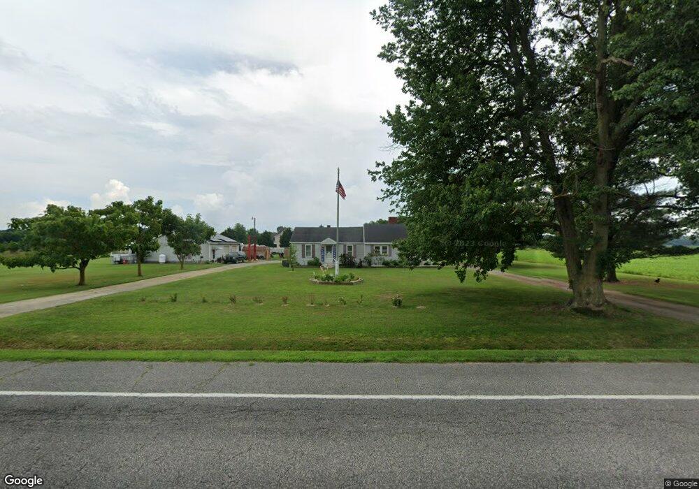
5849 Bethlehem Rd Preston, MD 21655
Estimated Value: $257,000 - $334,000
Studio
1
Bath
1,618
Sq Ft
$188/Sq Ft
Est. Value
About This Home
This home is located at 5849 Bethlehem Rd, Preston, MD 21655 and is currently estimated at $303,749, approximately $187 per square foot. 5849 Bethlehem Rd is a home located in Caroline County with nearby schools including Preston Elementary School, Colonel Richardson Middle School, and Colonel Richardson High School.
Ownership History
Date
Name
Owned For
Owner Type
Purchase Details
Closed on
Feb 11, 2011
Sold by
Shuler Vaughn Duane
Bought by
Shuler Vaughn Duane and Shuler Bonita Ann
Current Estimated Value
Purchase Details
Closed on
Jun 21, 2001
Sold by
Patrick James E and Patrick Penny L
Bought by
Shuler Vaughn Duane
Purchase Details
Closed on
Jan 10, 2001
Sold by
Wheeler Rose Marie E
Bought by
Patrick James E and Patrick Penny L
Purchase Details
Closed on
Jun 10, 1996
Sold by
Mcelhany Thomas Hugh
Bought by
Wheeler Donald Pergoy and Rose Marie E Wheeler
Create a Home Valuation Report for This Property
The Home Valuation Report is an in-depth analysis detailing your home's value as well as a comparison with similar homes in the area
Home Values in the Area
Average Home Value in this Area
Purchase History
| Date | Buyer | Sale Price | Title Company |
|---|---|---|---|
| Shuler Vaughn Duane | -- | -- | |
| Shuler Vaughn Duane | $84,900 | -- | |
| Patrick James E | $37,025 | -- | |
| Wheeler Donald Pergoy | $73,000 | -- |
Source: Public Records
Mortgage History
| Date | Status | Borrower | Loan Amount |
|---|---|---|---|
| Closed | Wheeler Donald Pergoy | -- |
Source: Public Records
Tax History
| Year | Tax Paid | Tax Assessment Tax Assessment Total Assessment is a certain percentage of the fair market value that is determined by local assessors to be the total taxable value of land and additions on the property. | Land | Improvement |
|---|---|---|---|---|
| 2025 | $2,115 | $194,633 | $0 | $0 |
| 2024 | $2,115 | $188,167 | $0 | $0 |
| 2023 | $2,044 | $181,700 | $64,000 | $117,700 |
| 2022 | $1,974 | $175,267 | $0 | $0 |
| 2021 | $1,833 | $168,833 | $0 | $0 |
| 2020 | $1,833 | $162,400 | $64,000 | $98,400 |
| 2019 | $1,798 | $159,200 | $0 | $0 |
| 2018 | $1,764 | $156,000 | $0 | $0 |
| 2017 | $1,729 | $152,800 | $0 | $0 |
| 2016 | -- | $152,533 | $0 | $0 |
| 2015 | $1,317 | $152,267 | $0 | $0 |
| 2014 | $1,317 | $152,000 | $0 | $0 |
Source: Public Records
Map
Nearby Homes
- lot 6 Harmony Woods Dr
- 5585 Harmony Woods Dr
- 22408 Hog Creek Rd
- 23116 Gilpin Point Rd
- 0 Nelpine Rd
- 23547 Jonestown Ln
- LOT #6 High Banks Dr
- 0 High Banks Dr
- 4218 Harmony Rd
- 5026 Bethlehem Rd
- 21682 Dover Bridge Rd
- 6401 Laurel Grove Rd
- 21405 Tanyard Rd
- 22403 Marsh Creek Rd
- 24111 Friendship Rd
- 21245 Tanyard Rd
- 162 Main St
- 103 Chamber St
- 212 Main St
- 126 Maple Ave
- 5853 Bethlehem Rd
- 5855 Bethlehem Rd
- 5879 Bethlehem Rd
- 5971 Bethlehem Rd
- 6020 Bethlehem Rd
- 6009 Bethlehem Rd
- 6071 Bethlehem Rd
- 23032 Grove Rd
- 22949 Grove Rd
- 22949 Grove Rd
- 5750 Bell Creek Rd
- 6075 Bethlehem Rd
- 5774 Bell Creek Rd
- 5794 Bell Creek Rd
- 5716 Bethlehem Rd
- 22929 Grove Rd
- 6089 Bethlehem Rd
- 22975 Grove Rd
- 23161 Grove Rd
- 23190 Grove Rd
Your Personal Tour Guide
Ask me questions while you tour the home.