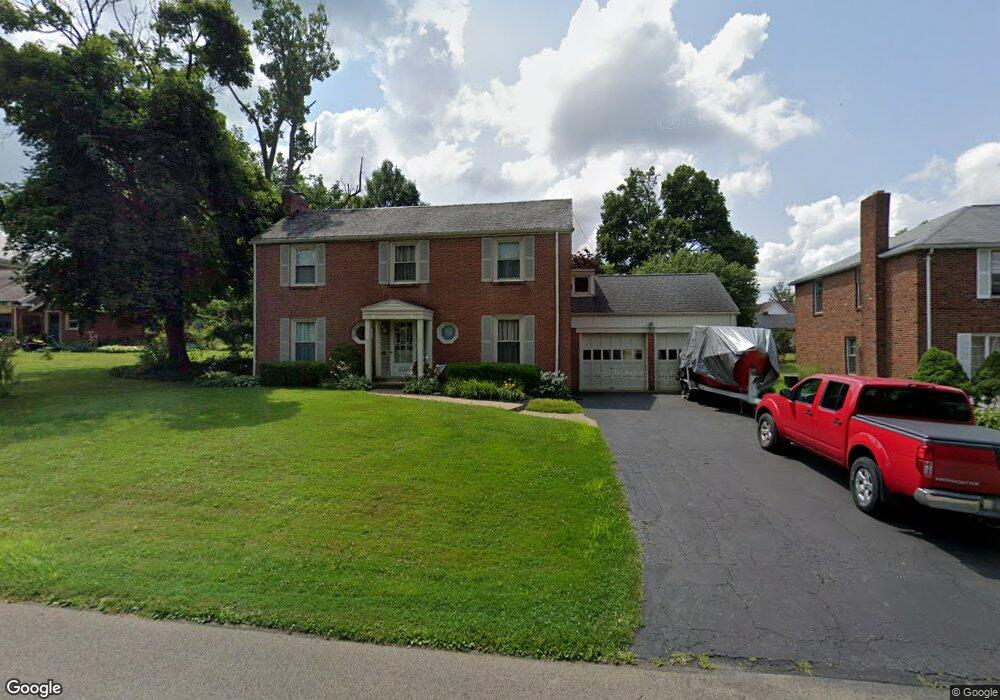
585 Barnard Ave Mansfield, OH 44903
Estimated Value: $174,727 - $228,000
3
Beds
2
Baths
2,040
Sq Ft
$94/Sq Ft
Est. Value
About This Home
This home is located at 585 Barnard Ave, Mansfield, OH 44903 and is currently estimated at $190,932, approximately $93 per square foot. 585 Barnard Ave is a home located in Richland County with nearby schools including Goal Digital Academy, Discovery School, and St. Peter's High School/Junior High.
Ownership History
Date
Name
Owned For
Owner Type
Purchase Details
Closed on
Aug 2, 2004
Sold by
Stewart John C and Stewart Jenifer S
Bought by
Kleshinski Brian and White Patti
Current Estimated Value
Home Financials for this Owner
Home Financials are based on the most recent Mortgage that was taken out on this home.
Original Mortgage
$88,000
Outstanding Balance
$44,792
Interest Rate
6.4%
Mortgage Type
Purchase Money Mortgage
Estimated Equity
$146,140
Purchase Details
Closed on
Feb 1, 2000
Sold by
Est Margaret M Wagstaff
Bought by
Stewart John C and Moritz Jennifer S
Home Financials for this Owner
Home Financials are based on the most recent Mortgage that was taken out on this home.
Original Mortgage
$56,000
Interest Rate
7.84%
Mortgage Type
New Conventional
Purchase Details
Closed on
Nov 21, 1990
Sold by
Maul Wilhelmina
Bought by
Maul Margaret Belle
Create a Home Valuation Report for This Property
The Home Valuation Report is an in-depth analysis detailing your home's value as well as a comparison with similar homes in the area
Home Values in the Area
Average Home Value in this Area
Purchase History
| Date | Buyer | Sale Price | Title Company |
|---|---|---|---|
| Kleshinski Brian | $113,000 | -- | |
| Stewart John C | $70,000 | -- | |
| Maul Margaret Belle | -- | -- |
Source: Public Records
Mortgage History
| Date | Status | Borrower | Loan Amount |
|---|---|---|---|
| Open | Kleshinski Brian | $88,000 | |
| Previous Owner | Stewart John C | $56,000 | |
| Closed | Kleshinski Brian | $25,000 |
Source: Public Records
Tax History Compared to Growth
Tax History
| Year | Tax Paid | Tax Assessment Tax Assessment Total Assessment is a certain percentage of the fair market value that is determined by local assessors to be the total taxable value of land and additions on the property. | Land | Improvement |
|---|---|---|---|---|
| 2024 | $2,120 | $45,280 | $4,810 | $40,470 |
| 2023 | $2,120 | $45,280 | $4,810 | $40,470 |
| 2022 | $1,801 | $32,230 | $4,120 | $28,110 |
| 2021 | $1,813 | $32,230 | $4,120 | $28,110 |
| 2020 | $1,854 | $32,230 | $4,120 | $28,110 |
| 2019 | $2,055 | $32,230 | $4,120 | $28,110 |
| 2018 | $2,027 | $32,230 | $4,120 | $28,110 |
| 2017 | $1,972 | $32,230 | $4,120 | $28,110 |
| 2016 | $2,086 | $33,060 | $5,220 | $27,840 |
| 2015 | $1,993 | $33,060 | $5,220 | $27,840 |
| 2014 | $1,967 | $33,060 | $5,220 | $27,840 |
| 2012 | $749 | $33,060 | $5,500 | $27,560 |
Source: Public Records
Map
Nearby Homes
- 679 Coleman Rd
- 538 Broadview Ave
- 408 Fairlawn Ave
- 133 Stewart Ave S
- 191 Fairlawn Ave
- 118 Parkwood Blvd
- 126 Dawson Ave
- 143 Fairlawn Ave
- 212 Marlow Rd
- 135 Fairlawn Ave
- 129 Fairlawn Ave
- 78 Glenwood Blvd
- 71 Glenwood Blvd
- 88 Sherman Ave
- 41 Parkwood Blvd
- 76 Bartley Ave
- 24 Stewart Ave S
- 114 Vennum Ave
- 21 Glenwood Blvd
- 190 S Linden Rd
- 591 Barnard Ave Unit 593
- 560 Marion Ave
- 532 Marion Ave
- 599 Barnard Ave
- 597 Barnard Ave
- 564 Marion Ave
- 584 Barnard Ave
- 594 Manchester Rd
- 580 Barnard Ave
- 592 Barnard Ave
- 607 Barnard Ave
- 598 Barnard Ave
- 600 Manchester Rd
- 611 Barnard Ave
- 606 Barnard Ave
- 603 Manchester Rd
- 570 Marion Ave 603-609 Manchester Rd
- 551 Marion Ave
- 608 Manchester Rd
- 583 Coleman Rd