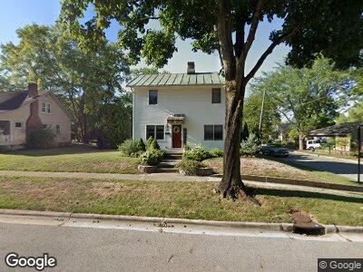
585 Elm St Groveport, OH 43125
Estimated Value: $208,000 - $240,000
2
Beds
2
Baths
1,196
Sq Ft
$185/Sq Ft
Est. Value
About This Home
This home is located at 585 Elm St, Groveport, OH 43125 and is currently estimated at $221,585, approximately $185 per square foot. 585 Elm St is a home located in Franklin County with nearby schools including Groveport Madison High School, Groveport Community School, and Madison Christian School.
Ownership History
Date
Name
Owned For
Owner Type
Purchase Details
Closed on
Dec 27, 2024
Bought by
Williamson Marc F
Current Estimated Value
Purchase Details
Closed on
Jan 28, 2016
Sold by
Williamson Marc F
Bought by
Williamson Joni E
Purchase Details
Closed on
Sep 9, 2011
Sold by
Williamson Lori K
Bought by
Williamson Marc F
Purchase Details
Closed on
Jun 8, 2005
Sold by
Williamson Marc F and Williamson Lori K
Bought by
Williamson Marc F and Williamson Lori K
Purchase Details
Closed on
Aug 14, 1987
Bought by
Williamson Marc F
Create a Home Valuation Report for This Property
The Home Valuation Report is an in-depth analysis detailing your home's value as well as a comparison with similar homes in the area
Home Values in the Area
Average Home Value in this Area
Purchase History
| Date | Buyer | Sale Price | Title Company |
|---|---|---|---|
| Williamson Marc F | -- | Attorney | |
| Williamson Marc F | -- | -- | |
| Williamson Marc F | $36,000 | -- |
Source: Public Records
Mortgage History
| Date | Status | Borrower | Loan Amount |
|---|---|---|---|
| Previous Owner | Henry Ronald Dale | $65,000 | |
| Previous Owner | Williamson Marc | $47,000 |
Source: Public Records
Tax History Compared to Growth
Tax History
| Year | Tax Paid | Tax Assessment Tax Assessment Total Assessment is a certain percentage of the fair market value that is determined by local assessors to be the total taxable value of land and additions on the property. | Land | Improvement |
|---|---|---|---|---|
| 2024 | $3,100 | $63,390 | $16,980 | $46,410 |
| 2023 | $3,073 | $63,385 | $16,975 | $46,410 |
| 2022 | $2,286 | $37,630 | $7,320 | $30,310 |
| 2021 | $2,295 | $37,630 | $7,320 | $30,310 |
| 2020 | $2,300 | $37,630 | $7,320 | $30,310 |
| 2019 | $2,139 | $30,840 | $6,090 | $24,750 |
| 2018 | $2,165 | $30,840 | $6,090 | $24,750 |
| 2017 | $2,155 | $30,840 | $6,090 | $24,750 |
| 2016 | $2,161 | $28,080 | $6,270 | $21,810 |
| 2015 | $2,180 | $28,080 | $6,270 | $21,810 |
| 2014 | $2,052 | $28,080 | $6,270 | $21,810 |
| 2013 | $920 | $29,540 | $6,580 | $22,960 |
Source: Public Records
Map
Nearby Homes
- 633 Wirt Rd
- 336 Lambert St
- 387 Kinsel Ave
- 403 Tallman St
- 4822 Elmont Place
- 5907 Ebright Rd
- 7628 Groveport Rd
- 4909 Bixby Rd
- 5453 Sims Rd
- 5127 Phillips Run
- 0 Pontius Rd
- 5589 Morgan Ct
- 3501 Rohr Rd
- 3339 Lauren Fields Dr S
- 5424 Bixby Rd
- 5181 MacClellan St N
- 4655 Hayes Rd
- 4832 Bay Grove Ct Unit 4832
- 5227 Knight St
- 4979 Johnanne Dr