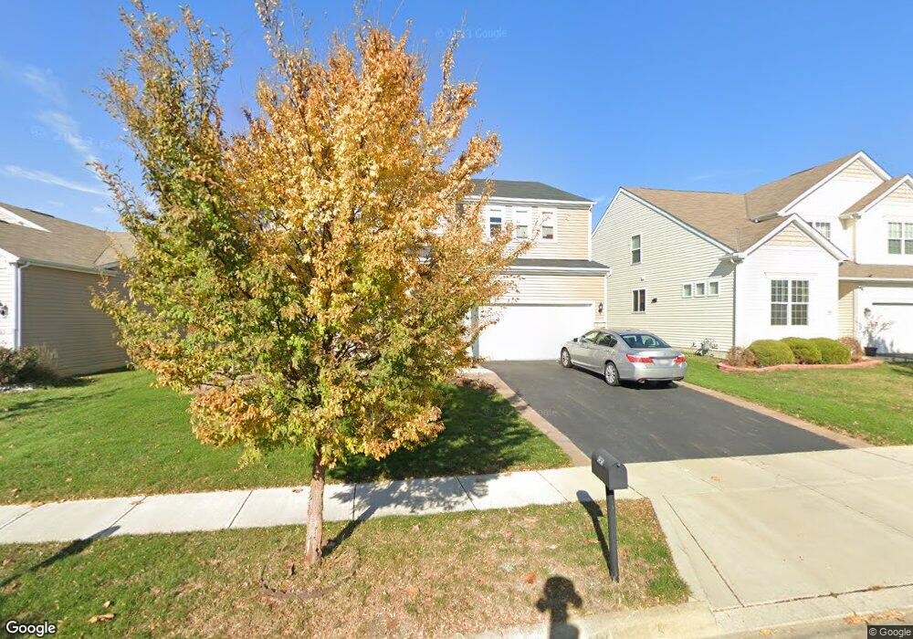
5850 Bucksburn Dr Galloway, OH 43119
Estimated Value: $408,260 - $463,000
4
Beds
3
Baths
2,972
Sq Ft
$148/Sq Ft
Est. Value
About This Home
This home is located at 5850 Bucksburn Dr, Galloway, OH 43119 and is currently estimated at $441,315, approximately $148 per square foot. 5850 Bucksburn Dr is a home with nearby schools including Georgian Heights Alt Elementary School, Wedgewood Middle School, and Briggs High School.
Ownership History
Date
Name
Owned For
Owner Type
Purchase Details
Closed on
May 2, 2024
Sold by
Vo An and Vo Toan
Bought by
Vo Family Revocable Living Trust and Vo
Current Estimated Value
Purchase Details
Closed on
Dec 7, 2018
Sold by
Pulte Homes Of Ohio Llc
Bought by
Vo An and Vo Toan
Purchase Details
Closed on
Mar 28, 2013
Sold by
Mi Homes Of Central Ohio Llc
Bought by
Dominion Homes Inc
Create a Home Valuation Report for This Property
The Home Valuation Report is an in-depth analysis detailing your home's value as well as a comparison with similar homes in the area
Home Values in the Area
Average Home Value in this Area
Purchase History
| Date | Buyer | Sale Price | Title Company |
|---|---|---|---|
| Vo Family Revocable Living Trust | -- | -- | |
| Vo An | $303,900 | First Ohio Title Insurance | |
| Dominion Homes Inc | $78,000 | None Available |
Source: Public Records
Tax History
| Year | Tax Paid | Tax Assessment Tax Assessment Total Assessment is a certain percentage of the fair market value that is determined by local assessors to be the total taxable value of land and additions on the property. | Land | Improvement |
|---|---|---|---|---|
| 2025 | $5,849 | $130,320 | $26,470 | $103,850 |
| 2024 | $5,849 | $130,320 | $26,470 | $103,850 |
| 2023 | $5,774 | $130,305 | $26,460 | $103,845 |
| 2022 | $6,415 | $123,690 | $10,920 | $112,770 |
| 2021 | $6,427 | $123,690 | $10,920 | $112,770 |
| 2020 | $6,435 | $123,690 | $10,920 | $112,770 |
| 2019 | $6,253 | $103,080 | $9,100 | $93,980 |
| 2018 | $541 | $9,100 | $9,100 | $0 |
| 2017 | $567 | $9,100 | $9,100 | $0 |
| 2016 | $569 | $8,370 | $8,370 | $0 |
| 2015 | $518 | $8,370 | $8,370 | $0 |
| 2014 | $519 | $8,370 | $8,370 | $0 |
| 2013 | $256 | $8,365 | $8,365 | $0 |
Source: Public Records
Map
Nearby Homes
- 5910 Bucksburn Dr
- 5919 Bucksburn Dr
- 5843 Tully Cross Dr
- 5965 Tully Cross Dr
- 5711 Greendale Dr
- 296 Rye St Unit Lot 48
- 320 Rye St Unit Lot 51
- 286 Fortune Dr Unit Lot 145
- 332 Rye St Unit Lot 53
- 294 Fortune Dr Unit Lot 144
- 325 Rye St Unit Lot 123
- 289 Fortune Dr Unit Lot 113
- 310 Fortune Dr Unit Lot 142
- 326 Fortune Dr Unit Lot 140
- 313 Fortune Dr Unit Lot 110
- 6200 Trefoil St Unit Lot 109
- 376 Galloway Ridge Dr
- 5409 Longworth Dr
- 5713 Larksdale Dr
- 69 Lawrence Ave
- 5844 Bucksburn Dr Unit 4
- 5844 Bucksburn Dr
- 5856 Bucksburn Dr
- Lot 3 Bucksburn Dr
- 5864 Bucksburn Dr
- 5838 Bucksburn Dr
- Lot 1 Bucksburn Dr
- 5853 Bucksburn Dr
- 5829 Bucksburn Dr
- 5859 Bucksburn Dr
- 5832 Bucksburn Dr
- 5865 Bucksburn Dr
- 5865 Bucksburn Dr Unit 31
- 5826 Bucksburn Dr
- 5858 Tully Cross Dr
- 5858 Tully Cross Dr Unit 26
- 5852 Tully Cross Dr
- 5884 Bucksburn Dr
- 5864 Tully Cross Dr
- 5814 Bucksburn Dr
Your Personal Tour Guide
Ask me questions while you tour the home.