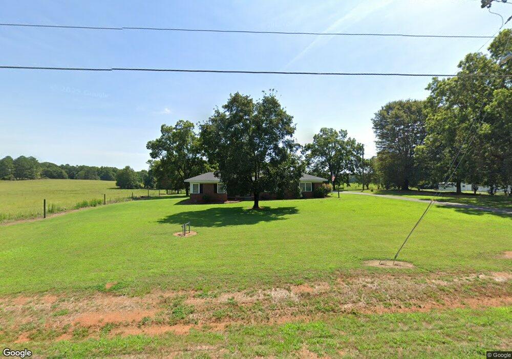
5854 Highway 187 Anderson, SC 29625
Estimated Value: $290,000 - $311,626
3
Beds
--
Bath
1,461
Sq Ft
$204/Sq Ft
Est. Value
About This Home
This home is located at 5854 Highway 187, Anderson, SC 29625 and is currently estimated at $298,542, approximately $204 per square foot. 5854 Highway 187 is a home with nearby schools including Pendleton High School.
Ownership History
Date
Name
Owned For
Owner Type
Purchase Details
Closed on
Sep 15, 2015
Sold by
Garren Karen M
Bought by
Hix Joseph R and Hix Vickie A
Current Estimated Value
Home Financials for this Owner
Home Financials are based on the most recent Mortgage that was taken out on this home.
Original Mortgage
$134,518
Outstanding Balance
$107,389
Interest Rate
4.4%
Mortgage Type
FHA
Estimated Equity
$191,153
Purchase Details
Closed on
May 19, 2015
Sold by
Estate Of Hazel Louise Moore
Bought by
Garren Karen M
Purchase Details
Closed on
Aug 6, 2008
Sold by
Garren Karen M
Bought by
Moore Lucy N
Create a Home Valuation Report for This Property
The Home Valuation Report is an in-depth analysis detailing your home's value as well as a comparison with similar homes in the area
Home Values in the Area
Average Home Value in this Area
Purchase History
| Date | Buyer | Sale Price | Title Company |
|---|---|---|---|
| Hix Joseph R | $137,000 | -- | |
| Garren Karen M | -- | -- | |
| Moore Lucy N | -- | -- |
Source: Public Records
Mortgage History
| Date | Status | Borrower | Loan Amount |
|---|---|---|---|
| Open | Hix Joseph R | $134,518 |
Source: Public Records
Tax History Compared to Growth
Tax History
| Year | Tax Paid | Tax Assessment Tax Assessment Total Assessment is a certain percentage of the fair market value that is determined by local assessors to be the total taxable value of land and additions on the property. | Land | Improvement |
|---|---|---|---|---|
| 2024 | $695 | $3,860 | $390 | $3,470 |
| 2023 | $695 | $3,860 | $390 | $3,470 |
| 2022 | $604 | $3,860 | $390 | $3,470 |
| 2021 | $582 | $3,620 | $340 | $3,280 |
| 2020 | $573 | $3,620 | $340 | $3,280 |
| 2019 | $573 | $3,620 | $340 | $3,280 |
| 2018 | $576 | $3,620 | $340 | $3,280 |
| 2017 | -- | $3,620 | $340 | $3,280 |
| 2016 | $575 | $80 | $80 | $0 |
| 2015 | $25 | $80 | $80 | $0 |
| 2014 | -- | $80 | $80 | $0 |
Source: Public Records
Map
Nearby Homes
- 108 Grindstone Way
- 5924 S Carolina 187
- 5028 Patterson Rd
- 1103 Burns Bridge Rd
- 114 Ann Rd
- 1011 Shadow Ln
- 360 Cann Rd
- 201 Shore Dr
- 116 Dean Rd
- 1011 Arrowhead Point Rd
- 4638 Pine Needle Cir
- 4615 Pine Needle Cir
- 3310 Centerville Rd
- 2152 Deloach Dr
- 527 Nautical Way
- 04 Gibson Rd
- 03 Gibson Rd
- 02 Gibson Rd
- 01 Gibson Rd
- 1130 Cartee Rd
- 2850 Highway 187 S
- 5851 Highway 187
- 5846 Highway 187
- 5846 Highway 187 Unit 2.10 Acres
- 5846 Highway 187 Unit Wild Hog Road
- 5848 S Carolina 187
- 5900 Highway 187
- 107 Mount Tabor Rd
- 5902 Highway 187
- 5847 Highway 187
- 5904 Highway 187
- 00 Mt Tabor Rd
- 121 Mount Tabor Rd
- 1002 Old Gantt Mill Rd
- 123 Mount Tabor Rd
- 102 Grindstone Way
- 115 Mount Tabor Rd
- 106 Grindstone Way
- 100 Grindstone Way
- 125 Mount Tabor Rd