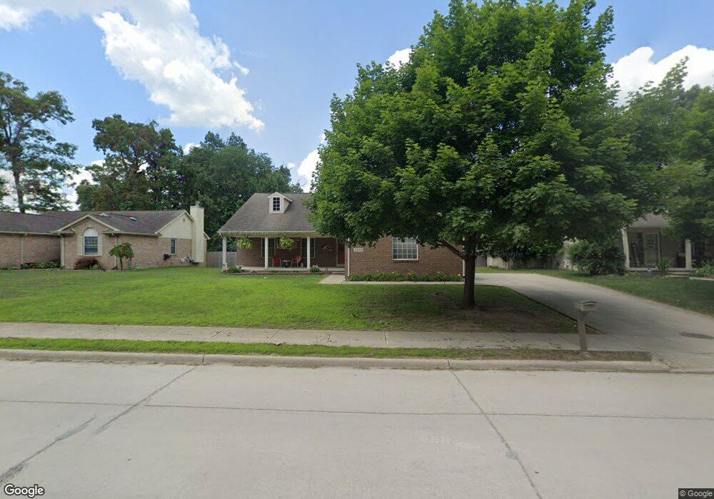
5855 N Christine Westland, MI 48185
Estimated Value: $274,000 - $351,047
3
Beds
2
Baths
1,800
Sq Ft
$175/Sq Ft
Est. Value
About This Home
This home is located at 5855 N Christine, Westland, MI 48185 and is currently estimated at $314,512, approximately $174 per square foot. 5855 N Christine is a home located in Wayne County with nearby schools including Thomas A. Edison Elementary School, Marshall Upper Elementary School, and Adlai Stevenson Middle School.
Ownership History
Date
Name
Owned For
Owner Type
Purchase Details
Closed on
Apr 18, 2016
Sold by
Koskif Matthew
Bought by
Koskie Robert M
Current Estimated Value
Purchase Details
Closed on
Oct 15, 2008
Sold by
The Cit Group/Consumer Finance Inc
Bought by
Lsf6 Mercury Reo Investments Llc
Purchase Details
Closed on
Jul 31, 2008
Sold by
Cogswell Kathryn
Bought by
The Cit Group/Consumer Finance Inc
Purchase Details
Closed on
Sep 21, 2006
Sold by
Rs Re Enterprises Llc
Bought by
Cogswell Kathryn
Purchase Details
Closed on
Dec 5, 2003
Sold by
Pierce Place Llc
Bought by
Rs Re Enterprises Llc
Purchase Details
Closed on
Oct 6, 2003
Sold by
Harwood Alan W and Harwood Constance C
Bought by
Pierce Place Llc
Create a Home Valuation Report for This Property
The Home Valuation Report is an in-depth analysis detailing your home's value as well as a comparison with similar homes in the area
Home Values in the Area
Average Home Value in this Area
Purchase History
| Date | Buyer | Sale Price | Title Company |
|---|---|---|---|
| Koskie Robert M | -- | None Available | |
| Lsf6 Mercury Reo Investments Llc | -- | Ntc | |
| The Cit Group/Consumer Finance Inc | $107,164 | None Available | |
| Cogswell Kathryn | $227,250 | Vintage Title Agency | |
| Rs Re Enterprises Llc | -- | Minnesota Title Agency | |
| Pierce Place Llc | $95,000 | Multiple |
Source: Public Records
Tax History Compared to Growth
Tax History
| Year | Tax Paid | Tax Assessment Tax Assessment Total Assessment is a certain percentage of the fair market value that is determined by local assessors to be the total taxable value of land and additions on the property. | Land | Improvement |
|---|---|---|---|---|
| 2025 | $3,945 | $156,300 | $0 | $0 |
| 2024 | $3,945 | $201,200 | $0 | $0 |
| 2023 | $3,768 | $186,400 | $0 | $0 |
| 2022 | $4,377 | $163,900 | $0 | $0 |
| 2021 | $4,475 | $139,700 | $0 | $0 |
| 2020 | $5,807 | $139,800 | $0 | $0 |
| 2019 | $5,818 | $121,800 | $0 | $0 |
| 2018 | $3,100 | $113,900 | $0 | $0 |
| 2017 | $2,816 | $112,400 | $0 | $0 |
| 2016 | $4,518 | $113,600 | $0 | $0 |
| 2015 | $7,672 | $94,930 | $0 | $0 |
| 2013 | $8,030 | $82,290 | $0 | $0 |
| 2012 | $3,613 | $84,690 | $0 | $0 |
Source: Public Records
Map
Nearby Homes
- 34802 Pardo St
- 34752 John Hauk St
- 0 N Wayne Rd
- 7051 Wayne Rd
- 35601 Pheasant Ln
- 1680 N Hanlon St
- 6546 Quail Run Cir
- 35737 Hunter Ave
- 35754 Castlewood Ct
- 1605 N Hanlon St
- 35833 Ford Rd
- 34203 Tomahawk Dr
- 1654 Shoemaker Dr Unit 145
- 33640 Birchlawn
- 35863 Hunter Ave Unit 34
- 1309 Shoemaker Dr
- 33540 Birchlawn
- 6815 Apache Trail
- 33435 Krauter St
- 34036 Pawnee St
- 5895 N Christine
- 5815 N Christine
- 35051 Stacy St
- 5800 N Christine
- 5800 N Christine
- 35123 Stacy St
- 34845 Stacy St
- 0 Stacy Unit 4910985
- 34819 Stacy St
- 34862 Stacy St
- 34846 Stacy St
- 34826 Stacy St
- 34757 Stacy St
- 34816 Stacy St
- 34768 Stacy St
- 34745 Stacy St
- 34752 Stacy St
- 34736 Stacy St
- 34735 Block
- 34759 Block