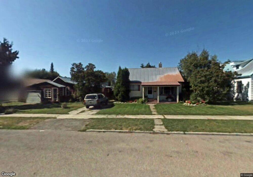
586 1st Avenue West N Kalispell, MT 59901
Estimated Value: $340,414 - $393,000
2
Beds
1
Bath
1,104
Sq Ft
$331/Sq Ft
Est. Value
About This Home
This home is located at 586 1st Avenue West N, Kalispell, MT 59901 and is currently estimated at $365,354, approximately $330 per square foot. 586 1st Avenue West N is a home located in Flathead County with nearby schools including Russell School, Glacier High School, and Trinity Lutheran School.
Ownership History
Date
Name
Owned For
Owner Type
Purchase Details
Closed on
May 6, 2024
Sold by
Sanangelo Betty L and Pettis Kimberley A
Bought by
Sanangelo Betty L
Current Estimated Value
Purchase Details
Closed on
Mar 28, 2024
Sold by
Sanangelo Betty L
Bought by
Sanangelo Betty L and Pettis Kimberley A
Purchase Details
Closed on
Sep 12, 2008
Sold by
Broad Donald D
Bought by
Sanangelo Betty L
Purchase Details
Closed on
Oct 13, 2005
Sold by
Broad Emma M
Bought by
Braod Emma M and Broad Donald D
Create a Home Valuation Report for This Property
The Home Valuation Report is an in-depth analysis detailing your home's value as well as a comparison with similar homes in the area
Home Values in the Area
Average Home Value in this Area
Purchase History
| Date | Buyer | Sale Price | Title Company |
|---|---|---|---|
| Sanangelo Betty L | -- | None Listed On Document | |
| Sanangelo Betty L | -- | None Listed On Document | |
| Sanangelo Betty L | -- | None Available | |
| Braod Emma M | -- | None Available |
Source: Public Records
Tax History Compared to Growth
Tax History
| Year | Tax Paid | Tax Assessment Tax Assessment Total Assessment is a certain percentage of the fair market value that is determined by local assessors to be the total taxable value of land and additions on the property. | Land | Improvement |
|---|---|---|---|---|
| 2025 | $347 | $365,900 | $0 | $0 |
| 2024 | $473 | $303,700 | $0 | $0 |
| 2023 | $2,038 | $303,700 | $0 | $0 |
| 2022 | $1,006 | $213,000 | $0 | $0 |
| 2021 | $2,293 | $213,000 | $0 | $0 |
| 2020 | $839 | $182,200 | $0 | $0 |
| 2019 | $1,435 | $182,200 | $0 | $0 |
| 2018 | $1,275 | $147,200 | $0 | $0 |
| 2017 | $1,275 | $147,200 | $0 | $0 |
| 2016 | $1,240 | $115,600 | $0 | $0 |
| 2015 | $1,235 | $115,600 | $0 | $0 |
| 2014 | $1,299 | $75,471 | $0 | $0 |
Source: Public Records
Map
Nearby Homes
- 651 2nd Ave NW
- 3273 U S 93
- 679 1/2 4th Ave E
- 661 1st Avenue East N
- 376 4th Avenue West N
- 295 4th Ave
- 345 W Utah St Unit 4
- 577 6th Avenue West N
- 875 N Main St
- 495 3rd Ave NE
- 350 3rd Avenue East N
- 96 N Main St
- 417 W Arizona St
- NHN W Idaho St
- Nhn N Meridian Rd
- 5 6th Ave W
- 278 7th Ave W
- 262 Buffalo Hill Dr
- 119 5th Ave W
- 205 Rosewood Dr
- 568 1st Ave E
- 568 1st Avenue West N
- 596 1st Avenue West N
- 564 1st Avenue West N
- 567 1st Ave E
- 567 1st Avenue East N
- 569 1st Avenue West N
- 567 1st Ave W
- 567 1st
- 569 1st Ave E
- 554 1st Avenue West N
- 583 2nd Avenue West N
- 579 2nd Avenue West N
- 579 2nd
- 120 W Nevada St
- 573 2nd Avenue West N
- 573 2nd
- 47 W California St
- 135 W California St
- 27 W California St