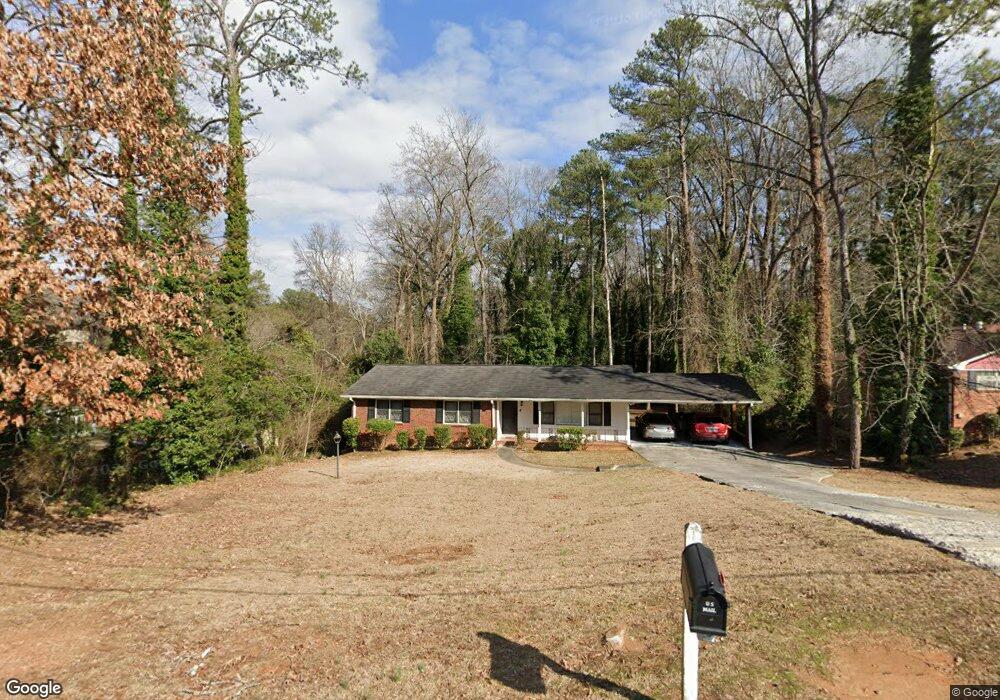
586 Brownlee Rd SW Atlanta, GA 30311
West Manor NeighborhoodEstimated Value: $250,642 - $387,000
4
Beds
3
Baths
1,441
Sq Ft
$211/Sq Ft
Est. Value
About This Home
This home is located at 586 Brownlee Rd SW, Atlanta, GA 30311 and is currently estimated at $304,661, approximately $211 per square foot. 586 Brownlee Rd SW is a home located in Fulton County with nearby schools including West Manor Elementary School, Young Middle School, and Mays High School.
Ownership History
Date
Name
Owned For
Owner Type
Purchase Details
Closed on
Oct 6, 2009
Sold by
Residential Trust 2006 & A5cb
Bought by
Thomas Henry J
Current Estimated Value
Purchase Details
Closed on
May 5, 2009
Sold by
Valerice Stania
Bought by
Deutsche Bank Trust 2006 & A5cb
Purchase Details
Closed on
Oct 1, 2004
Sold by
Rasheed Kenneth
Bought by
Valerice Stania
Home Financials for this Owner
Home Financials are based on the most recent Mortgage that was taken out on this home.
Original Mortgage
$154,800
Interest Rate
5.64%
Mortgage Type
New Conventional
Purchase Details
Closed on
Jun 28, 2004
Sold by
Mayfield Kelly M
Bought by
Valerice Stania
Purchase Details
Closed on
Sep 25, 2003
Sold by
Mayfield Gwendolyn M
Bought by
Rasheed Kenneth
Home Financials for this Owner
Home Financials are based on the most recent Mortgage that was taken out on this home.
Original Mortgage
$156,907
Interest Rate
6.28%
Mortgage Type
FHA
Create a Home Valuation Report for This Property
The Home Valuation Report is an in-depth analysis detailing your home's value as well as a comparison with similar homes in the area
Home Values in the Area
Average Home Value in this Area
Purchase History
| Date | Buyer | Sale Price | Title Company |
|---|---|---|---|
| Thomas Henry J | $58,000 | -- | |
| Deutsche Bank Trust 2006 & A5cb | $69,372 | -- | |
| Valerice Stania | $172,000 | -- | |
| Valerice Stania | -- | -- | |
| Rasheed Kenneth | $159,000 | -- |
Source: Public Records
Mortgage History
| Date | Status | Borrower | Loan Amount |
|---|---|---|---|
| Previous Owner | Valerice Stania | $154,800 | |
| Previous Owner | Rasheed Kenneth | $156,907 |
Source: Public Records
Tax History Compared to Growth
Tax History
| Year | Tax Paid | Tax Assessment Tax Assessment Total Assessment is a certain percentage of the fair market value that is determined by local assessors to be the total taxable value of land and additions on the property. | Land | Improvement |
|---|---|---|---|---|
| 2025 | $3,809 | $99,120 | $26,680 | $72,440 |
| 2023 | $4,943 | $119,400 | $36,680 | $82,720 |
| 2022 | $3,814 | $92,120 | $21,960 | $70,160 |
| 2021 | $3,623 | $89,440 | $21,320 | $68,120 |
| 2020 | $2,668 | $65,120 | $8,000 | $57,120 |
| 2019 | $498 | $52,320 | $7,080 | $45,240 |
| 2018 | $2,115 | $51,080 | $6,920 | $44,160 |
| 2017 | $1,209 | $28,000 | $3,720 | $24,280 |
| 2016 | $1,212 | $28,000 | $3,720 | $24,280 |
| 2015 | $1,215 | $28,000 | $3,720 | $24,280 |
| 2014 | $916 | $20,200 | $2,760 | $17,440 |
Source: Public Records
Map
Nearby Homes
- 3390 Cedar Island Dr SW
- 3175 W Manor Cir SW
- 3211 Hollydale Dr SW
- 3330 Pamlico Dr SW
- 3542 Lynfield Dr SW
- 650 Lynhurst Dr SW
- 400 Brownlee Rd SW
- 852 Venture Way SW
- 847 Venture Way SW
- 602 Lofty Ln
- 844 Venture Way
- 837 Crestwell Cir SW
- 839 Crestwell Cir SW
- 3311 Spreading Oak Dr SW
- 668 Lynn Cir SW Unit 3
- 734 Celeste Ln SW Unit 84
- 761 Lynn Cir SW
- 622 Providence Place SW
- 728 Crestwell Cir SW
- 882 Ambient Way SW
- 596 Brownlee Rd SW
- 3322 Rabun Dr SW
- 3311 Cedar Island Dr SW
- 620 Brownlee Rd SW
- 3310 Rabun Dr SW
- 3323 Cedar Island Dr SW
- 630 Brownlee Rd SW
- 629 Brownlee Rd SW Unit 1
- 3333 Cedar Island Dr SW Unit 1
- 640 Brownlee Rd SW
- 640 Brownlee Rd SW Unit A & B
- 3298 Rabun Dr SW
- 3298 Rabun Dr SW Unit 6
- 641 Brownlee Rd SW Unit 1
- 595 Brownlee Rd SW
- 3319 Rabun Dr SW
- 3311 Rabun Dr SW
- 585 Brownlee Rd SW
- 3304 W Manor Ln SW
- 3326 Cedar Island Dr SW