586 Bunker Rd New London, NH 03257
Highlights
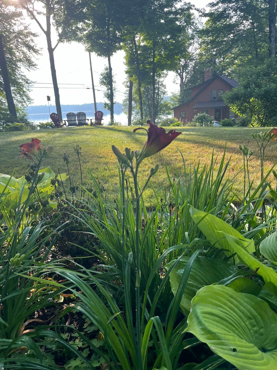
- Lake View
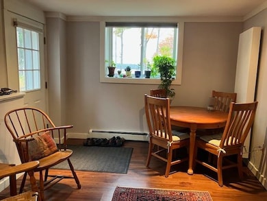
- Combination Dining and Living Room
- Mini Split Air Conditioners
- Contemporary Architecture
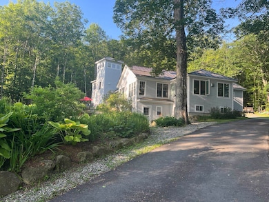
About This Home
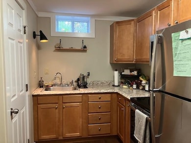
Immaculate, newer ground floor apartment in single family home with views of Pleasant Lake. Spacious living/dining area, compact and well appointed kitchen, two bedrooms with plenty of light. Mini splits for heat and a/c. Washer/dryer. Rent includes all utilities except wifi/cable. No pets, no smoking. One occupant preferred.

Property Details
Home Type
- Apartment
Est. Annual Taxes
- $10,480
Year Built
- Built in 2014
Parking
- Paved Parking
Home Design
- Contemporary Architecture
- Fixer Upper
Interior Spaces
- 800 Sq Ft Home
- Property has 1 Level
- Combination Dining and Living Room
- Lake Views
- Basement
- Interior Basement Entry
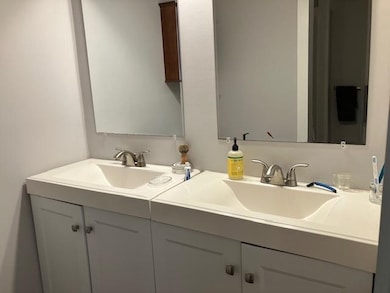
Bedrooms and Bathrooms
- 2 Bedrooms
- 1 Bathroom
Utilities
- Mini Split Air Conditioners
- Mini Split Heat Pump
- Radiant Heating System
- Drilled Well
- Cable TV Available
Map
Source: PrimeMLS
MLS Number: 5069386
APN: NLDN-000076-000032
Disclaimer: Certain information contained herein is derived from information provided by parties other than Homes.com. All information provided is deemed reliable, but is not guaranteed to be accurate and should be independently verified.
![]() Copyright 2025 PrimeMLS, Inc. All rights reserved. This information is deemed reliable, but not guaranteed. The data relating to real estate displayed on this display comes in part from the IDX Program of PrimeMLS. The information being provided is for consumers’ personal, non-commercial use and may not be used for any purpose other than to identify prospective properties consumers may be interested in purchasing.
Copyright 2025 PrimeMLS, Inc. All rights reserved. This information is deemed reliable, but not guaranteed. The data relating to real estate displayed on this display comes in part from the IDX Program of PrimeMLS. The information being provided is for consumers’ personal, non-commercial use and may not be used for any purpose other than to identify prospective properties consumers may be interested in purchasing.
- 58 Kearsarge Rd
- 000 Shaker Rd Unit 288
- 385 Seamans Rd
- 92 Bunker Rd
- 295 Andover Rd
- 760 Pleasant St
- 157 Seamans Rd
- 7 Buker Way
- 0 Fairway Ln Unit 8
- 158 Quail Run
- 65 Barrett Rd
- 24 Mountain Overlook
- 0 Quiet Cove Way Unit 5
- 712 Sugarhouse Rd
- Lot 16 Granite Hill Rd
- 0 Hominy Pot Rd Unit 5036928
- 0 Newport Rd Unit 10
- 26 Hilltop Place
- 71 Hilltop Place
- 626 Nh Route 4a
- 792 Bunker Rd
- 12 Woodland Ln
- 997 King Hill Rd
- 96 Baker Rd
- 155 Stoney Brook Rd
- 104 Stoney Brook Rd
- 274 Depot St Unit B
- 1005 Lake Ave
- 14 Gerald Dr
- 319 Chalk Pond Rd
- 6 High Ridge Rd
- 648 Route 103a
- 25 Hilltop Dr
- 34 Fairway Dr Unit 34
- 15 Kelley St
- 96 Fairway Dr
- 83 Bowles Rd
- 306 Rollins Rd
- 18 Alpine Ct Unit ID1312388P
- 62 Lower Main St