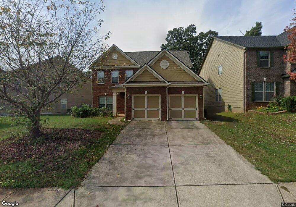
586 Highbranch Cir Lawrenceville, GA 30044
Estimated Value: $405,000 - $451,000
4
Beds
3
Baths
2,195
Sq Ft
$195/Sq Ft
Est. Value
About This Home
This home is located at 586 Highbranch Cir, Lawrenceville, GA 30044 and is currently estimated at $428,769, approximately $195 per square foot. 586 Highbranch Cir is a home located in Gwinnett County with nearby schools including Bethesda Elementary School, Sweetwater Middle School, and Berkmar High School.
Ownership History
Date
Name
Owned For
Owner Type
Purchase Details
Closed on
Apr 30, 2009
Sold by
Ryland Group Inc
Bought by
Chung Xiang Y and Kwok Lai
Current Estimated Value
Home Financials for this Owner
Home Financials are based on the most recent Mortgage that was taken out on this home.
Original Mortgage
$187,840
Outstanding Balance
$117,721
Interest Rate
4.86%
Mortgage Type
New Conventional
Estimated Equity
$311,048
Purchase Details
Closed on
Jan 26, 2009
Sold by
Corridor Property Group Llc
Bought by
Ryland Group Inc
Create a Home Valuation Report for This Property
The Home Valuation Report is an in-depth analysis detailing your home's value as well as a comparison with similar homes in the area
Home Values in the Area
Average Home Value in this Area
Purchase History
| Date | Buyer | Sale Price | Title Company |
|---|---|---|---|
| Chung Xiang Y | $208,800 | -- | |
| Ryland Group Inc | $60,000 | -- |
Source: Public Records
Mortgage History
| Date | Status | Borrower | Loan Amount |
|---|---|---|---|
| Open | Chung Xiang Y | $187,840 |
Source: Public Records
Tax History Compared to Growth
Tax History
| Year | Tax Paid | Tax Assessment Tax Assessment Total Assessment is a certain percentage of the fair market value that is determined by local assessors to be the total taxable value of land and additions on the property. | Land | Improvement |
|---|---|---|---|---|
| 2025 | $6,343 | $169,920 | $24,000 | $145,920 |
| 2024 | $6,010 | $158,680 | $24,000 | $134,680 |
| 2023 | $6,010 | $122,680 | $32,000 | $90,680 |
| 2022 | $4,703 | $122,680 | $32,000 | $90,680 |
| 2021 | $3,753 | $94,600 | $21,800 | $72,800 |
| 2020 | $3,774 | $94,600 | $21,800 | $72,800 |
| 2019 | $3,636 | $94,600 | $21,800 | $72,800 |
| 2018 | $3,639 | $94,600 | $21,800 | $72,800 |
| 2016 | $3,303 | $85,040 | $20,800 | $64,240 |
| 2015 | $3,115 | $78,760 | $18,400 | $60,360 |
| 2014 | -- | $78,760 | $18,400 | $60,360 |
Source: Public Records
Map
Nearby Homes
- 660 Maple Crest Dr Unit 1
- 400 Autumn Bluff Dr
- 357 Celia Glen Ct
- 532 Autumn Shore Dr
- 757 Dunlin Fields Dr Unit 2
- 764 Avalon Forest Way
- 877 Dunlin Fields Dr
- 2639 Summerfield Way
- 3047 Dunlin Way
- 3065 Chandon Ln
- 534 Paden Bluff Trail
- Forsyth Plan at Rosewood Farm
- Reynolds Plan at Rosewood Farm
- 2810 Creekwood Ln
- 3002 Cruse Rd
- 524 Provence Gate Ln
- 3062 Ferrite Loop
- 841 Woods Ct
- 517 Provence Gate Ln
- 2845 Rosehall Way
- 596 Highbranch Cir Unit 8B
- 596 Highbranch Cir
- 556 Highbranch Cir Unit 10B
- 556 Highbranch Cir
- 606 Highbranch Cir
- 526 Highbranch Cir
- 476 Highbranch Cir
- 476 Highbranch Cir Unit 13
- 486 Highbranch Cir Unit 12B
- 486 Highbranch Cir
- 565 Highbranch Cir
- 616 Highbranch Cir
- 585 Highbranch Cir
- 575 Highbranch Cir Unit 14A
- 575 Highbranch Cir
- 466 Highbranch Cir
- 466 Highbranch Cir Unit 14B
- 595 Highbranch Cir
- 605 Highbranch Cir
- 456 Highbranch Cir