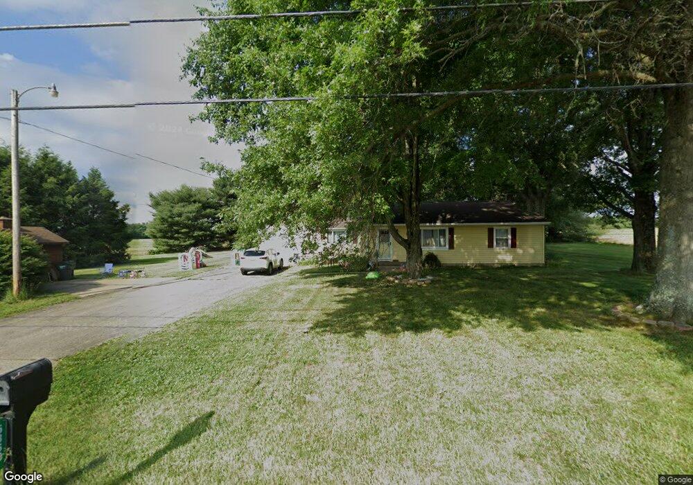
5860 Burbank Rd Wooster, OH 44691
Estimated Value: $203,000 - $247,000
2
Beds
1
Bath
984
Sq Ft
$220/Sq Ft
Est. Value
About This Home
This home is located at 5860 Burbank Rd, Wooster, OH 44691 and is currently estimated at $216,639, approximately $220 per square foot. 5860 Burbank Rd is a home located in Wayne County with nearby schools including Kean Elementary School, Parkview Elementary School, and Edgewood Middle School.
Ownership History
Date
Name
Owned For
Owner Type
Purchase Details
Closed on
Mar 7, 2016
Sold by
Fisher Christopher A
Bought by
Fisher Christopher A
Current Estimated Value
Home Financials for this Owner
Home Financials are based on the most recent Mortgage that was taken out on this home.
Interest Rate
3.64%
Purchase Details
Closed on
Apr 28, 2010
Sold by
Baker Carolyn D
Bought by
Fisher Christopher A and Fisher Jessica A
Home Financials for this Owner
Home Financials are based on the most recent Mortgage that was taken out on this home.
Original Mortgage
$90,204
Interest Rate
5.02%
Purchase Details
Closed on
Apr 26, 2010
Sold by
Baker Carolyn D
Bought by
Fisher Christopher A and Fisher Jessica A
Home Financials for this Owner
Home Financials are based on the most recent Mortgage that was taken out on this home.
Original Mortgage
$90,204
Interest Rate
5.02%
Purchase Details
Closed on
Jan 1, 1987
Bought by
Conn Harold L
Create a Home Valuation Report for This Property
The Home Valuation Report is an in-depth analysis detailing your home's value as well as a comparison with similar homes in the area
Home Values in the Area
Average Home Value in this Area
Purchase History
| Date | Buyer | Sale Price | Title Company |
|---|---|---|---|
| Fisher Christopher A | -- | -- | |
| Fisher Christopher A | -- | Southern Title | |
| Fisher Christopher A | -- | Southern Title | |
| Conn Harold L | -- | -- |
Source: Public Records
Mortgage History
| Date | Status | Borrower | Loan Amount |
|---|---|---|---|
| Closed | Fisher Christopher A | -- | |
| Previous Owner | Fisher Christopher A | $90,204 | |
| Previous Owner | Fisher Christopher A | $90,204 |
Source: Public Records
Tax History Compared to Growth
Tax History
| Year | Tax Paid | Tax Assessment Tax Assessment Total Assessment is a certain percentage of the fair market value that is determined by local assessors to be the total taxable value of land and additions on the property. | Land | Improvement |
|---|---|---|---|---|
| 2024 | $2,469 | $56,840 | $14,410 | $42,430 |
| 2023 | $2,469 | $56,840 | $14,410 | $42,430 |
| 2022 | $2,172 | $40,030 | $10,150 | $29,880 |
| 2021 | $2,238 | $40,030 | $10,150 | $29,880 |
| 2020 | $2,127 | $40,030 | $10,150 | $29,880 |
| 2019 | $1,444 | $25,930 | $8,800 | $17,130 |
| 2018 | $1,448 | $25,930 | $8,800 | $17,130 |
| 2017 | $1,462 | $25,930 | $8,800 | $17,130 |
| 2016 | $1,509 | $25,110 | $8,800 | $16,310 |
| 2015 | $1,483 | $25,110 | $8,800 | $16,310 |
| 2014 | $1,455 | $25,110 | $8,800 | $16,310 |
| 2013 | $1,534 | $26,070 | $8,440 | $17,630 |
Source: Public Records
Map
Nearby Homes
- 888 Flag Stone Ave
- 0 W Smithville Western Rd
- 4975 Clearcreek Valley Rd
- 4553 Deer Creek Dr
- 4366 Wood Lake Trail
- 4356 Hunters Chase Ln
- 1177 Church Hill Ct
- 1467 Hunt Club Dr
- 348 Fox Lake Rd
- 4520 Country Ln
- 2200 Schellin Rd
- 3283 W Smithville Western Rd
- 4874 Oasis Ave
- 1024 Kadas Ln
- 4852 Oasis Ave
- 4830 Oasis Ave
- 3303 W Smithville Western Rd
- 1457 Fox Lake Rd
- 4897 Oasis Ave
- 4859 Oasis Ave
- 5919 Burbank Rd
- 1070 W Hutton Rd
- 5988 Burbank Rd
- 968 Sand Stone Dr
- 830 Sand Stone Dr
- 0 Burbank Rd
- 788 Sand Stone Dr
- 5839 Stonesthrow Dr
- 5913 Stonesthrow Dr
- 5879 Stonesthrow Dr
- 969 Sand Stone Dr
- 740 Sand Stone Dr
- 5759 Stonesthrow Dr
- 5799 Stonesthrow Dr
- 925 Sand Stone Dr
- 875 Sand Stone Dr
- 1030 W Hutton Rd
- 5715 Stonesthrow Dr
- 5959 Stonesthrow Dr
- 821 Sand Stone Dr